News
EOS contributes to land degradation monitoring in south Crete under the MONALISA Project
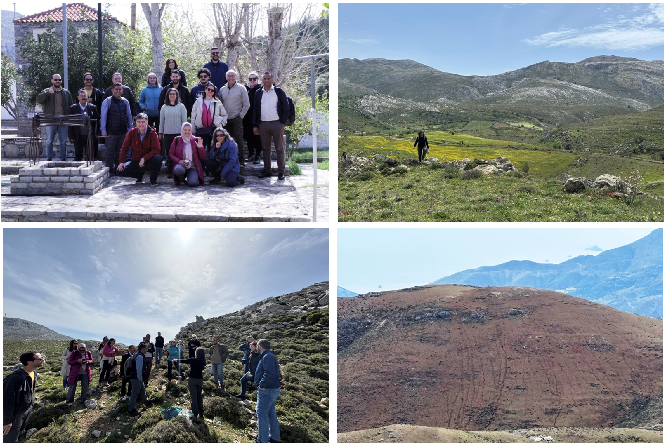
EOS contributes to land degradation monitoring in south Crete under the MONALISA Project, April 15-17, 2025
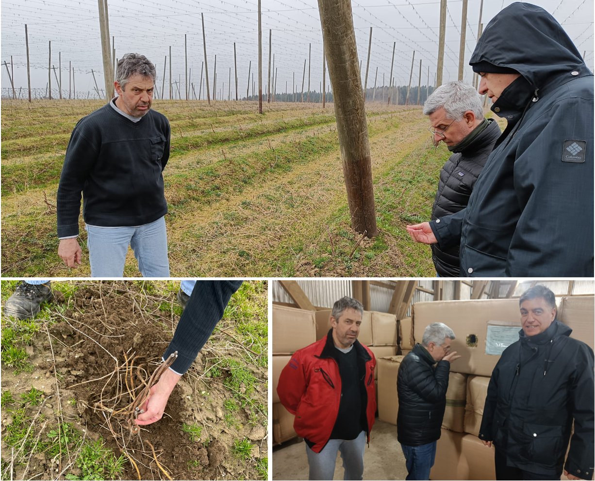
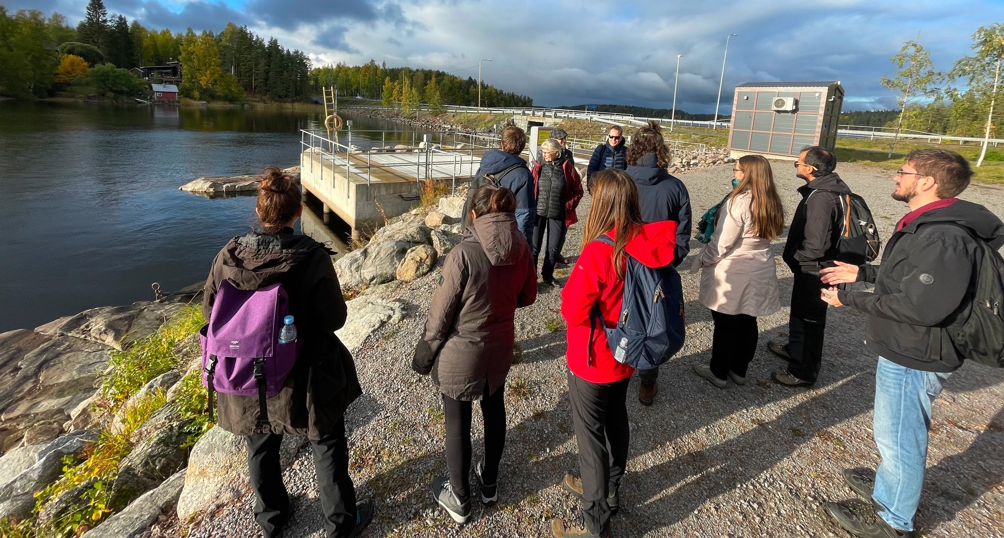
As part of the EU Horizon Europe RIA MONALISA project, EOS is actively contributing to efforts aimed at monitoring and mitigating land degradation and desertification. Dr. Ioannis Manakos recently participated in a field visit to the Asterousia region in South Crete, where local environmental conditions were recorded in preparation for upcoming Earth Observation-based monitoring activities.
The visit included fruitful discussions with local stakeholders on land use dynamics, landscape development, and the interplay of socioeconomic, geomorphological, and climatic factors contributing to soil loss in the area. The MONALISA team assessed the current situation and documented the complex interrelations behind the observed environmental impacts.
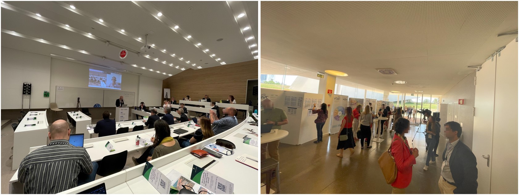
EOS Team at GISTAM 2025 in Porto, Portugal
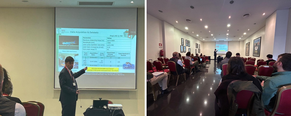
EOS Team at GISTAM 2025 in Porto, Portugal, April 1-3, 2025
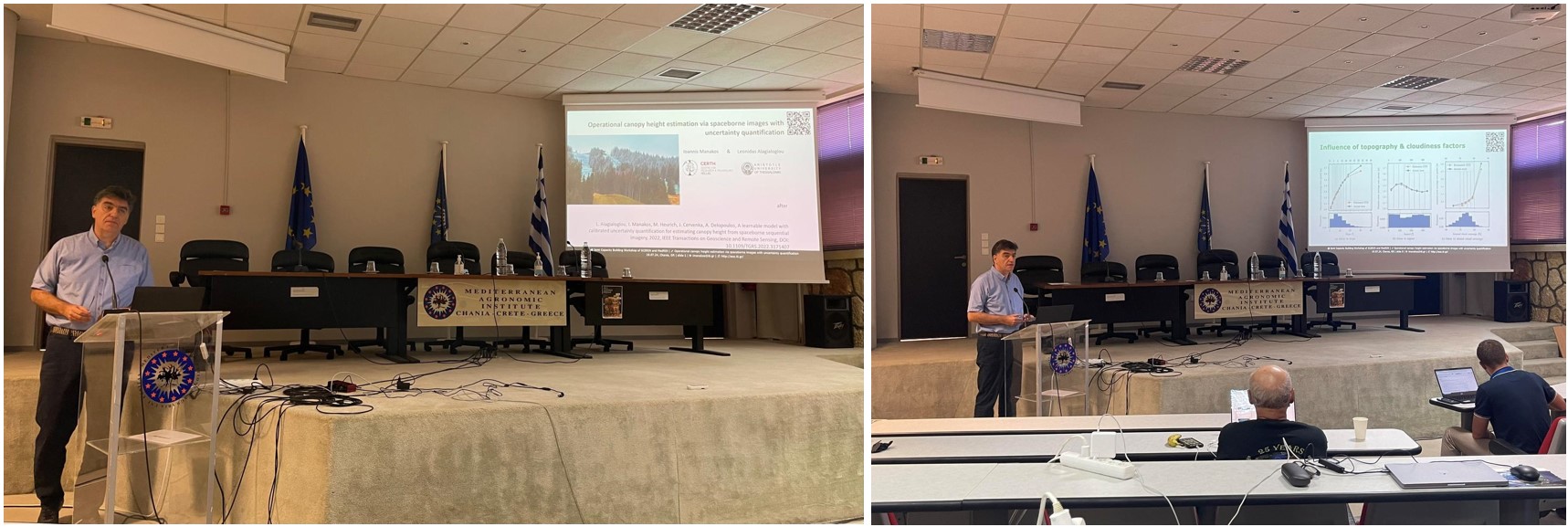
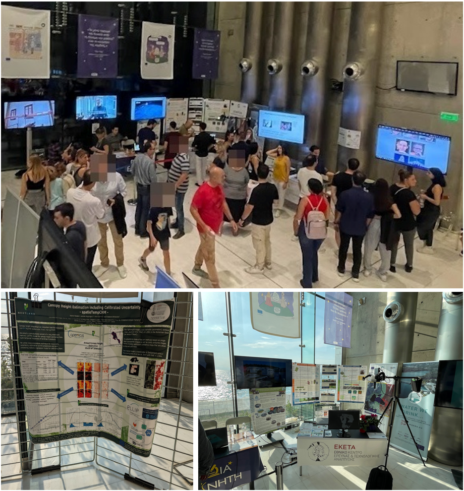
The EOS team participated in the 11th International Conference on Geographical Information Systems Theory, Applications and Management (GISTAM 2025), held in Porto, Portugal. The event brought together leading researchers and professionals in geoinformatics, remote sensing, and environmental monitoring.
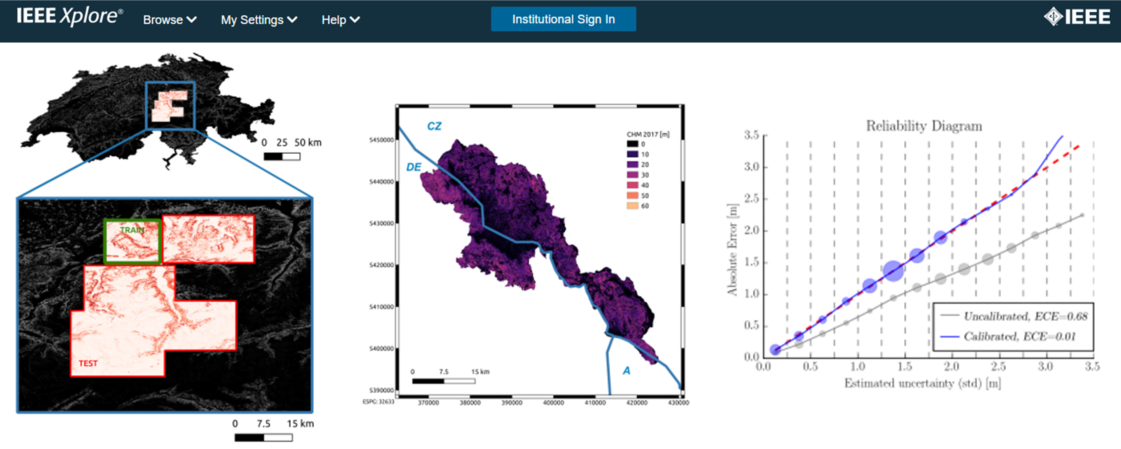
Dr. Ioannis Manakos represented the EOS team, delivered an oral presentation during the session "Forest Management and Climate-smart Forestry." His talk, titled "Assessment of Fine-Tuned Canopy Height Maps from Satellite Imagery: A Case Study in the Czech Republic," showcased the team's latest research on using Sentinel-2 satellite time series and deep learning (ConvLSTM) to enhance forest canopy height estimation. The model, initially trained on forest data from Germany and Switzerland, incorporated uncertainty quantification techniques and was subsequently fine-tuned using dense airborne laser scanning (ALS) data collected between 2022 and 2024. Results demonstrated that fine-tuning reduced the Mean Absolute Error from 4.26 m to 2.74 m in the primary test area, with similar improvements across other regions. Additionally, species-specific uncertainties were analyzed, revealing performance variations between deciduous and coniferous forests.
In addition to his presentation, Dr. Manakos also served as Session Chair for the Remote Sensing session, contributing to the smooth coordination and scientific discussion of cutting-edge research in Earth Observation technologies.
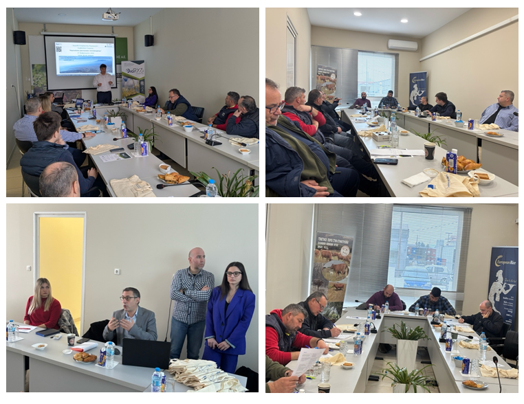
DigiCotton - Producer and Agricultural Advisor Information Day

DigiCotton - Producer and Agricultural Advisor Information Day, March 27, 2025
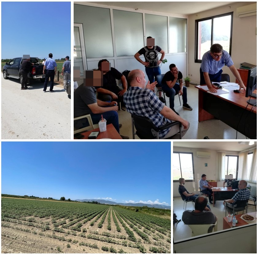
The EOS team met with agricultural producers and advisors at the offices of the Agricultural Corporate Partnership of Kavala (EAS Kavalas) in Chrysoupoli on March 27, 2025. The event, organized in collaboration with foodStandard S.A. and EAS Kavalas, focused on integrating digital tools-enhanced by Earth Observation services and products-into cotton cultivation management.
The representative from foodStandard S.A. opened the event by welcoming participants and introducing the project. EAS's experts discussed the challenges in cotton farming and the cooperative's role in supporting producers. The EOS team presented ongoing research on crop monitoring and demonstrated the DigiCotton platform's real-time data capabilities. An engaging discussion highlighted opportunities and challenges that DigiCotton can address through its outputs and tools. Both producers and advisors expressed satisfaction about incorporating these tools and products into their everyday practices, recognizing that such innovations could lower costs and enhance farmers' responsiveness, while simultaneously ensuring alignment with EU agricultural policy management standards. The conversation extended further, focusing on the platform's user-friendliness and areas for future enhancement, underscoring the project's dedication to advancing digital transformation in agriculture. Additionally, valuable insights were gathered from cotton producers via a structured two-page questionnaire distributed by the EOS team.
DigiRyzi Presentation at Agrothessaly
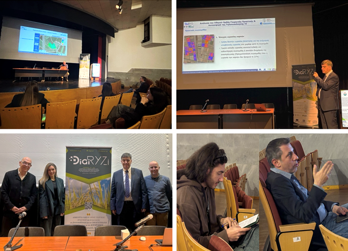
DigiRyzi Presentation at Agrothessaly, March 7, 2025
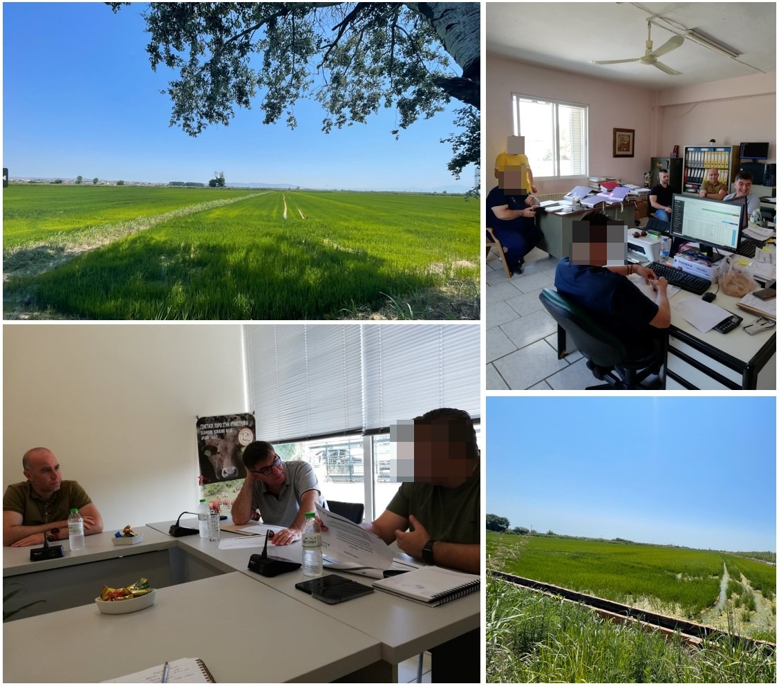
The EOS team participated in Agrothessaly 2025, presenting the DigiRyzi project at the Municipal Art Gallery of Larissa on March 7, 2025. Organized in collaboration with FoodStandard S.A., the event focused on leveraging digital tools, Earth Observation services, and precision agriculture to enhance rice farming practices.
EOS team representatives welcomed attendees, outlining the project's goals and its role in promoting sustainable agriculture. The event featured a presentation of DigiRyzi's research results, including an analysis of different rice crop growth stages and a demonstration of how the platform identifies harvest timing and yield variability within fields.
Additionally, the DigiRyzi online platform was introduced, showcasing its real-time field data management capabilities and benefits for farmers. A discussion with producers followed, highlighting the practical applications of DigiRyzi in daily farming operations, potential improvements, and future functionalities. The feedback gathered will contribute to refining the platform, ensuring its usability and effectiveness for rice farmers.
DigiCotton Presentation at Agrothessaly
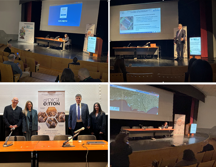
DigiCotton Presentation at Agrothessaly, March 7, 2025
The EOS team participated in Agrothessaly 2025, presenting the DigiCotton project at the Municipal Art Gallery of Larissa on March 7, 2025. Organized in collaboration with FoodStandard S.A., the event focused on integrating digital tools, Earth Observation services, and precision agriculture to enhance cotton cultivation.
EOS team representatives welcomed attendees, outlining the project's goals and its role in promoting sustainable agricultural practices. The event featured a presentation of DigiCotton's research results, including an analysis of different cotton growth stages and a demonstration of how the platform identifies harvest timing and yield variability within fields.
Additionally, the DigiCotton online platform was introduced, showcasing its real-time field data management capabilities and benefits for farmers. A discussion with producers followed, focusing on the practical applications of DigiCotton in daily farming operations, potential improvements, and future functionalities.
Participants engaged in a constructive exchange on how digital innovations can support environmental protection in agricultural regions such as the Nestos Delta, aligning with Agrothessaly's broader theme of sustainable farming. The feedback gathered will contribute to refining the platform, ensuring its usability and effectiveness for cotton producers.
DigiRyzi - Producer and Agricultural Advisor Information Day
DigiRyzi - Producer and Agricultural Advisor Information Day, February 27, 2025
The EOS team met with agricultural producers and advisors at the offices of the Agricultural Corporate Partnership of Thessaloniki (EASTh) in Sindos on February 27, 2025. The event, organized in collaboration with foodStandard S.A. and EASTh, focused on integrating digital tools-enhanced by Earth Observation services and products-into rice cultivation management.
The representative from foodStandard S.A. opened the event by welcoming participants and introducing the project. EASTh's experts discussed the challenges in rice farming and the cooperative's role in supporting producers. The EOS team presented ongoing research on crop monitoring and demonstrated the DigiRyzi platform's real-time data capabilities. A lively discussion revealed new opportunities and challenges that DigiRyzi may address with its outcomes and tools. Producers and advisors appeared satisfied and eager to test the tools and products in their daily work, acknowledging that these innovations would reduce costs and improve farmers' reaction time while ensuring compliance with EU agricultural policy management guidelines. The discussions continued for a while regarding the platform's usability and potential future improvements, reinforcing the project's commitment to digital transformation in agriculture. Additionally, valuable feedback was collected from rice producers through a predesigned two-page survey distributed by the EOS team.
EOS team at GIL2025 in Wieselburg, Austria

EOS team at GIL2025 in Wieselburg, Austria, February 25, 2025
On February 25-26th 2025, the EOS Team participated in the 45th GIL Annual Conference (GIL2025) in Wieselburg, Austria. This prestigious event focused on "Digital Infrastructures for Sustainable Agriculture, Forestry, and Food Industry," bringing together researchers and industry experts to explore the latest advancements in digital technologies.
As part of the Remote Sensing session, Ioannis Manakos presented EOS team's work on 'Hop Yield Forecast Using Sentinel-2 Images'. His talk highlighted the potential of Earth Observation technologies in hop management, demonstrating how satellite imagery and data-driven models can enhance yield prediction and support sustainable farming practices.
The GIL2025 conference featured a diverse range of topics, including AI & Machine Learning, Digital Transformation, Robotics & Automation, and Sensor Technology. The EOS team's contribution underscored the growing role of remote sensing and geospatial analytics in optimizing agricultural productivity and environmental sustainability.
Satellite Image Analysis Expanded for Hallertau Hop Farms
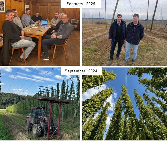
Satellite Image Analysis Expanded for Hallertau Hop Farms, February 23, 2025
Ioannis Manakos visited the Hallertau region, where he presented the latest satellite image analysis results for hop farms in Wolnzach. So far, satellite images of Stefan Linseisen's hop farm in Weikenhausen, municipality of Schweitenkirchen, have been analyzed. Now, additional hop farms from the Pfaffenhofen district are joining the project. During the presentation, participating hop farmers were shown the latest findings from six years of Sentinel-2 satellite image analysis for the most common German hop varieties-Tradition, Perle, and Herkules-on the Linseisen hop farm. The slope of the red edge inflection point between May and July, as well as its value in mid-July, shows a strong correlation with the yield of the respective varieties. Encouraged by these positive results, additional hop farms are now being included in the analyses to strengthen the correlations and enable evaluations using artificial intelligence. Local newspaper articles report about this visit (e.g. at the Donau Kurier).
EOS team at the 200th anniversary of the Karlsruhe Institute of Technology (KIT)

EOS team at the 200th anniversary of the Karlsruhe Institute of Technology (KIT), February 20, 2025
The EOS team was cordially invited to celebrate the 200th anniversary of the Karlsruhe Institute of Technology (KIT) and its predecessor institutions, and participate in the KATHES Workshop between KIT, AUTh, CERTH and Thess INTEC in Karlsruhe, Germany. KATHES Workshop is a recurring event fostering collaboration between German and Greek research institutions. EOS team took part in the thematic session that focused on System & AI Integration in Health, Space, Automotive & Energy, bringing together experts to explore cutting-edge technological advancements.
As part of this initiative, Ioannis Manakos delivered a presentation titled "Advancing Earth Observation Services via IT Solutions", where cloud computing, artificial intelligence (machine learning in particular), big data analytics, high-performance computing and the facilitation of machine2machine and human2machine interaction in support of Decision Support Systems were demonstrated. Insights revealed around satellite data utilization, machine learning and prediction, climate and environmental modelling, Big Data processing, interactive data platforms, AI-based monitoring, and data harmonization. His contribution was considered during vivid discussions on AI and system integration across multiple domains.
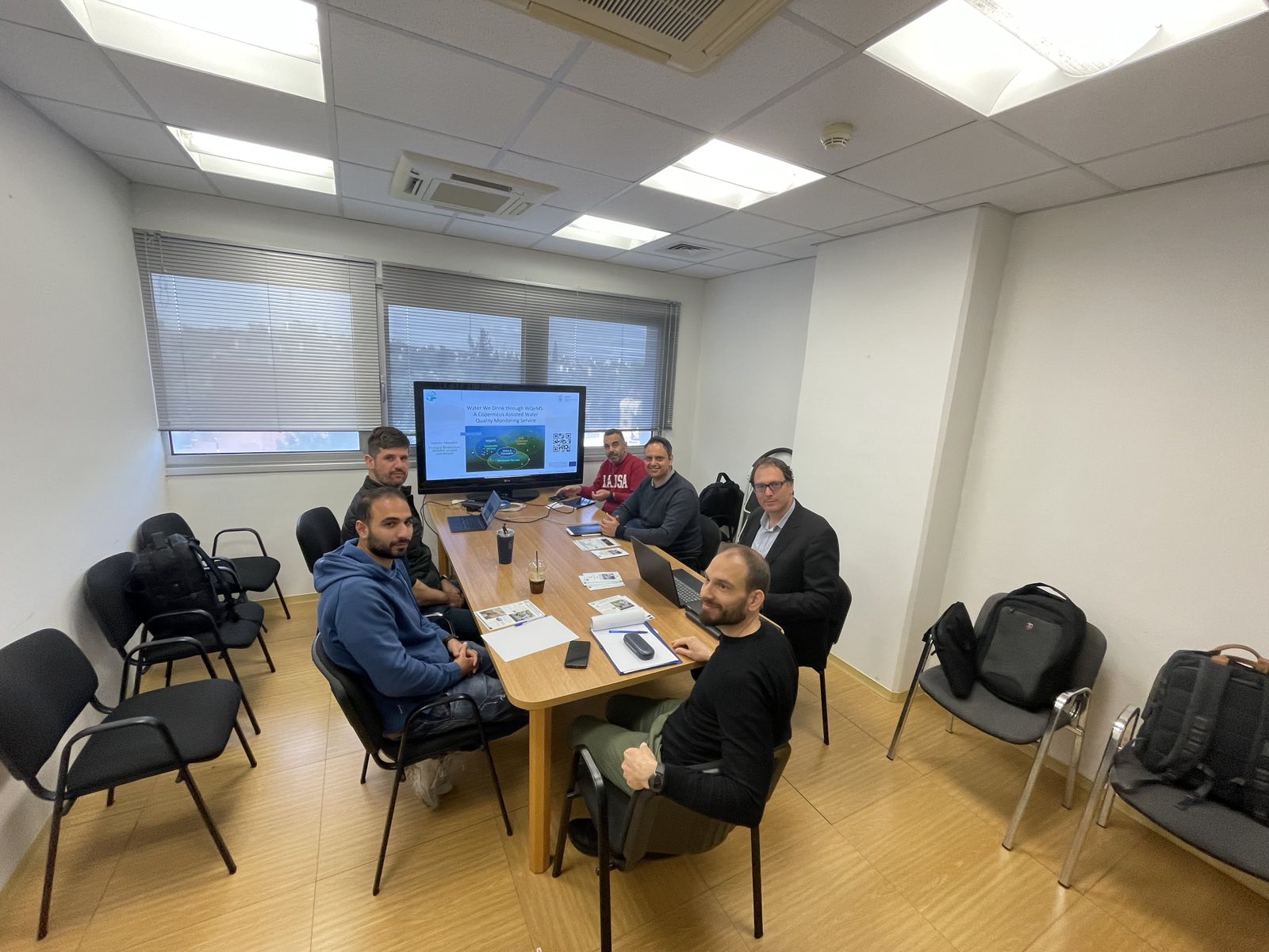
WQeMS featured in 'Copernicus Observer'!
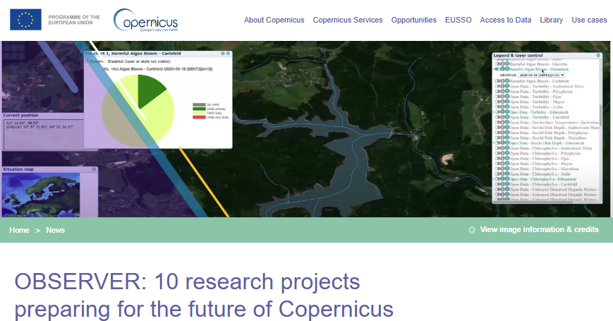
WQeMS featured in 'Copernicus Observer'!, January 16, 2025
WQeMS project has been highlighted in the latest issue of the Copernicus Observer, the communication platform associated with the EU's Copernicus Programme. It is demonstrated among ten research initiatives that prepare the future of Earth observation through the Copernicus programme. The inclusion of WQeMS in this exclusive list is an acknowledgement of its offer for reliable, accessible, and actionable insights into water quality towards the scientific community, policymakers, industry, and the public.
This recognition underscores the project's innovative approach to leveraging satellite data for water quality monitoring and management. Moreover, it is an official identification by Copernicus for WQeMS's vital role in supporting sustainable water resource management and addressing global environmental challenges. For more details on the Copernicus Observer article, please visit Copernicus Observer.
Spotlight on WQeMS: Advancing Water Quality Monitoring
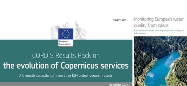
Spotlight on WQeMS: Advancing Water Quality Monitoring, December 19, 2024
WQeMS project has been featured in the European Commission's special publication: "The Evolution of Copernicus Services". This milestone recognizes the project's pivotal role in advancing water quality monitoring technologies and their practical applications. WQeMS builds upon the Copernicus Emergency Monitoring Service (CEMS), introducing state-of-the-art methodologies for the real-time collection and analysis of critical water quality indicators. These groundbreaking innovations not only equip decision-makers with the tools to sustainably manage water resources but also provide citizens and stakeholders with accessible, user-friendly insights via its advanced platform.
This recognition highlights WQeMS's role in shaping the future of water management, fostering a more resilient and sustainable environment. The project demonstrates how cutting-edge technology can transform traditional water monitoring practices, ensuring improved resource management and environmental health.
Final UAV field survey for 2024 is completed for the DigiCotton Project

Final UAV field survey for 2024 is completed for the DigiCotton Project, October 29, 2024
The 2024 UAV survey for the DigiCotton project has been successfully concluded. Utilizing the advanced capabilities of the UAV acquired for this initiative, valuable insights into the cotton crop cycle were collected. These data will play a crucial role in enhancing the development of algorithms by the EOS team, enabling the effective use of Sentinel-2 satellite imagery. This integration will power the DigiCotton application platform, offering farmers and agronomists the tools to monitor their fields remotely and access regular updates and recommendations without the need for on-site visits.
This milestone underscores the progress and innovative approach of the DigiCotton project, further solidifying its role in advancing cotton farming practices and contributing to sustainable agriculture.
Invited keynote speech at the 11th International Symposium Forest and Sustainable Development
Invited keynote speech at the 11th International Symposium Forest and Sustainable Development, October 17-18, 2024
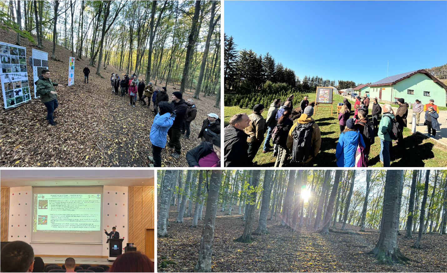
Ioannis Manakos participated in the 11th International Symposium of Forest and Sustainable Development, organised by the Faculty of Silviculture and Forest Engineering at the Transilvania University of Brasov (Romania) on October 17-18, 2024. Upon official invitation from the organizers he delivered a keynote speech on "Canopy height estimation from spaceborne images with uncertainty quantification: towards meeting user needs," showcasing the EOS team's research accomplishments. The Symposium was lively attended by numerous stakeholders and international actors from academia, government and the private sector, reflecting the growing interest in sustainable forest management with the application of advanced techniques and technologies. Field visit took place at local experimental sites, monitoring and training infrastructure during the second day, where the exploitation of latest scientific and technological advancements towards smart climate forest management (as applied in the Carpathian mountains) was showcased.
MONALISA Project Kick-Off Meeting in Sassari, Sardinia
MONALISA Project Kick-Off Meeting in Sassari, Sardinia, October 1-3, 2024
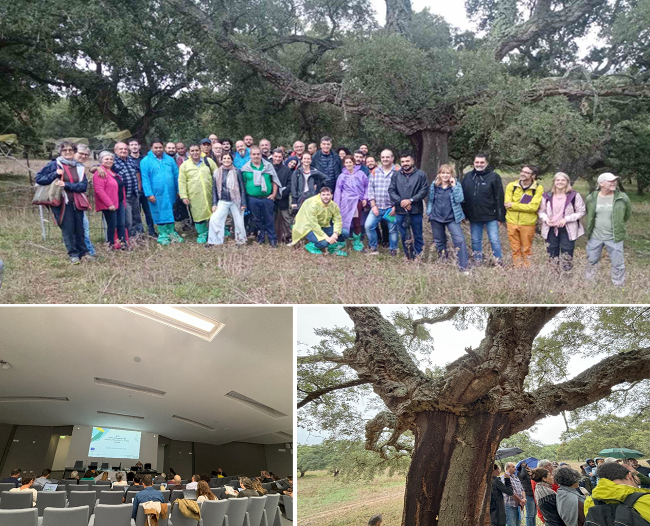
The MONALISA Kick-off Meeting was held in Sassari, Sardinia, from 1-3 October 2024, launching an initiative to combat land degradation and desertification in Mediterranean regions. The project will focus on six case studies across Italy, Spain, Greece, Tunisia, and Palestine, exploring innovative solutions, such as adaptive grazing systems, microbial-based biofertilizers, conservation agriculture, ecological restoration, water harvesting, and treated wastewater reuse. A key outcome will be the development of a Decision Support System leveraging remote sensing and Artificial Intelligence to promote sustainable, cost-effective solutions and boost economic growth in drylands.
On the last day there took place a field visit at cultivations of cork oak trees, where practices, processes, and multiannual experimental designs were presented. Vivid discussions followed among researchers, others sites' practicioners and managers, as well as local farmers.
Final UAV field survey for 2024 is completed for the DigiRyzi Project
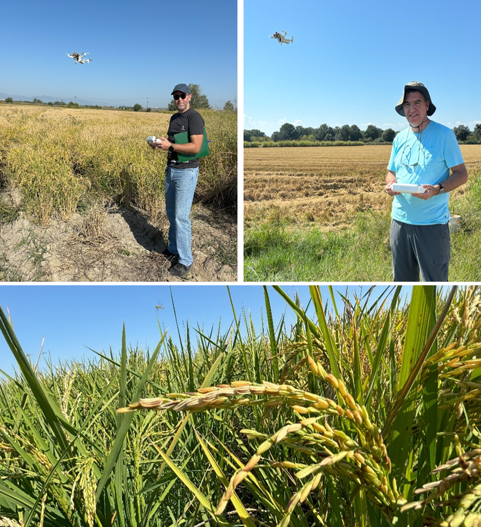
Final UAV field survey for 2024 is completed for the DigiRyzi Project, September 26, 2024
The final survey using the Unmanned Aerial Vehicle (UAV) of the DigiRyzi project has been successfully completed. The UAV have gathered valuable data that will significantly enhance our understanding of the rice crop cycle and assist the EOS team in developing algorithms that leverage free-of-cost (Sentinel-2) satellite data. These data will be integrated into the DigiRyzi application platform, allowing all farmers and consulting agronomists to remotely monitor their fields and receive frequent valuable insights without the need to physically visit their fields.
The completion of this survey marks a major milestone in the DigiRyzi project with promising benefits for the future of rice farming and sustainability.
EOS team at the harvest in the hops farms of Weikenhausen

EOS team at the harvest in the hops farms of Weikenhausen, September 19, 2024
EOS team is working for a year now in an experiment related to the benefits of the assimilation of remotely sensed derived information in support of hops farming management. Preliminary results are formulated in a study about satellite image analysis and its hops yield forecast capacity for three local varieties, which was reviewed, accepted and successfully presented at the German national conference on agricultural informatics last March. The collaboration is ongoing and aims to gather more ground reference data to improve prediction and monitoring accuracy and leverage remote and proximal technologies for evidence-based hops production sustainability. In this context, Ioannis Manakos visited on September 19 the hops farms in Weikenhausen during the harvest to discuss with the farmers about issues that concerned the completed cultivation period to support image analysis for 2024.
EOS Team participated in a Hyperspectral Remote Sensing Workshop
EOS Team participated in a Hyperspectral Remote Sensing Workshop, September 18-19, 2024
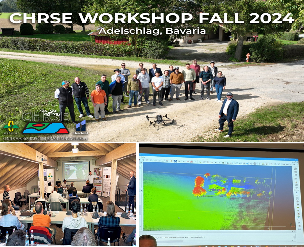
Ioannis Manakos participated in the Hyperspectral Remote Sensing Workshop held in Adelschlag , Germany, on 18-19 September 2024, organized by the Center for Hyperspectral Remote Sensing Europe (CHRSE). Key topics included mission and flight planning, a UAV flight demonstration with hyperspectral and LiDAR payloads, workflows for data handling, processing, and interpretation using ENVI. The Workshop highlighted the benefits of high-resolution DEMs and showcased examples of fused LiDAR and hyperspectral data for improved remote sensing applications.
Participation in the Hyperspectral Remote Sensing Workshop offered the EOS team hands-on experience with advanced UAV operations and data processing techniques. The insights gained on mission planning, hyperspectral sensors, and LiDAR data fusion will enhance the team's ability to deliver precise solutions for environmental monitoring in future projects.
EOS' marketable service demonstration
EOS' marketable service demonstration, July 19, 2024
Ioannis Manakos demonstrated the EOS team online service 'Canopy Height', which is available to the market as the result of the cooperation with the AUTh team (Prof. A. Delopoulos and PhD candidate L. Alagialoglou) and the Nextland H2020 partners, at the Joint Workshop of the GOFC-GOLD SCERIN and MedRIN Networks 'Land Cover Change (LCC) and Extreme Events in the Context of Climate Change', which was held at the CIHEAM conference center in Chania, Greece, July 16 - July 19, 2024.
EOS research topics communicated to SCERIN and MedRIN members

EOS research topics communicated to SCERIN and MedRIN members, July 18, 2024
Ioannis Manakos proudly presented the recent research topics and achievements of the EOS research working group at the Joint Workshop of the GOFC-GOLD SCERIN and MedRIN Networks 'Land Cover Change (LCC) and Extreme Events in the Context of Climate Change', which was held at the CIHEAM conference center in Chania, Greece, July 16 - July 19, 2024.
CERTH/ EOS contribution at the 11th ESA-NASA training on Earh Observation
CERTH/ EOS contribution at the 11th ESA-NASA training on Earh Observation, July 17, 2024
Ioannis Manakos offered an invited lecture with practical examples about the Copernicus Assisted Inland Water Quality Emergency Monitoring Service at the Trans-Atlantic-Training (TAT) 2024 "Earth Observation and Machine Learning for Disaster Mapping" (TAT-11), which will take place from 14 July to 17 July 2024 at Chania University in Chania, Greece. The Trans-Atlantic-Training (TAT) is a series of annual workshops and training courses in Earth Observation (EO), organized since 2013 by the National Aeronautics and Space Administration (NASA), the European Space Agency (ESA) and Charles University in Prague, Czechia. The course is at MSc/PhD level for a limited number of participants and will be held in English.
As it is stated in the TAT website "Leading experts from Europe and the US will present and discuss state-of-the-art advanced Earth Observation methods in the beautiful setting of Chania, on Crete. Technologies and data from Copernicus, ESA, and NASA missions will be presented in tutorial lectures and practical hands-on training sessions."
Lectures and training activities "will focus on SAR and optical passive satellite data for the mapping and monitoring of natural disasters including earthquakes and forest fires, and the use of free and accessible cloud computing, machine learning, and Artificial Intelligence methods for analysing Earth Observation data. Working with different types of sensor data and their combinations will be demonstrated."
More information at https://eo4society.esa.int/event/2024-tat-11/ & https://web.natur.cuni.cz/gis/tat/.
EOS demonstrated its capacity for flood mapping
EOS demonstrated its capacity for flood mapping, July 16, 2024
Rizos-Theodoros Chadoulis offered a flash talk about the study 'Assessing the Impact of the 2023 Storm Daniel Flood in Pineios River Estuaries' at the Joint GOFC-GOLD SCERIN/MedRIN Workshop 2024, held at the Mediterranean Agronomic Institute of Chania from July 16-19. The study was authored by R. T. Chadoulis, I. Manakos, and C. Kotropoulos and presented in the poster session of the Workshop. The conference, organized by GOFC-GOLD (Global Observation of Forest and Land Cover Dynamics), brought together international experts to advance remote sensing and environmental monitoring. GOFC-GOLD, supported by NASA, is dedicated to improving the availability, quality, and use of observations on forests and other land covers to support sustainable resource management. Our team's participation underscores our commitment to addressing critical environmental issues and contributing to global scientific efforts.
EOS function in the South Central and Eastern Europe
EOS function in the South Central and Eastern Europe, July 16, 2024
Dr Garik Gutman, Program Manager of the NASA Land Cover/ Land Use Change Program (LCLUC) acknowledged the valuable multiannual contribution of Ioannis Manakos in the South Central and Eastern European Regional Information Network (SCERIN) of the Global Observations of Forest Cover and Land Use Dynamics (GOFC-GOLD) in his opening speech at the Joint Workshop of the GOFC-GOLD SCERIN and MedRIN Networks 'Land Cover Change (LCC) and Extreme Events in the Context of Climate Change', which was held at the CIHEAM conference center in Chania, Greece, July 16 - July 19, 2024.
MedEOS Project Concludes with Key Presentation at IEEE IGARSS 2024
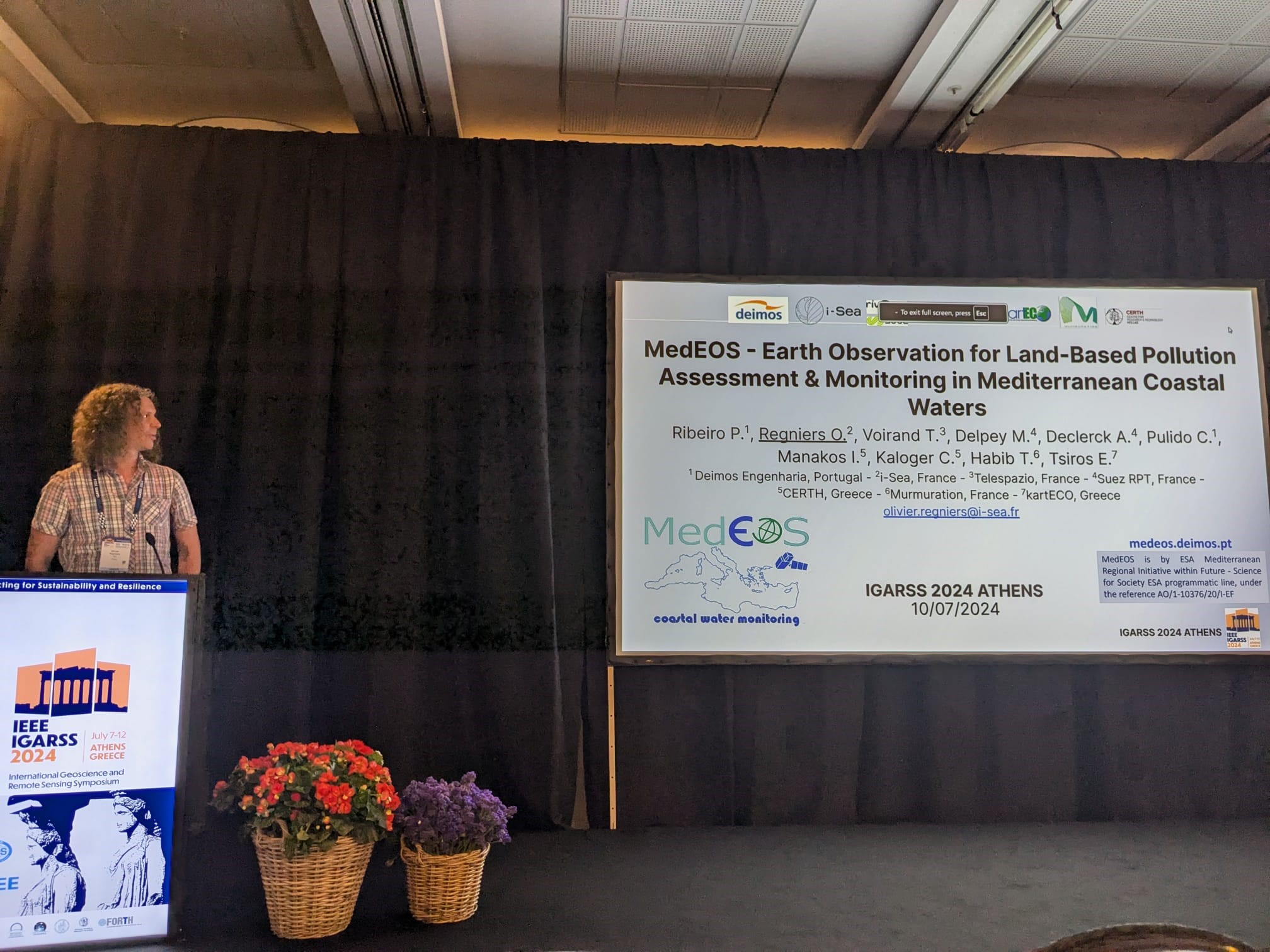
MedEOS Project Concludes with Key Presentation at IEEE IGARSS 2024, July 12, 2024
MedEOS project, a significant initiative aimed at advancing satellite-based Earth observation technologies, has officially been completed. The project has achieved its objectives of developing cutting-edge tools for environmental monitoring and data analysis, providing valuable insights into climate change, natural disasters, and resource management.
As part of the project's dissemination efforts, MedEOS team presented their findings at the IEEE International Geoscience and Remote Sensing Symposium (IGARSS) 2024 held in Athens, Greece from 7 to 12 July 2024. The oral presentation, titled "Earth Observation for Land-Based Pollution Assessment & Monitoring in Mediterranean Coastal Waters" highlighted the project's significant contribution to monitoring and assessing pollution in coastal regions using satellite data.
MedEOS has greatly benefited from the involvement of its end-users throughout the project. The next steps will be dedicated to further improve the large-scale developed products to their local requirements.
For more detailed information about the MedEOS project and its achievements, please visit the official project website at https://medeos.deimos.pt/
EOS team discusses with EAS Kavala in support of Cotton management in the agricultural plain of Chrysoupoli

EOS team discusses with EAS Kavala in support of Cotton management in the agricultural plain of Chrysoupoli, June 28, 2024
EOS team visited the offices of the Rural Corporate Partnership of Kavala (EAS Kavala) in the cities of Kavala and Chrysoupoli on June 28, 2024, for key technical meetings regarding the DigiCotton project. Representatives from all three partner organizations involved in the project were present (FoodStandard, EAS Kavalas and CERTH{EOS}). The discussion focused on the development of the DigiCotton project app, which aims to improve cotton farmers' ability to monitor and assess field conditions using remote sensing technology. The app will also integrate live data from the meteorological station acquired by the project, further enhancing its capability to provide real-time insights for farmers. Suggestions revolved around the better alignment of the UAV flight campaign (supporting the field experimentations) with the growth phases of the cultivation in the area. The meetings highlighted the commitment of all parties to assimilate Earth Observation products for facilitating agricultural practices in line with the Common Agricultural Policy.
EOS team discusses with EASTH in support of rice management in the agricultural plain of Thessaloniki

EOS team discusses with EASTH in support of rice management in the agricultural plain of Thessaloniki, June 13, 2024
EOS team visited the offices of the Rural Corporate Partnership of Thessaloniki (EASTH) in Sindos on June 13, 2024, for a key technical meeting regarding the DigiRyzi project. Representatives from all three partner organizations involved in the project were present (FoodStandard, EASTH and CERTH{EOS}). The discussion focused on the development of the DigiRyzi project app, which aims to improve rice farmers' ability to monitor and assess field conditions using remote sensing technology. Additionally, the app will integrate live data from two meteorological stations acquired by the project, further enhancing its capability to provide real-time insights for farmers. The meeting highlighted the commitment of all parties to leverage Earth Observation technology for better agricultural practices in line with the Common Agricultural Policy, supporting farmers in Thessaloniki and beyond.
EOS team contributes to Water4All Workshop and presents the WQeMS Services Platform
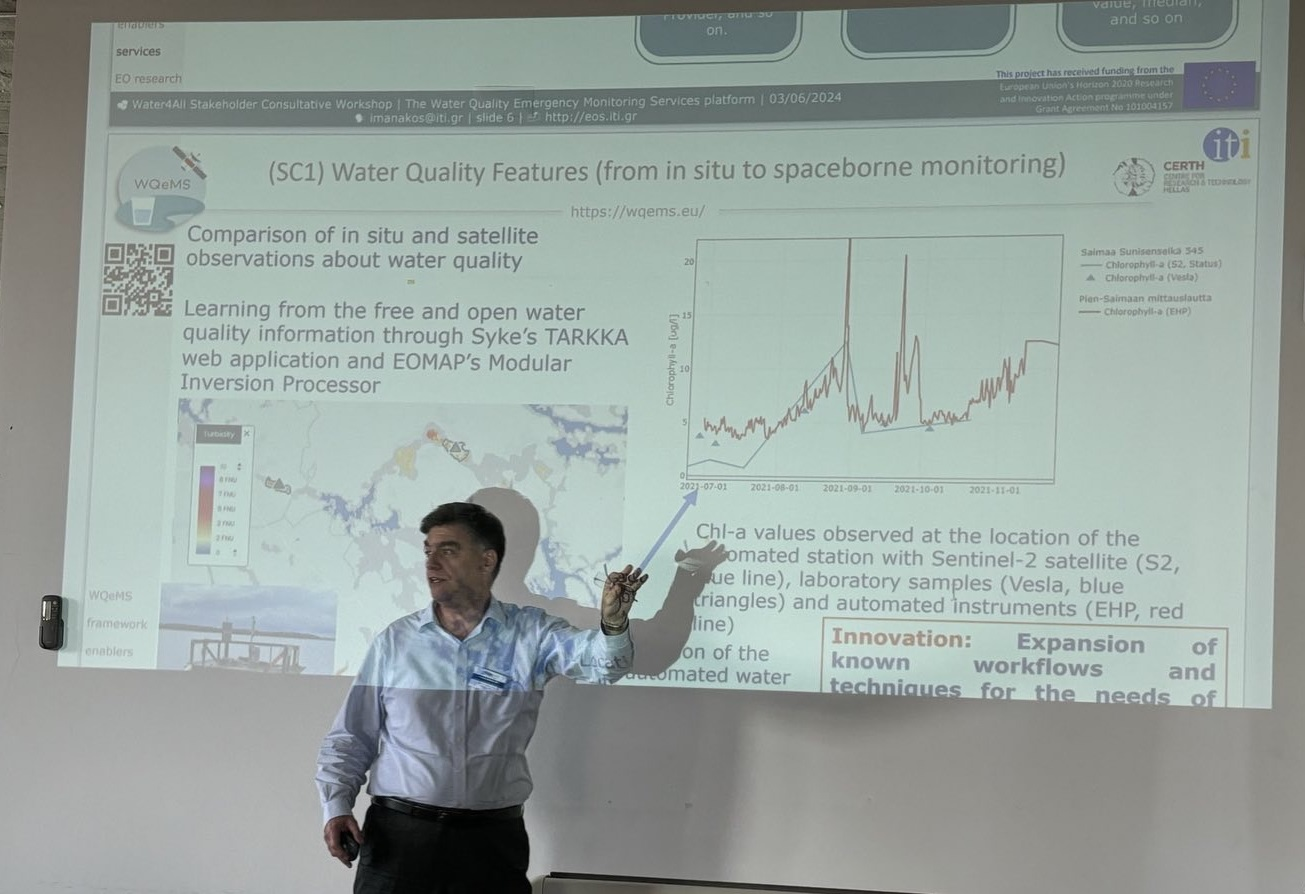
EOS team contributes to Water4All Workshop and presents the WQeMS Services Platform, June 04, 2024
EOS team was invited at the Second Stakeholder Consultative Workshop, held in Lisbon from June 3 to 4, 2024. The Workshop was organized by Water4All - Water Security for the Planet, bringing together key stakeholders to discuss about digital tools for smart water management. Special focus was placed on smart water meters, remote sensing and Geographical Information Systems (GIS), Internet of Things (IoT), Machine Learning, Cloud Computing platforms and mobile applications. Main topics concerned data quality and accessibility, integration and interoperability, cybersecurity risks, privacy and data protection policies for the collection and storing of sensitive data, digital divide, costs and resource constraints, and slow adoption of digital solutions on the market. During the Workshop, Ioannis Manakos presented the cutting-edge WQeMS Services platform, which is designed to analyse Earth Observation data and facilitate the adoption of Earth Observation monitoring services in the water utilities operations. The presentation highlighted the platform's capabilities in enhancing water security by providing timely insights for stakeholders.
Earth Observation research in support of archaeological surveys
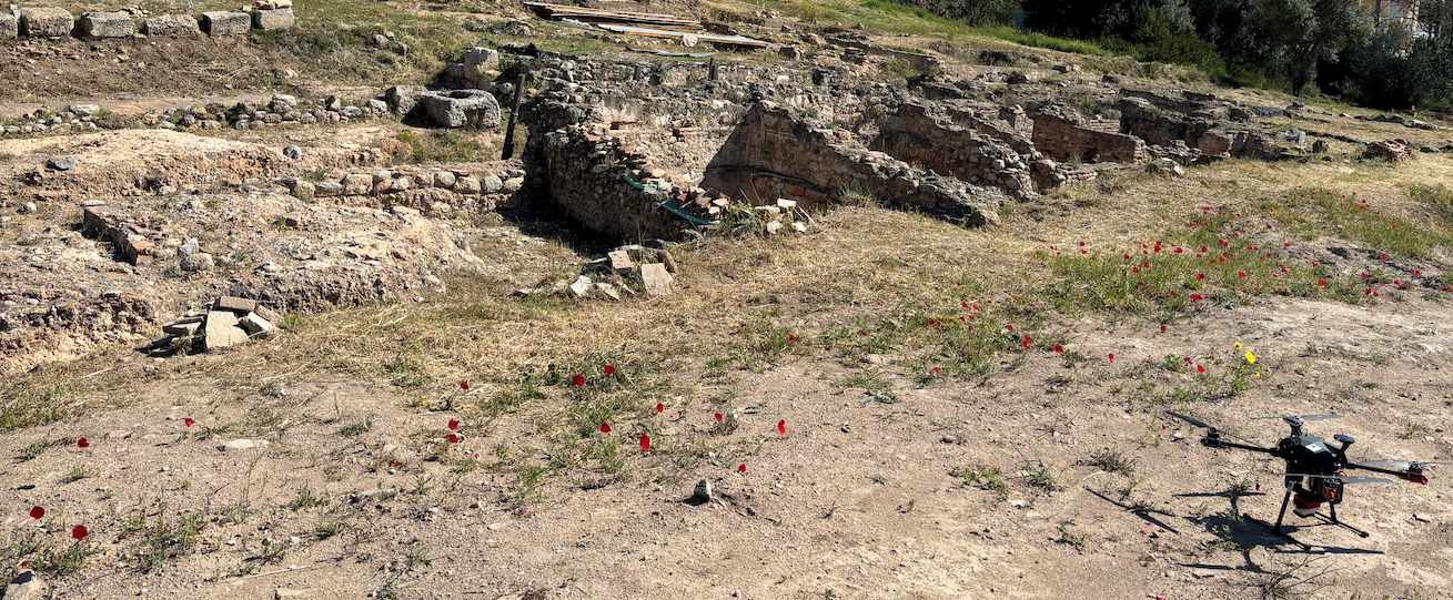
Earth Observation research in support of archaeological surveys, May 22, 2024
EOS team conducted an extensive aerial mapping survey in Rafina and Penteli (Attiki, Greece) on April 10 and May 22, 2024. Utilizing advanced UAVs attached with 48Mpx and multispectral cameras, as well as a LiDAR camera provided by the collaborating company GeoSense, EOS team focused on the archaeological site of the Roman Baths in Rafina, the ancient farmhouse in Daou Penteli, and the surrounding areas.
This initiative aims to document these significant historical sites and create detailed 3D models for research purposes. The data gathered will enhance the understanding of these ancient structures and contribute to the ongoing preservation efforts.
Outreach and Training overseas
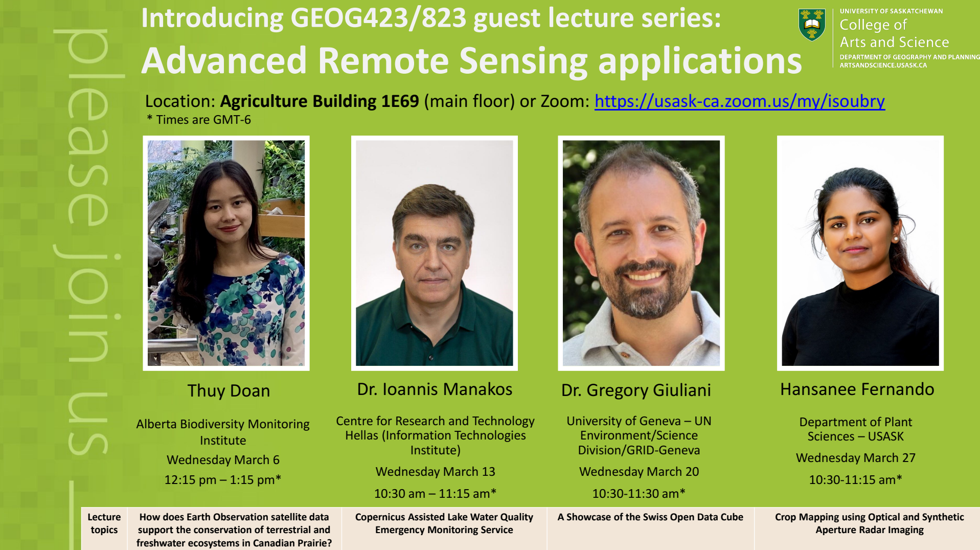
Outreach and Training overseas, March 13, 2024
The Department of Geography and Planning, College of Arts and Science, University of Saskatchewan, Canada, invited Ioannis Manakos as a Guest Lecturer to present Advanced Remote Sensing applications; in particular, the "Copernicus Assisted Lake Water Quality Emergency Monitoring Service". You are invited to take part and attend either at the Agriculture Building 1E69 (main floor) or via Zoom on the 13 March 2024 (10:30 - 11:15am GMT-6).
Artificial Intelligence and Earth Observation for hop yield management
Artificial Intelligence in Hop Farming - Greek Scientists Visit Hop farms in Weikenhausen, March 01, 2024
Article in the Pfaffenhofener Kurier (translated from German, as appeared in the regional newspaper in Bavaria, Germany, on March 13 2024).
Schweitenkirchen - Recently, international guests visited the hop farm of Stefan Linseisen in Weikenhausen. The two Greek scientists, Anastasios Delopoulos and Ioannis Manakos, accepted the invitation from Hubert Linseisen, an agricultural consultant from Geroldshausen, to visit the Hallertau region and Weihenstephan. According to the announcement, Delopoulos works at the Department of Electrical and Computer Engineering at the Aristotle University of Thessaloniki, while Manakos is at the Centre for Research and Technology Hellas (CERTH), also in Thessaloniki. Manakos obtained his PhD in remote sensing in Weihenstephan and has visited the Hallertau region several times. Together with colleagues and Hubert Linseisen, the scientists presented an article on satellite image analysis and the use of artificial intelligence for hop farming operations at a conference on agricultural informatics in Stuttgart. A special highlight of the subsequent trip was the visit to Stefan Linseisen's hop farm in Weikenhausen, located in the municipality of Schweitenkirchen. Satellite images for the hop gardens with the Herkules, Perle, and Tradition varieties were evaluated for over three years. Assessments show a high potential to provide important information for hop production. On-site visits included touring the hop gardens and the hop farm in Weikenhausen. Additionally, the hop research center in Huell, the German Hop Museum in Wolnzach, and scientific institutions in Weihenstephan were visited.
An additional relevant reference to our work and visit is placed at the 'Bayerisches Landwirtschaftliches Wochenblatt' on 12.04.2024. The title is 'KI soll im Hopfenbau helfen' (engl. : AI should help in hop growing).
EOS UAV services
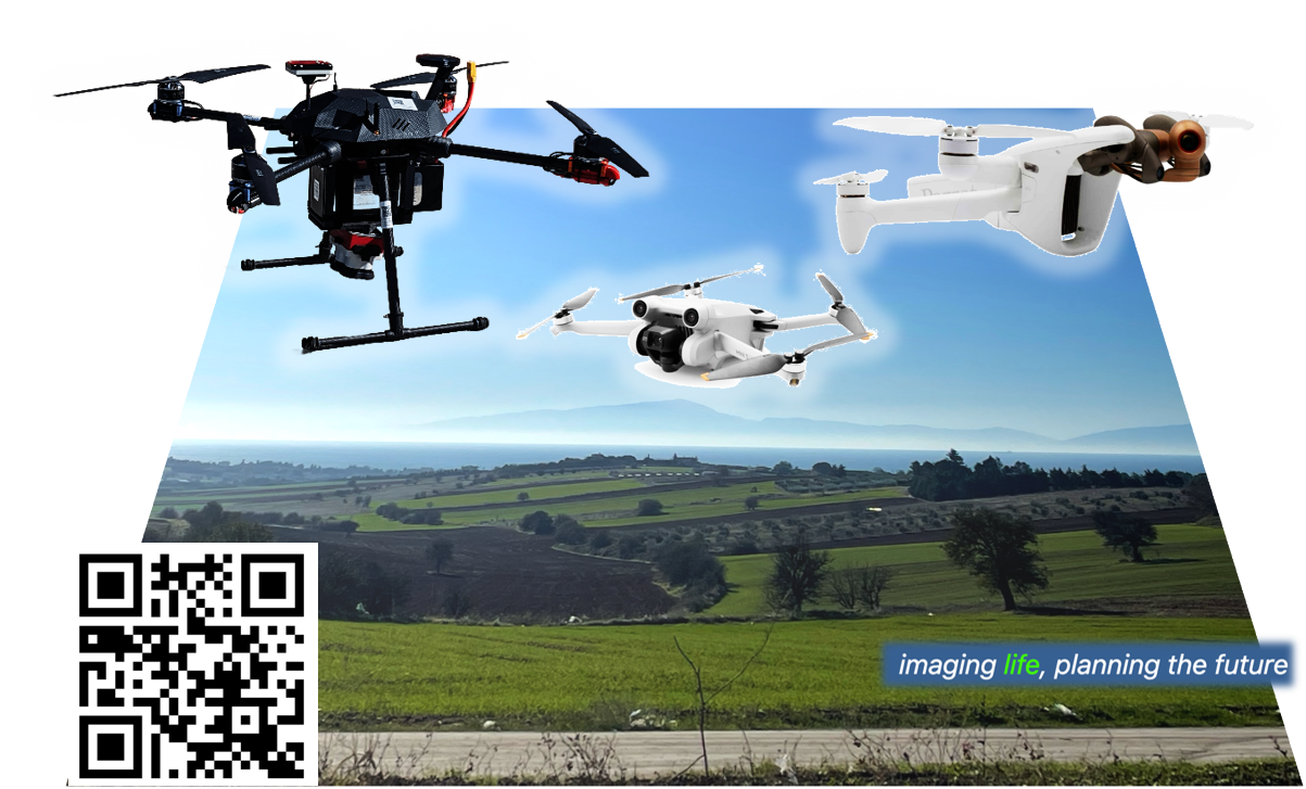
EOS UAV services, December 08, 2023
EOS Team has developed the capacity of its personnel and hardware with three cutting-edge Unmanned Aerial Vehicles (UAV) to facilitate its activities in environmental monitoring: 🚁 DJI Mini 3 Pro with 4K camera; 🌍 Anafi AI Parrot with 48Mpx camera and advanced obstacle avoidance, precise navigation, and increased operational range; 🔍 GEO690 with the Micansense RedEdge-P multispectral camera, which enables detailed and accurate data collection for environmental applications.
Complementary of the shelf UAV image analysis software is acquired, i.e. the 🖥️ Pix4DFields Software. Moreover, own software modules are being developed to support research and application targets. Georeferenced mosaics can be generated, where upon environmental changes and trends may be monitored in tandem with timely equivalent cross-scale satellite and/ or in-situ data.
Why Choose EOS Team's Drones for Environmental Monitoring?
- Cutting-edge technology tailored for environmental applications
- Evidence-based monitoring in diverse ecosystems
- Eco-friendly data collection
- In-depth data analysis for tailor-made solutions
- Experienced and specialized personnel
CORDIS showcases WQeMS project results
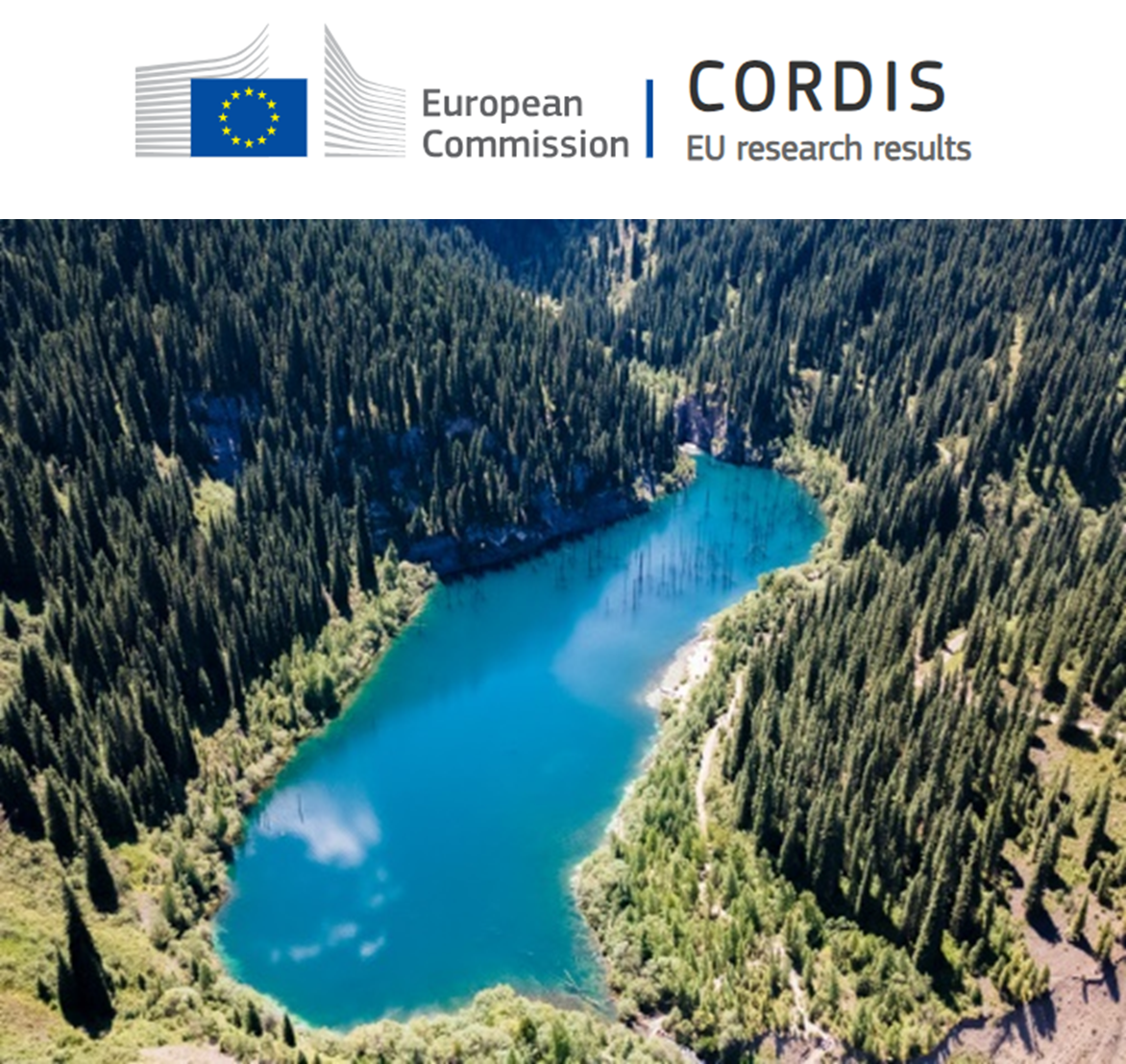
CORDIS showcases WQeMS project results, November 20, 2023
The results of the Research and Innovation Action (RIA) project Water Quality emergency Monitoring Service (WQeMS) are now accessible on the CORDIS EU website. CORDIS belongs to the Research and Innovation community platform of the European Commission and complements the Funding and Tender Opportunities website.
WQeMS project results are available in six languages: German (DE), English (EN), Spanish (ES), French (FR), Italian (IT), and Polish (PL) to ensure that project research reaches a global audience. Explore the in-depth analyses, innovative methodologies, and practical solutions developed by the WQeMS team. Navigate the CORDIS website to access detailed reports, training courses, and the interactive WQeMS platform.
NextLand project at the European Researchers’ Night in Thessaloniki - Greece
NextLand project at the European Researchers’ Night in Thessaloniki - Greece, September 29, 2023
The NextLand H2020 project, an alliance of Earth observation providers, presented its groundbreaking technology for land management geoservices at the European Researchers’ Night in Thessaloniki (Greece) on September 29, 2023.
WQeMS project at the European Researchers’ Night in Thessaloniki - Greece
WQeMS project at the European Researchers’ Night in Thessaloniki - Greece, September 29, 2023
Results of the WQeMS project were presented at the European Researchers’ Night in Thessaloniki (Greece) on September 29, 2023. WQeMS captured attention for its mission to revolutionize water quality and environmental monitoring, demonstrating its groundbreaking results to an eager audience of local residents, students, and fellow researchers.
WQeMS: Copernicus evolution services become handy for monitoring megastorms’ impact
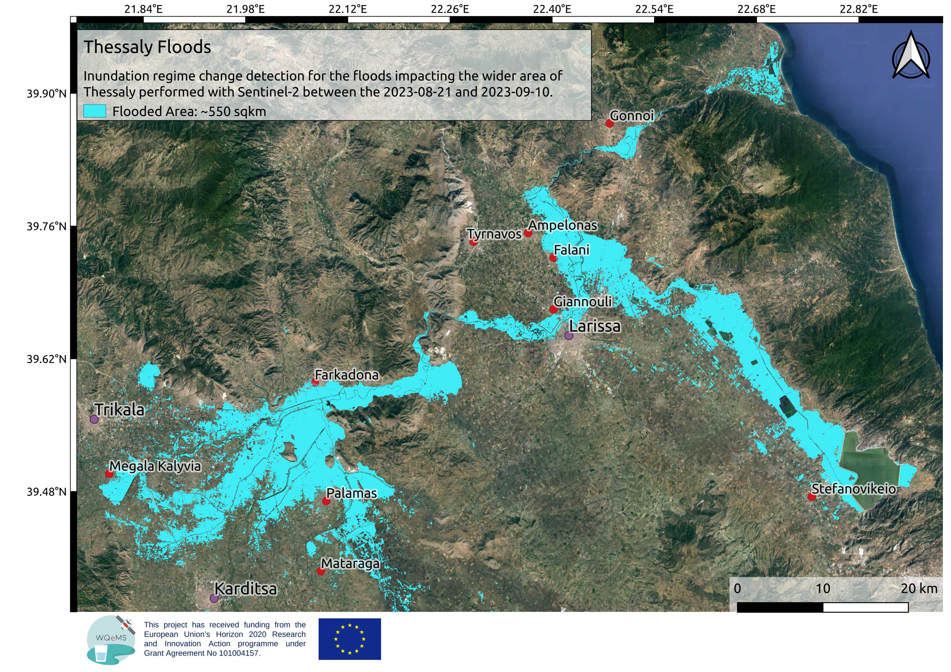
WQeMS: Copernicus evolution services become handy for monitoring megastorms’ impact, September 10, 2023
EOS team demonstrates high efficiency in registering flood extent between two dates in time. In support of accurate monitoring and mitigation of the aftermath of the tremendous destruction, caused by the ‘megastorm’ Daniel in Greece, Sentinel-2 spaceborne multispectral imagery was acquired prior the event on August 21 2023, and after the end of the precipitation events on September 10 2023 to map the prevailing inundation regime in the area. The WQeMS Land-Water Transition Zone Change Detection Service registered a substantial flood covering approximately 550 square kilometres in Thessaly region. Further analysis of the data is ongoing to better understand the flood's impact.
DigiRYZi Kick-off Meeting
DigiRYZi Kick-off Meeting, July 11, 2023
The DigiRYZi Kick-off Meeting was held in Sindos, Thessaloniki on 11 July 2023. The project aims to create a guide for agricultural practices that will ensure the protection of biodiversity and the preservation of the ecosystem in the region of Axios Delta. Simultaneously, it will contribute to the promotion of local products by establishing an Environmental Product Declaration Certification, focusing on rice cultivation in the Central Macedonia region, specifically in Sindos.
DIGICOTTON Kick-off Meeting
DIGICOTTON Kick-off Meeting, July 06, 2023
The DIGICOTTON Kick-off Meeting was held in Chrysoupoli, Kavala on 06 July 2023. Within the scope of the project, a guide to agricultural practices and a management system will be developed, focusing on cotton cultivation and will be accessible through a mobile application available on smartphones/tablets for cotton growers. Cotton farmers will be able to monitor and manage their cultivation more effectively, ensuring economic viability and environmental protection.
WQeMS participated in the first webinar of the Water Europe Human Capital Working Group: Train and Develop yourself
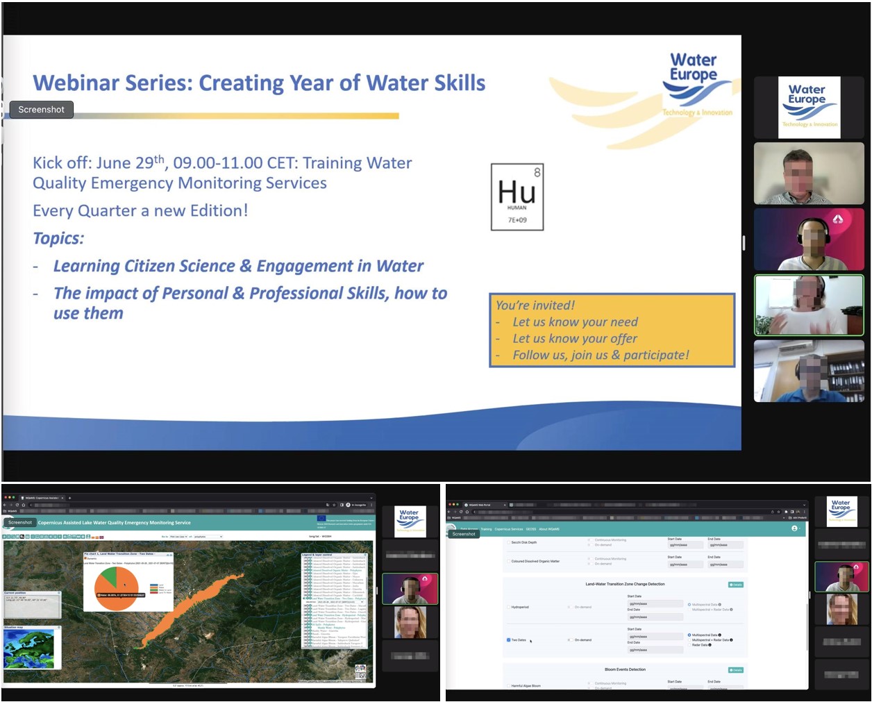
WQeMS participated in the first webinar of the Water Europe Human Capital Working Group: Train and Develop yourself, June 28, 2023
The webinar showcased the powerful WQeMS platform, providing valuable insights and an online demonstration with hands-on experience. Moreover, the value of the WQeMS online capacity-building courses was demonstrated, along with the material and suggested training pathways per user and case.
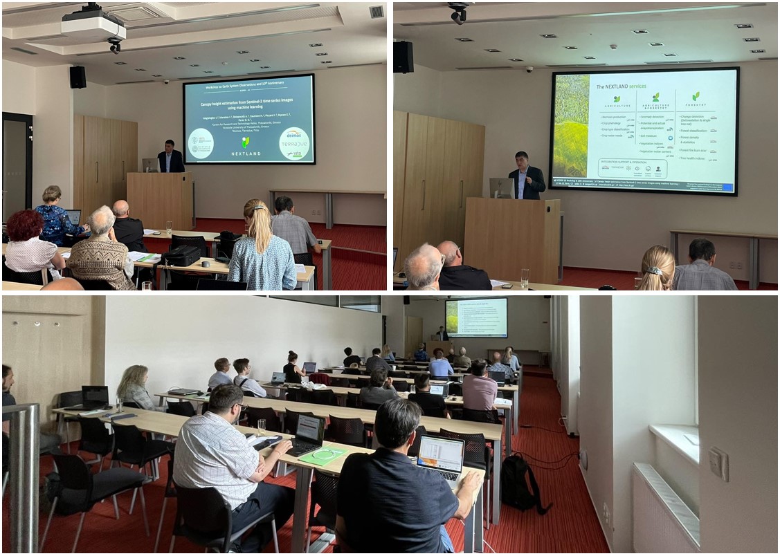
Nextland canopy height service presented to SCERIN colleagues
Nextland canopy height service presented to SCERIN colleagues, June 26-29, 2023
ΝEXTLAND and its services were presented at the SCERIN-10 Workshop on Earth System Observations and 10th Anniversary in Brno, Czechia, on 26th-29th June 2023. Focus was given on the new service developed by CERTH and AUTH about the estimation of canopy height from Sentinel-2 images: ‘Canopy height estimation from Sentinel-2 time series images using machine learning’. Details about the workflow and the method were demonstrated. Vivid discussion arose with the audience showing its interest for the service, asking for clarifications about its applicability in various areas and possible limitations.
WQeMS participated at the SCERIN-10 Workshop
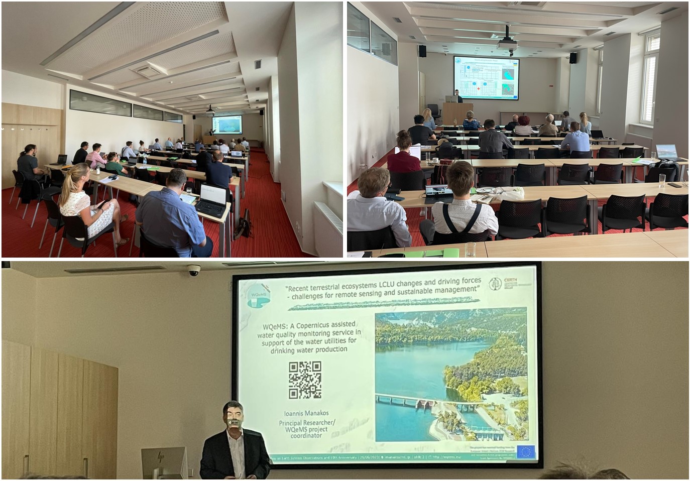
WQeMS participated at the SCERIN-10 Workshop on Earth System Observations and 10th Anniversary in Brno, Czech Republic, June 26-29, 2023
Ioannis Manakos delivered an insightful oral presentation titled "WQeMS: A Copernicus assisted water quality monitoring service in support of the water utilities for drinking water production".
Eleftherios Katsikis also delivered an insightful presentation titled: “Water emergent and floating aquatic vegetation mapping using Earth Observation data: An example at the Dniester Delta in Ukraine”.
AQUACYCLE Project demonstrates Online Irrigation Suggestion Tool at Final Conference
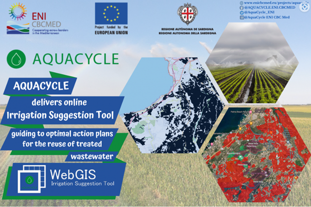
AQUACYCLE Project demonstrates Online Irrigation Suggestion Tool at Final Conference, June 23, 2023
The online Irrigation Suggestion Tool, developed as part of the ENI CBC Med funded AQUACYCLE project, is ready for use. This innovative tool is designed to assist stakeholders in creating optimal action plans for the reuse of treated wastewater, furthering the project's mission of sustainable water management. The tool leverages advanced WebGIS technology, offering a user-friendly interface that empowers users to make informed decisions regarding irrigation strategies.
To showcase this remarkable achievement and other project outcomes, the AQUACYCLE Final Conference is scheduled to take place from June 23rd to 24th, 2023. The conference will provide a platform for experts, researchers, policymakers, and stakeholders to explore outcomes of the project in support of their understanding and use of advanced IT and APOC (Anaerobic digestion and Photocatalytic Oxidation of the outflow from Constructed wetlands) technologies for supporting efficient water allocation, reduced waste, and increased agricultural productivity.
WQeMS H2020 project showcases service lines and products at the Water Innovation Europe 2023
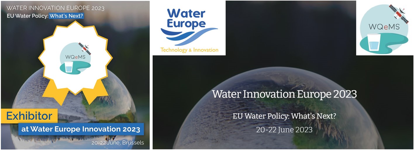
WQeMS H2020 project showcases service lines and products at the Water Innovation Europe 2023, June 20, 2023
WQeMS H2020 project will participate as an exhibitor at the Water Innovation Europe 2023 event. This prestigious gathering of industry leaders and innovators will provide a platform for the project to showcase its groundbreaking research and solutions.
As an exhibitor, WQeMS project will have a dedicated booth where attendees can learn more about our research results, cutting-edge technologies, and data-driven approaches. We invite you to visit our booth at Water Innovation Europe 2023 and join us in shaping the future of sustainable water management.
WQeMS H2020 project has also been chosen as a selected candidate for the prestigious Global Water Challenges Award!
Ιoannis Manakos presented WQeMS at the GEO organized Open Data/Open Knowledge Workshop in Geneva
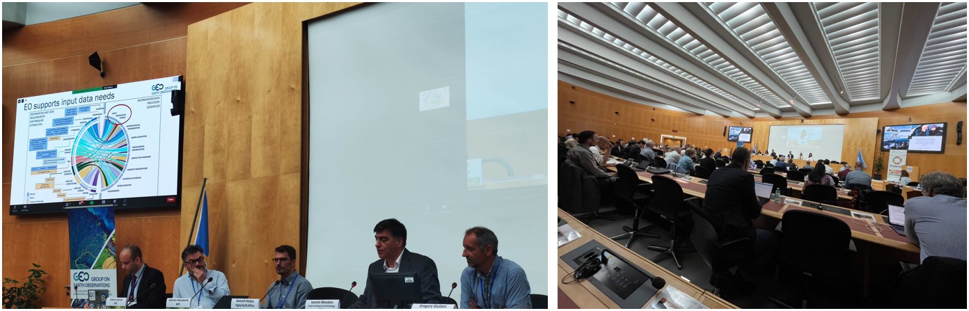
Ιoannis Manakos presented WQeMS at the GEO organized Open Data/Open Knowledge Workshop in Geneva, June 16, 2023
The Workshop served as an exceptional platform for international collaboration and knowledge exchange, bringing together experts, researchers, and organizations committed to advance the field of IT support in EO data analysis and open distribution to stakeholders.
During this event WQeMS showcased its contribution to the GEOSS Portal, amplifying the accessibility and availability of WQeMS water quality monitoring services. Moreover, WQeMS discussed its position in relation with open data structures towards enhancing the accessibility and availability of water quality information; facilitating the seamless exchange of information across platforms, promoting interoperability and streamlining workflows.
WQeMS Project contributes to the development of Tarkka+ latest version
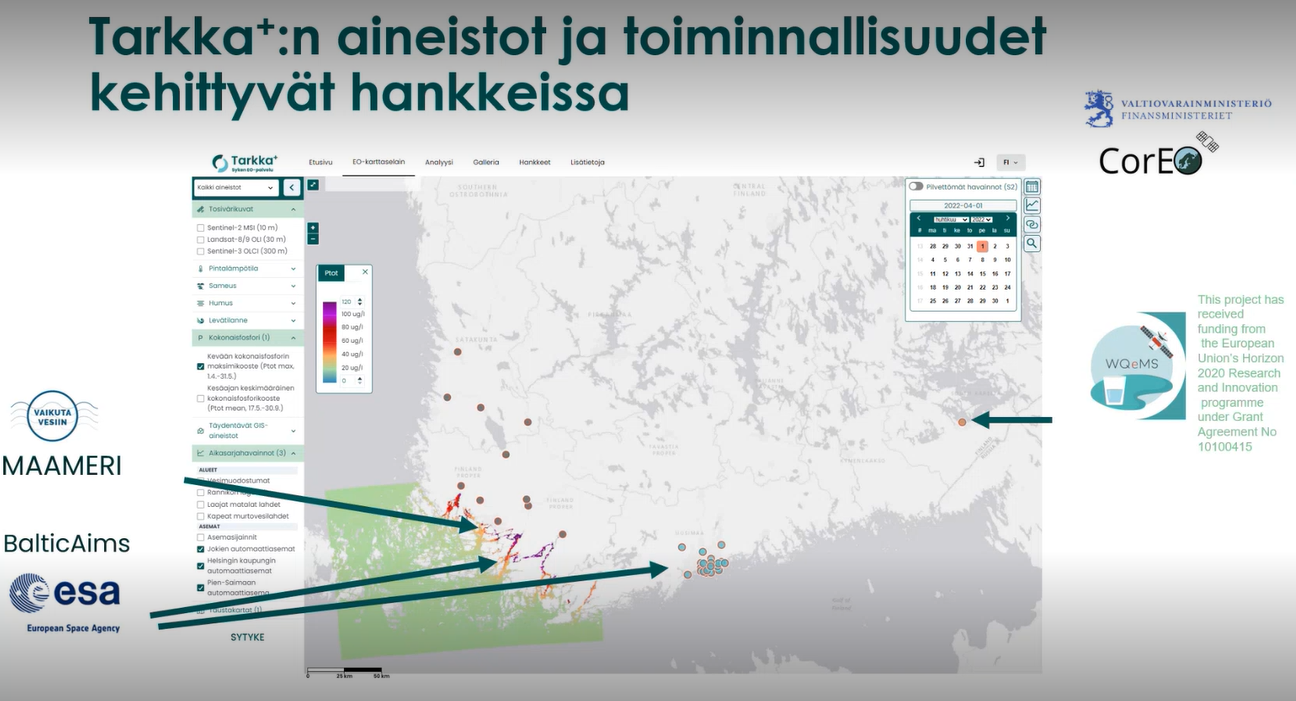
WQeMS Project contributes to the development of Tarkka+ latest version, June 08, 2023
The WQeMS project has participated in the development of the latest version of Tarkka+. Tarkka+ is a free and open service operated by SYKE (Finnish Environment Institute) and it is used to publish various EO based materials together with in situ, GIS and model data. The 1st version of the service was published in June 2017 and it has been continuously updated in various projects since then. As part of its role, WQeMS has focused on providing quality-controlled data from the pilot area of Pien-Saimaa, located adjacent to the city of Lappeenranta.
Highlighting the significance of the development work, an information and publication event about Tarkka+ was recently held on June 8 for the Finnish regional environmental authorities, working at the ELY centres. These authorities utilize the information provided by Tarkka+ for vital tasks such as algal bloom monitoring, directive reporting, and other environmental monitoring purposes. During the event, the WQeMS project's role within the broader development framework was presented.
The WQeMS project has been presented at the WATERVERSE project’s stakeholders’ workshop in Limassol, Cyprus
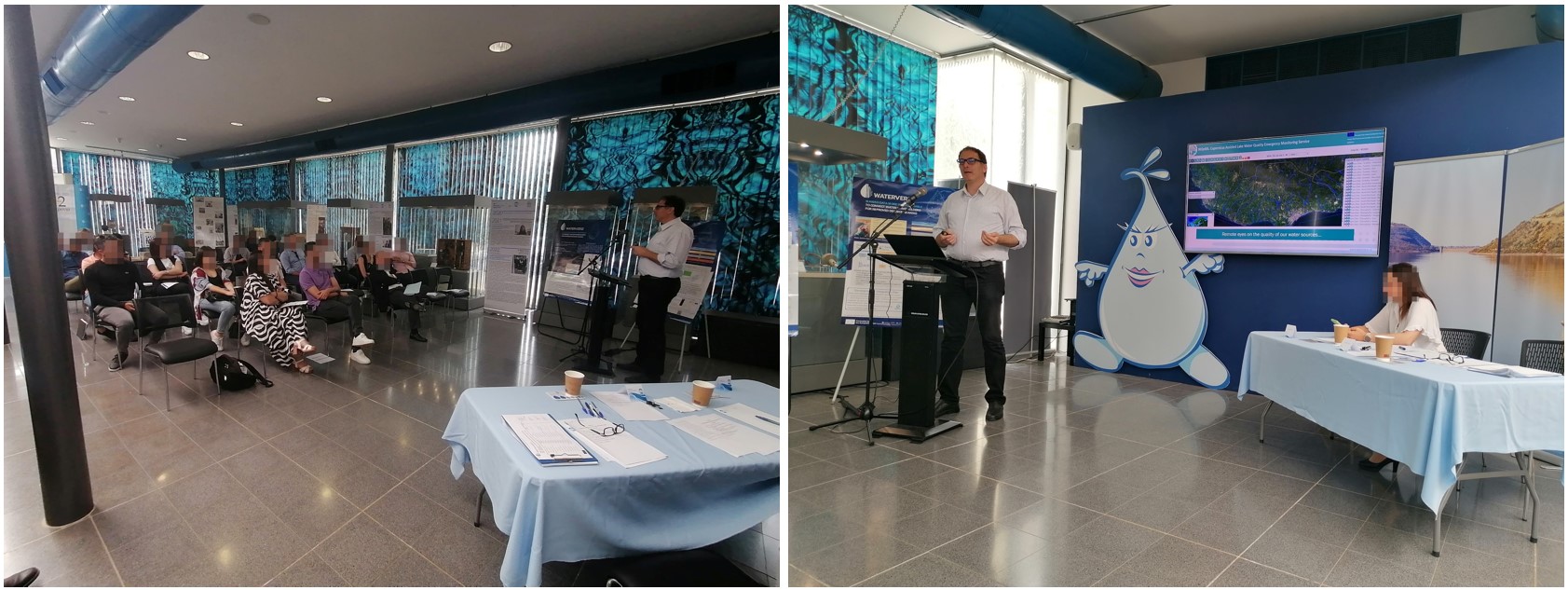
The WQeMS project has been presented at the WATERVERSE project’s stakeholders’ workshop in Limassol, Cyprus, June 02, 2023
The WQeMS project has been presented in the workshop organized by the Water Board of Limassol in Cyprus, in the framework of the WATERVERSE project. The event was dedicated to the water data spaces, and offered an excellent platform for the local stakeholers to discuss the importance of the data interoperability in modern water systems' operation. The capabilities and the potential of WQeMS as a powerful integrated tool in the utilities' decision support systems, were showcased by our partner, PHOEBE Research and Innovation Ltd (PHOEBE). Specifically, leveraging the expertise and insights gained from WQeMS, PHOEBE highlighted the significance of incorporating remote sensing based water quality monitoring and management into broader data spaces, enabling more informed decision-making processes.
WQeMS and NextLand Poster presentations at SVC Summit 2023 in Portugal
WQeMS and NextLand Poster presentations at SVC Summit 2023 in Portugal, May 25, 2023
The SVC Summit 2023 held in NOVA SBE, Carcavelos, Portugal witnessed the presentation of two posters by the WQeMS and NextLand projects. As part of the renowned event, the posters showcased the pioneering research and technological advancements in water quality and forest management.
EOS team at the annual EOTiST meeting
EOS team at the annual EOTiST meeting, May 18, 2023
The EOTiST annual meeting took place in Warsaw on May 16-18, 2023. The meeting sessions included among others:
- On site training for new EU proposals submission
- Workshop about "Time series in service of ecosystem monitoring"
- Information Day about "Training for scientific career planning"
- Business Day in relation with the transfer or research results to the market
MDPI Special Issue "Sentinel Analysis Ready Data (Sentinel ARD)"
MDPI Special Issue "Sentinel Analysis Ready Data (Sentinel ARD)", May 18, 2023
The MDPI Special Issue "Sentinel Analysis Ready Data (Sentinel ARD)" is completed and open to the public. Ioannis Manakos, being guest co-editor, wishes to thank authors for their contributions and his co-editors for the collaboration. This special issue belongs to the section "Satellite Missions for Earth and Planetary Exploration" and is consequently aiming to cover the most recent advances in Analysis Ready Data (ARD) developments and implementations for Sentinel data, to support community consensus on Sentinel ARD.
EOS Team participation at CERTH's Open Day Event
EOS Team participation at CERTH's Open Day Event, May 12, 2023
EOS team actively participated in the highly anticipated Open Day event organized by the Centre for Research and Technology Hellas (CERTH). The event, held on May 12, 2023, welcomed visitors of all ages to explore the cutting-edge activities and research projects undertaken by numerous research teams from the Informatics and Technology Institute. During the event, the EOS team showcased its main activities and research projects to the attendees and successfully bridged the gap between complex concepts and everyday life, making its work accessible and engaging for visitors of all backgrounds.
Medwaycap First Newsletter
Medwaycap First Newsletter, May 03, 2023
MEDWAYCAP project responds to the challenges of climate change impact on water resources through the promotion of best practices on treated wastewater reuse as non-conventional water resource (NCWR) thus strongly contributing to local water shortage mitigation.
Best Paper Award for EOS team members
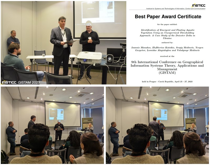
Best Paper Award for EOS team members, April 27, 2023
The conference paper "Identification of Emergent and Floating Aquatic Vegetation Using an Unsupervised Thresholding Approach: A Case Study of the Dniester Delta in Ukraine" by I. Manakos, E. Katsikis, S. Medinets, Y. Gazyetov, L. Alagialoglou and V. Medinets, led by EOS team members, has been awarded the best paper award during the 9th International Conference on Geographical Information Systems Theory, Applications and Management.
Ioannis Manakos at the GISTAM 2023
Ioannis Manakos at the GISTAM 2023, April 27, 2023
Ioannis Manakos participated in the GISTAM 2023 and presented the "Identification of Emergent and Floating Aquatic Vegetation Using an Unsupervised Thresholding Approach: A Case Study of the Dniester Delta in Ukraine" at the session "Spatio-Temporal Data Acquisition".
Ioannis Manakos at the e-shape Final General Assembly
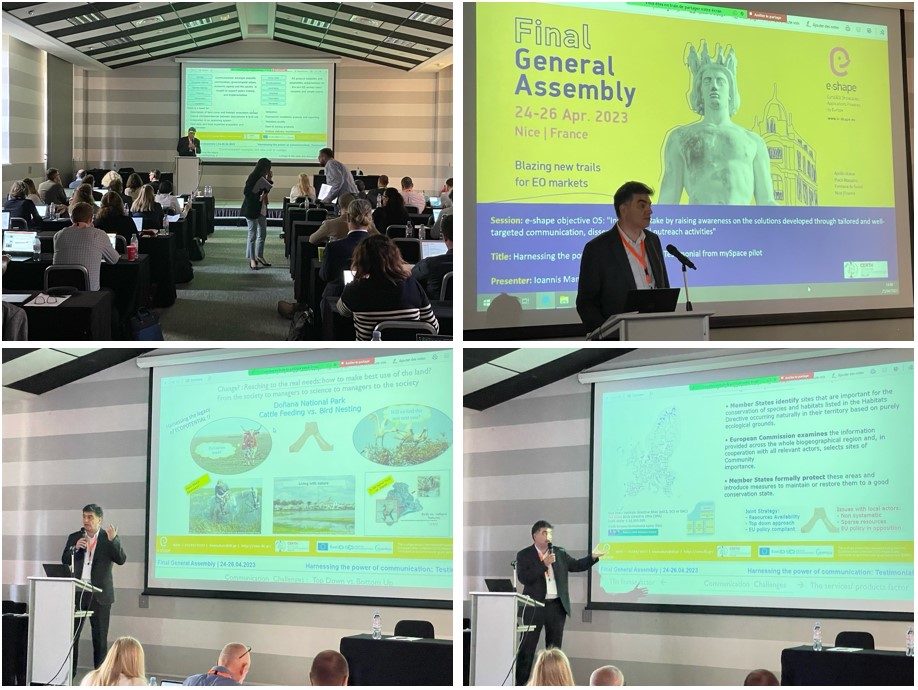
Ioannis Manakos at the e-shape Final General Assembly, April 25, 2023
Ioannis Manakos participated in the e-shape Final General Assembly and presented the "Harnessing the power of communication: Testimonial from mySpace pilot", especially about "Inundation mapping in service of habitat change monitoring", at the session e-shape objective O5: "Increase uptake by raising awareness on the solutions developed through tailored and well targeted communication, dissemination and outreach activities".
WQeMS Local Meeting
WQeMS Local Meeting, April 06, 2023
WQeMS meeting in Cyprus with local stakeholders at the offices of the Water Development Department of Nicosia.
WQeMS Local Meeting
WQeMS Local Meeting, April 06, 2023
WQeMS meeting in Cyprus with local stakeholders at the offices of the Water Board of Limassol.
WQeMS General Assembly meeting
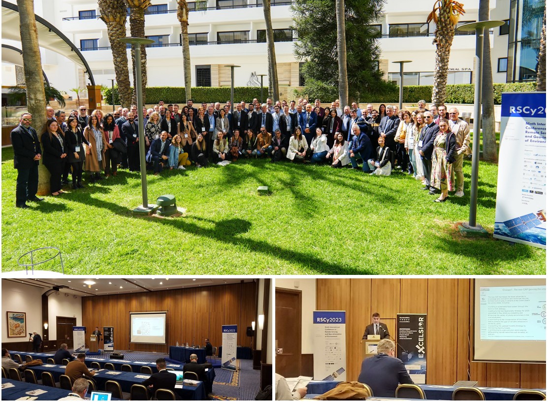
WQeMS General Assembly meeting, April 04, 2023
The Hybrid meeting was organised in parallel to the RSCy2023 Conference on April 4th 2023. Location: Cyprus, Ayia Napa.
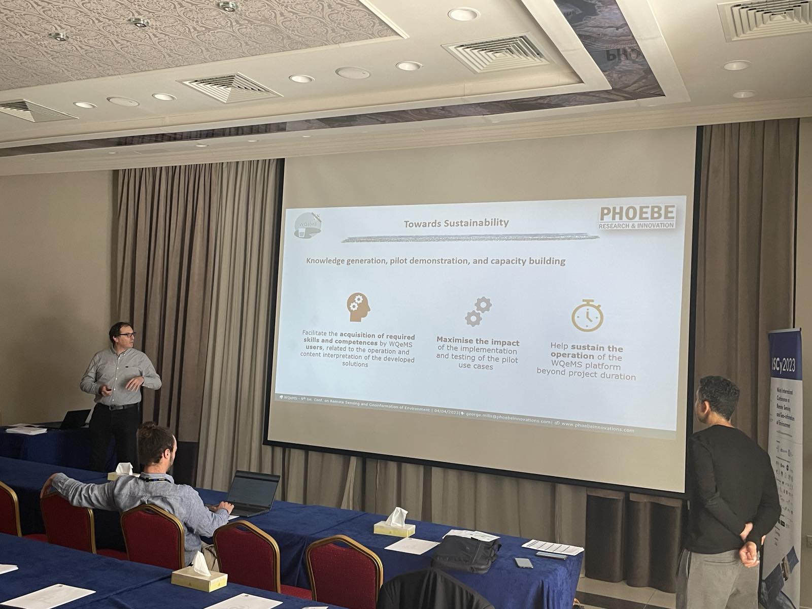
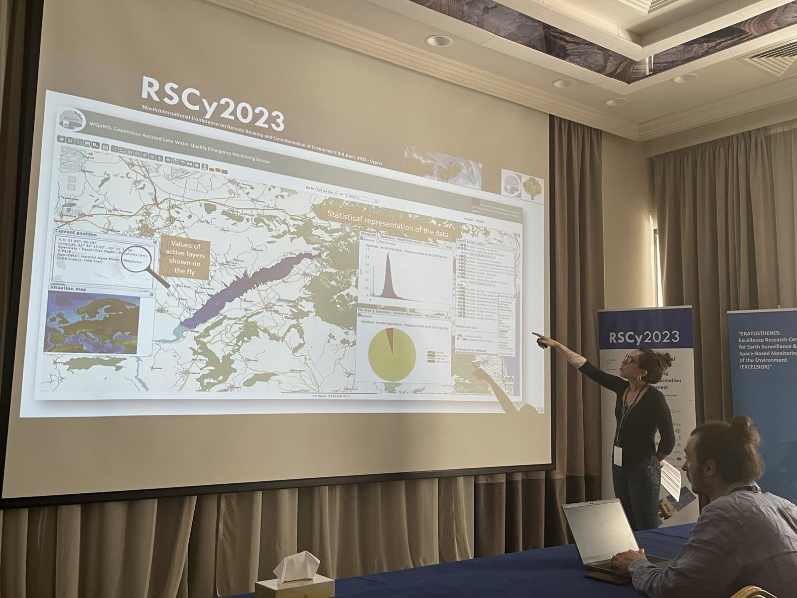
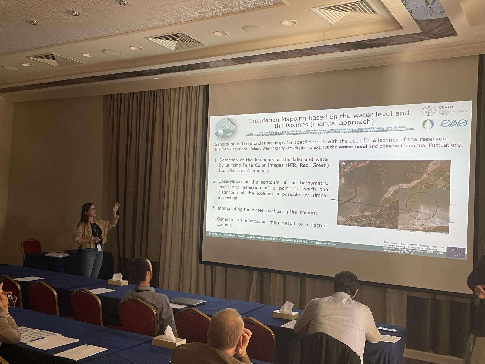
WQeMS at the Ninth International Conference on Remote Sensing & Geoinformation of Environment
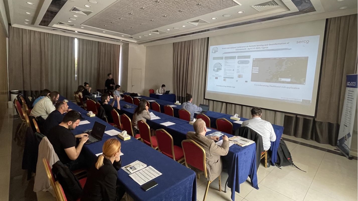
WQeMS at the Ninth International Conference on Remote Sensing & Geoinformation of Environment, April 04, 2023
G. Scarpino, M. Matera, G. Milis, P. Bauer, I. Manakos, 2023. The WQeMS platform for inland surface water bodies' monitoring: serving user communities and supporting experts' analyses, 04, April.
WQeMS at the Ninth International Conference on Remote Sensing & Geoinformation of Environment
WQeMS at the Ninth International Conference on Remote Sensing & Geoinformation of Environment, April 04, 2023
G. Milis, A. Nicolaou, M. Matera, I. Serral, K. Sampsa, A. Kita, A. Bozas, K. Vlachos, I. Manakos, 2023. Capacity building for professionals towards the application of remote sensing in the monitoring of inland water sources, 04, April.
WQeMS at the Ninth International Conference on Remote Sensing & Geoinformation of Environment
WQeMS at the Ninth International Conference on Remote Sensing & Geoinformation of Environment, April 04, 2023
I.Serral, J. Masó, I. Manakos, M. Matera, M. Basile, N. Julià, 2023. Harmonized and fair lake water quality datasets for a better policy decision making, 04, April.
WQeMS at the Ninth International Conference on Remote Sensing & Geoinformation of Environment
WQeMS at the Ninth International Conference on Remote Sensing & Geoinformation of Environment, April 04, 2023
I.Manakos, A. Kita, S. Papadopoulou, I. Lioumpas, M. Katsiapi, E. Katsikis, L. Alagialoglou, A. Christodoulou, 2023. Land water transition zone mapping challenges in dynamically changing environments, 04, April.
e-shape at the Ninth International Conference on Remote Sensing & Geoinformation of Environment
e-shape at the Ninth International Conference on Remote Sensing & Geoinformation of Environment, April 04, 2023
On the 4th of April, 2023 our e-shape partner Ioannis Manakos (CERTH) presented in the Ninth International Conference on Remote Sensing and Geoinformation of Environment in Cyprus, Ayia Napa an invited keynote speech entitled “Inundation mapping in service of land cover evidence-based change monitoring”.
Capacity Building with WQeMS: a series of training modules and learning pathways
Capacity Building with WQeMS: a series of training modules and learning pathways, March 21, 2023
The training platform of WQeMS is launched. It can be used by stakeholders for effective training and capacity building to enhance understanding about projects services, outputs and solutions. A set of five training pathways have been identified about the ways the training can be offered, through scenarios, planning of pilots, as well as assessment options and feedback collection mechanisms to record the training results. The complete WQeMS Curriculum (training modules and programme) is provided in https://training.wqems.eu/ and can be used by experts/trainers beyond the project lifetime for the implementation of the defined training pathways.
The EOS team at the Water Market Europe event!
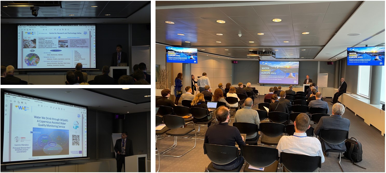
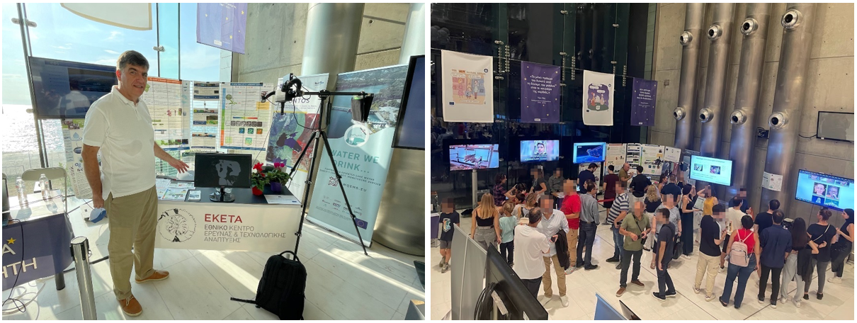
Production of the Water We Drink supported by WQeMS: A Copernicus Assisted Water Quality Monitoring Service, March 21, 2023
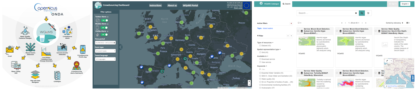
WQeMS provides an operational Water Quality Emergency Monitoring Service to the water utilities industry in relation with the quality of the “water we drink”. Exploiting Sentinel data (and in cases Very High Resolution data), it provides quality monitoring of open surface water reservoirs valorized for the delivery of drinking water at a fine spatial resolution. It focuses on slow and fast developing phenomena by offering Continuous Monitoring for a specified area; Alert Notifications in case some water quality parameter thresholds values are exceeded and in case water related issues are detected through social media; and On-demand Mapping with one-off geospatial maps of a selected area at a requested date. Service components comprise of Harmful Algal Bloom detection, Water Quality Features Changes monitoring, Extreme events detection and Land Water transition zone mapping; accompanied by horizontally offered auxiliary tools, such as crowdsourcing dashboard and capacity building. The platform, the services, the products and the user interface are presented, while exploitation opportunities are discussed.
The WQeMS - ONDA catalogue Demo has been published on ONDA marketplace
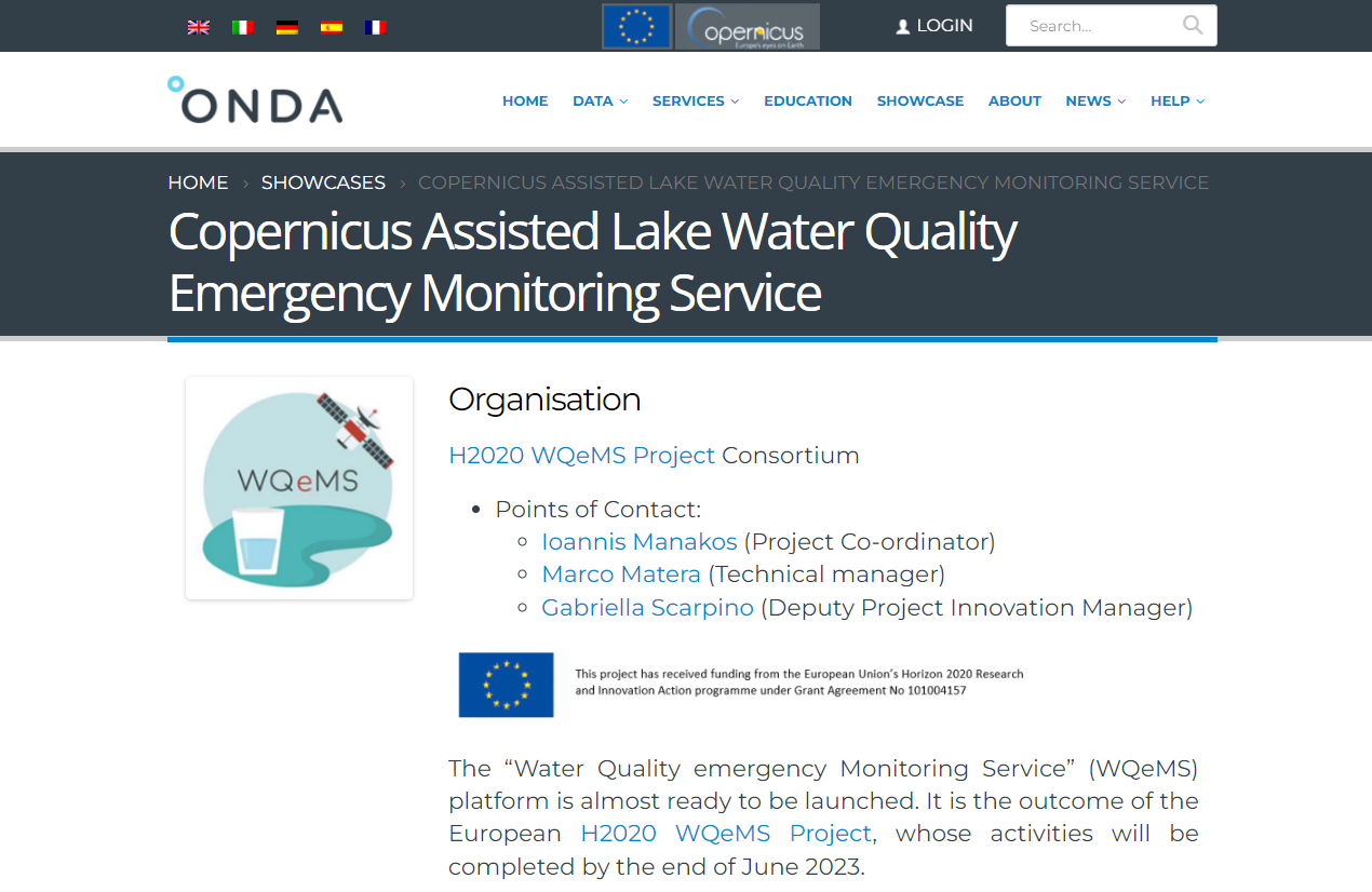
The WQeMS - ONDA catalogue Demo has been published on ONDA marketplace, February 09, 2023
The “Water Quality emergency Monitoring Service” (WQeMS) platform is almost ready to be launched. It is the outcome of the European H2020 WQeMS Project, whose activities will be completed by the end of June 2023.
The WQeMS platform has been developed on ONDA cloud machines, and exploits the ONDA DIAS infrastructure for accessing Copernicus products, as well as other DIAS used in some already service elements, which have been adapted to the WQeMS platform.
Practical School with WQeMS for Professionnals
Practical School with WQeMS for Professionnals, December 16, 2022
A Practical School with WQeMS for Professionnals was held on December 2022 aiming to provide a guided hands-on tour for the demonstration of the Water Quality Emergency Monitoring Service (WQeMS) Platform. It was intended to serve water utilities’ industry leveraging on the Copernicus products and services. After the success of the 1st Practical School for professionals, a second one is planned for February 2023.
PONTOS Final Video
PONTOS Final Video, December 13, 2022
The PONTOS Final Video released on YouTube platform. The video aims to inform the public about the PONTOS project activities, the partners and the pilot sites. It is available in English version and translated in Armenian, Georgian, Greek, Ukranian languages.
The WQeMS project presented two posters in the EuroGEO workshop
The WQeMS project presented two posters in the EuroGEO workshop, December 07-09, 2022
- “A Copernicus evolution service component towards monitoring of the open surface water reservoirs for the production of the Water We Drink” - Ioannis Manakos (CERTH)
- “Closing the gap in Water Quality datasets for Copernicus Services. The WQeMS solution for harmonized and FAIR product”- Ivette Serral (CREAF)
Oral presentation at the EuroGEO workshop
Oral presentation at the EuroGEO workshop, December 08, 2022
Ioannis Manakos (CERTH) presented the "WQeMS: a Copernicus assisted monitoring platform for the water we drink in Athens" to the Parallel Sessions: Pathways to sustainable development through use cases in the Athens metropolis.
The WQeMS project was represented in the Ecosystems and Biodiversity Action Group
The WQeMS project was represented in the Ecosystems and Biodiversity Action Group, December 07, 2022
The discussion took place as a parallel session of the EuroGEO workshop on 7th December. Its Goal was to discuss common activities onecosystems and biodiversity, using remote sensing and field observations, blending models and data,thinking of Digital Twins, addressing geospherebiosphere interactions, the interplay of geodiversity and biodiversity, biotic and abiotic ecosystem services, land surface and coastal processes, and cross-scale interactions. With the possible goal of supporting/restarting the activities of GEO ECO. Ioannis Manakos (CERTH) presented the “Copernicus assisted mapping for seasonal inundation monitoring”.
WQeMS in the Copernicus Academy Monthly Videoconference
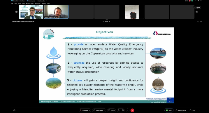
WQeMS in Copernicus Academy Monthly Videoconference, December 07, 2022
WQeMS presented “The WQeMS project, a Copernicus assisted monitoring platform for the water we drink”, and demonstrated the functionality of the WQeMS service platform in detail. Presentation by Marco Matera (ENG).
2nd WQeMS General Assembly Meeting
2nd WQeMS General Assembly Meeting, November 29 - December 2, 2022
Young researchers & technical meeting. SERCO welcomed its Partners & the Advisory Board Members of WQeMS for the second hybrid meeting!
Grow your gains with the NEXTLAND online store
Grow your gains with the NEXTLAND online store, November, 2022
NextLand offers a large variety of high-quality satellite-based earth observation services from leading European service providers.
NextLand will offer these services via a brand new online store which will be released in November 2022.
Join our webinars and be the first to discover the NextLand online store to easily access single or bundled EO services for agriculture and forestry.
- Release of the NextLand online store, 8 and 15 November 2022
- How to connect to support agricultural and forestry management, 22 and 29 November 2022
WQeMS in the SnapEarth's Final Conference
WQeMS in the SnapEarth's Final Conference, November 28, 2022
WQeMS contributed with an oral presentation "Observing potentially harmful algal blooms on waterbodies from space". - Presenter: Philipp Bauer, Data Analyst & Commercial Lead, (EOMAP).
WebGIS Irrigation Decision Support Tool
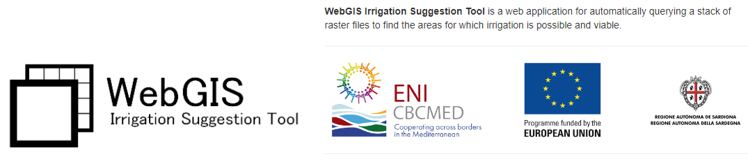
WebGIS Irrigation Decision Support Tool, November 17, 2022
CERTH team developed The ‘WebGIS Irrigation Decision Support Tool’, an on-line GIS based tool allowing end-users (i.e., local authorities, stakeholders, decision- and policy-makers etc.) to apply custom filtering criteria related to irrigation, to a stack of raster data layers and produce a binary .tif layer containing the area that satisfies those criteria. The final output can be accessed through http://web-gis-irrigation.iti.gr/ and serves three pilot areas in Spain, Tunisia and Lebanon. This is an output of the activities within AQUACYCLE ENI CBC MED project.
EOTiST: Earth Observation Training in Science and Technology
EOTiST: Earth Observation Training in Science and Technology, 07-10 November, 2022
CERTH participated in multiple events that took place in the framework of EOTiST in Warsaw from 07-10 November 2022. These were:
- the annual meeting and General Assembly of the project;
- Information Day I, wherein hands on practice was provided about the analysis of i) analysis of vegetation dynamics based on climate drivers (droughts), ii) inundation mapping, and iii) wildland fires modelling;
- Information Day II, wherein i) EuroGEO and Copernicus with the Hackathons' experience were presented, ii) existing EU startup accelerator programs were discussed (e.g. within the Green Deal EIC and various ESA, JRC, Bank tenders), and iii) CBK PAN' mentees guidance were provided on the way to find funding for their research goals and career (e.g. Marie Skłodowska-Curie funding Actions, ERC grants);
- Exploratory Visit IIb for the assessment of the progress achieved, the needs emerged, planing ahead, and the engagement of the CBK PAN in new EU calls for funding;
- and numerous mentoring (research lines) meetings with colleagues from CBK PAN and the consortium.
NASA LCLUC Science Team Meeting & Silver Jubilee Celebration
NASA LCLUC Science Team Meeting & Silver Jubilee Celebration, 18-20 October, 2022
Dr. Ioannis Manakos participated in NASA LCLUC NASA LCLUC Annual Science Team Meeting and Silver Jubilee Celebration (10/18/2022 to 10/20/2022), and gave a presentation about “An Overview of European Research Directions in Land-Use Science” and a flash talk/ poster about “Land cover and land use products in service of agriculture and ecosystem monitoring EuroGEO showcases”.
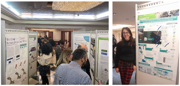
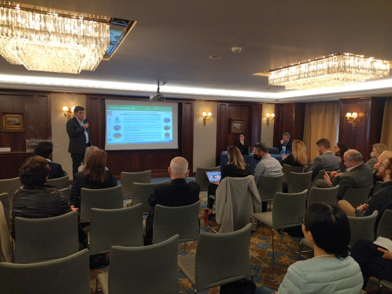
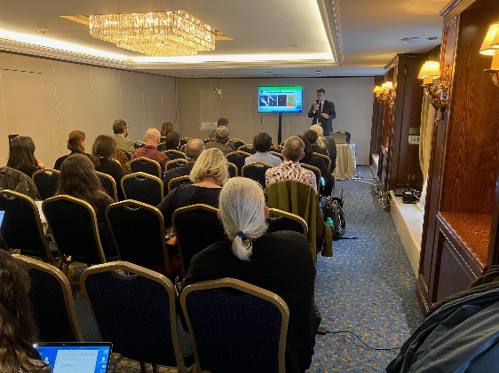
PONTOS Final Conference
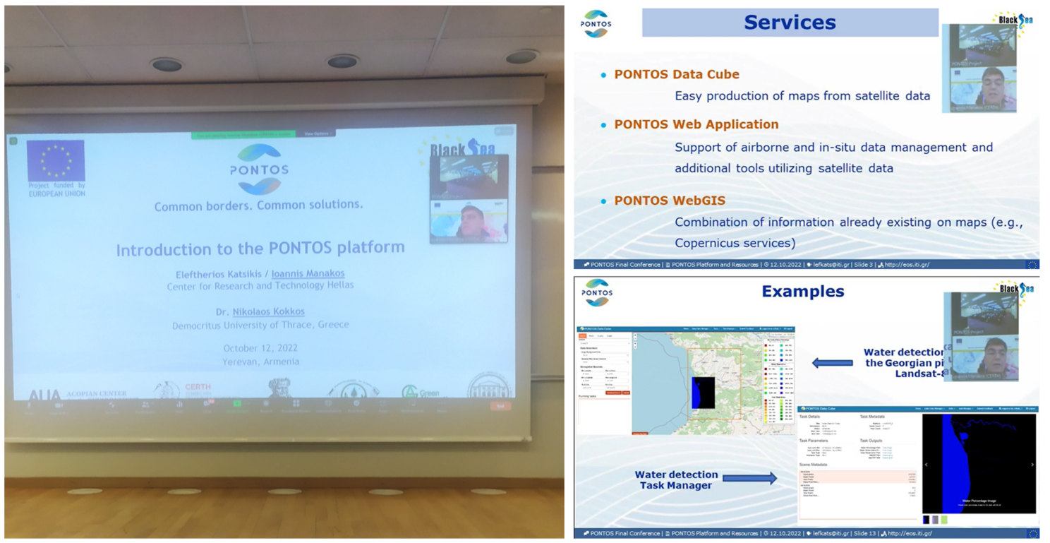
PONTOS Final Conference, 12 October, 2022
The aim of the conference is to summarize the work done by the project partners regionally, the problems addressed and the impact, share the experience with the stakeholders. The Conference brings together all the project partners from four countries as well as the Armenian stakeholders including local and national public authorities, academic and research institutions, NGOs, etc.
WQeMS Young Researchers & Technical Meeting in Helsinki
WQeMS Young Researchers & Technical Meeting in Helsinki, September 27-29, 2022
Within the Young Researchers framework of the Horizon 2020 funded project “Water Quality Emergency Monitoring Service” (WQeMS), a three-days meeting, from 27th to 29th of September 2022, was conducted in Helsinki, Finland coordinated by the Finnish environmental institute Syke. The first day was dedicated to young researchers’ current work. New ideas emerged on the topics related to WQeMS research lines and fruitful discussion conducted between the young scientists, the advisory board members and the members of the consortium who participated in person or remotely. The second day, a field trip to Lappeenranta took place. The first visit was to the Huhtiniemi drinking water purification plant of Lappeenrannan Energia Oy (a company fully owned by the City of Lappeenranta). Afterwards, the participants went aboard a small ship to visit the automated measurement platform located near the water intake of the purification plant. During the last day, on September 29th, a technical meeting was held as well as final comments, further ideas and future steps regarding the research lines were presented.
Water extent mapping for wetland monitoring, e-shape success stories
Water extent mapping for wetland monitoring, e-shape success stories, September 26, 2022
WaterMasks inundation mapping service, developed by CERTH's Earth Observation team, utilizes Sentinel-2 multispectral images for the creation of highly accurate inundation maps.
EOS team at 41st EARSeL Symposium
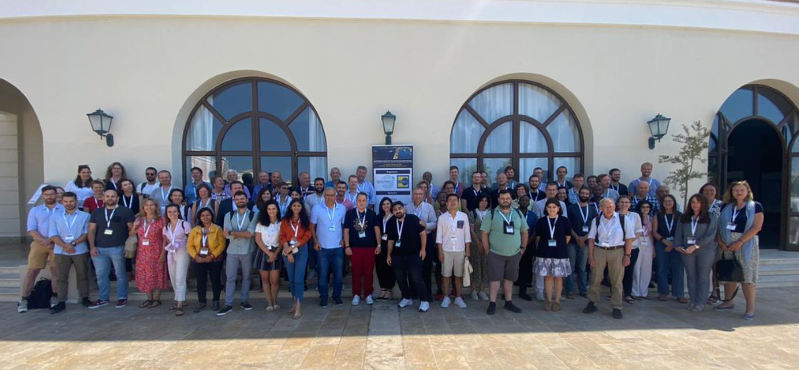
EOS team at 41st EARSeL Symposium, September 13-16, 2022
The 41st European Association Remote Sensing of Laboratories (EARSeL) Symposium was held in Paphos, Cyprus from 13th to 16th of September 2022. EOS team participated with oral presentations representing two European Horizon 2020 funded projects: “Water Quality Emergency Monitoring Service” (WQeMS) and “Next Generation Land Management services for Agriculture and Forestry”, (NextLand). The research conducted within WQeMS project for the italian pilot case of Giaretta Lake and Brenta river was presented on Wednesday 14th with the topic “Adaptability of Inundation Mapping in Service of the Water Utilities: the Case of Giaretta Lake and Brenta River” while NextLand´s presentation on Thursday 15th summarized the projects’ applications on forest and agricultural domain and presented the online store which is expected to be released on November 2022.
A globally relevant change taxonomy and evidence-based change framework for land monitoring
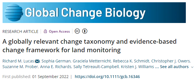
A globally relevant change taxonomy and evidence-based change framework for land monitoring, September 01, 2022
New universal language for land changes could explain ecosystem loss. Aberystwyth University scientists have jointly developed a universal language to describe the changing world, which could help uncover what is causing ecosystem loss and environmental degradation. The Global Change Taxonomy, a project involving researchers from countries including Australia, Italy and Greece in addition to Wales, attempts to unify the different ways of describing land cover change from local areas to globally, and over varying periods of time.
Publication in IEEE Transactions on Geoscience and Remote Sensing ( Early Access )
Publication in IEEE Transactions on Geoscience and Remote Sensing ( Early Access ), May 04, 2022
L. Alagialoglou, I. Manakos, M. Heurich, J. Cervenka, A. Delopoulos, A learnable model with calibrated uncertainty quantification for estimating canopy height from spaceborne sequential imagery, 2022, IEEE Transactions on Geoscience and Remote Sensing, DOI: 10.1109/TGRS.2022.3171407
Workshop on “Satellite Applications: From the Black Sea to the North Aegean Sea” in Greece

Workshop on “Satellite Applications: From the Black Sea to the North Aegean Sea” in Greece, March 11, 2022
Within the framework of the EU-funded “Copernicus Assisted Environmental Monitoring Across the Black Sea Basin – PONTOS” project, the Joint Open Workshop “Satellite Applications: From the Black Sea to the North Aegean Sea” was held on March 11, 2022 in Thessaloniki, Greece. The event was organized by the Centre for Research and Technology Hellas (CERTH) with the overall aim to inform the Public and the Authorities of Central Macedonia about PONTOS contribution in Environmental Remote Monitoring and the benefits from the data provided.
PONTOS - Joint Open Workshop
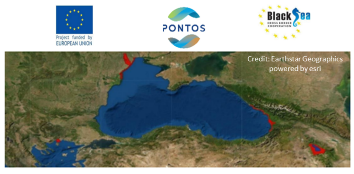
PONTOS - Joint Open Workshop, March 11, 2022
The Centre for Research and Technology Hellas (CERTH), as a partner of the PONTOS project, conducts a Joint Open Workshop on March 11, 2022, at the Mediterranean Palace Hotel in Thessaloniki. The Workshop will be focused on topics related to the Earth Observation with the help of the Copernicus programme through the PONTOS project for the Black Sea and the North Aegean Sea and will be implemented with the participation of Entities’ representatives from the local and regional government, public administration, civil society, universities, research centres, media and the society of entrepreneurs.
SnapEarth First International Development Workshop
SnapEarth First International Development Workshop, January 25, 2022
The SnapEarth Consortium would like to invite you to the First International Development Workshop on January 25th (virtual meeting).
SnapEarth (https://snapearth.eu/) is an innovative project financed by the European Commission and run by a consortium consisting of CS GROUP, CERTH, Qwant, IsardSAT, Middle East Technical University (METU) and Absiskey Polska. SnapEarth is a EU H2020-funded project that to facilitate access to Earth Observation data from the general public thanks to EO data labelling and indexation innovations and access from the Qwant search engine. The SnapEarth project aims to bring out new values through large-scale earth observation data services and to anticipate future priorities by leveraging artificial intelligence and cloud computing technologies and tools.
The aim of the workshop is to present preliminary versions of the developed services in the project and receive valuable feedback. We will be delighted if you take part in our First International Development Workshop.
More information, agenda and the registration form can be found in the information button.
MEDWAYCAP project launched
MEDWAYCAP project launched, January 18, 2022
AQUACYCLE, MENAWARA, MEDISS, NAWAMED, PROSIM and MAIATAQA projects launched the new MEDWAYCAP project to jointly supply solutions and methodologies contributing to the water shortage challenges at Mediterranean level.
Partner organizations from Greece, Italy, Egypt, Malta, Tunisia, Palestine and Jordan, and many relevant stakeholders at National level together in Thessaloniki for the launching event of the project.
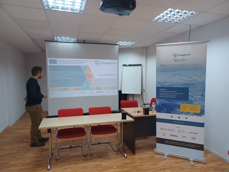
EarthPress - Earth Observation data and Artificial Intelligence in support of Journalism
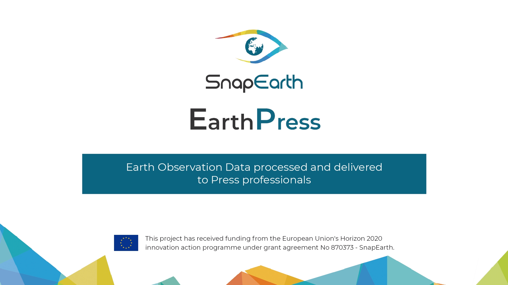
EarthPress - Earth Observation data and Artificial Intelligence in support of Journalism, January 14, 2022
Copernicus data are becoming tremendous in volume & quality. Copernicus services are focusing on professional services, like the Emergency Management Service focusing on providing information on major events to the rescue and security forces. In order to increase awareness of the Copernicus services to the EU citizens, there is a need to provide added value data to the Media Industry, rendering them to major demonstrators of the success of Copernicus to the citizens.
In this direction, the impact of the SnapEarth project will be enhanced through services for combinatorial EO data retrieval, data correlation between EO and news information will be developed.
In particular, the EarthPress pilot aims to tackle these issues by delivering value-added products to editors & journalists allowing them to enrich content of their publications & articles. These contents, tailored to specific user needs, will be notably based on EO data (e.g. disaster extent maps, background imagery, aggregated information from social media, blogs & websites, etc.) on a certain topic.
SnapEarth platform promotional video
SnapEarth platform promotional video, January 14, 2022
The SnapEarth platform promotional video is out. SnapEarth is a EU H2020-funded project that aims to facilitate access to Earth Observation data from the general public thanks to EO data labelling and indexation innovations and access from the Qwant search engine. The SnapEarth project aims to bring out new values through large-scale earth observation data services and to anticipate future priorities by leveraging artificial intelligence and cloud computing technologies and tools.
SnapEarth users and service providers will benefit in a transparent way from the processing platforms and data collections provided not only by future C -DIAS but also any cloud computing service provider. This cloud brokerage solution provides an efficient, cost-effective environment while also protecting investment in future third parties developing their own services.
PONTOS third newsletter released
PONTOS third newsletter released, December 29, 2021
The third newsletter of the PONTOS’ research project is out! The newsletter is available in five languages - English, Greek, Armenian, Georgian, and Ukrainian.
MEDWAYCAP Kick – off Meeting
MEDWAYCAP Kick – off Meeting, December 17, 2021
The MEDWAYCAP Kick – off Meeting was held at the Mediterranean Palace Hotel of Thessaloniki on 16 – 17 December 2021. MEDWAYCAP ‘The MEDiterranean pathWAY for innovation CAPitalisation toward an urban-rural integrated development of non-conventional water resources' is a strategic project in the framework of ENI CBC Sea Basin 2014-2020. It aims to challenge the paradigm in non-conventional water reuse and management in the Mediterranean region through the promotion of sustainable strategies and technological innovations.
ESA - Sentinel Success Stories
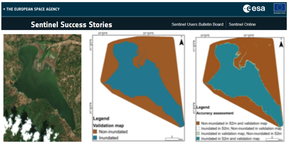
ESA - Sentinel Success Stories, December 16, 2021
New dissemination article published in ESA - Sentinel Success Stories on "Copernicus Sentinel-1 and Sentinel-2 data help create inundation maps". This study has been partially funded and supported by the European Union's Horizon 2020 Innovation Action program under Grant Agreement No. 820852, e-shape. It is compiled by Michail Sismanis and Ioannis Manakos (Centre for Research and Technology Hellas - CERTH, GR).
PONTOS project on Armenian public TV
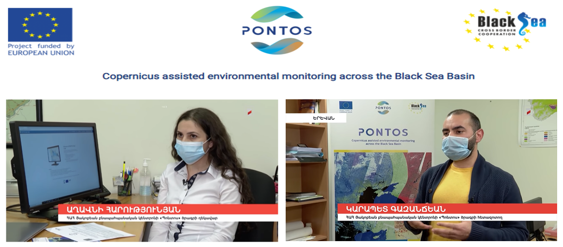
PONTOS project on Armenian puplic TV, December 09, 2021
PONTOS project was presented through the Armenian 1st public TV by Aghavni Harutyunyan (project manager). Furthermore, PONTOS Data Cube application and its functionalities was introduced to the viewers.
AQUACYCLE e-training platform
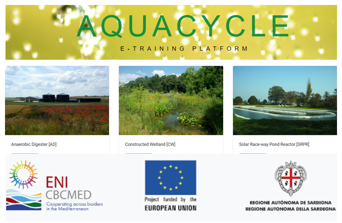
AQUACYCLE e-training platform, December 03, 2021
CERTH/ ITI team (Christos Kalogeropoulos, Rizos-Theodoros Chadoulis, Ioannis Manakos) cooperated closely with the CERTH/ CPERI team (Konstantinos Plakas, Vasileios Chatzis) within AQUACYCLE project and produced the AQUACYCLE e-training platform. The platform is built utilizing Angular functionalities in a responsive design. Latter incorporates tools and technologies, so that everyone can use them (including people with disabilities). Users can interact both with the platform administrators and with other users, get familiarized with the equations, and explore the available bibliography. AQUACYCLE project is implemented in the context of ENI CBC MED program (funded by the European Union), belonging in the thematic area "Environmental protection, climate change adaptation and mitigation", under "Water efficiency".
OBSERVER: The Copernicus Emergency Management Service Week 2021
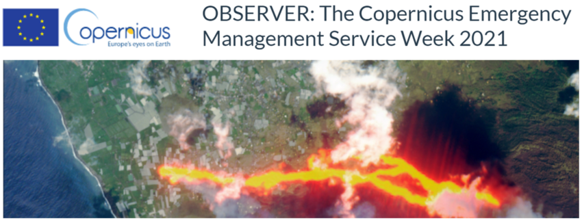
OBSERVER: The Copernicus Emergency Management Service Week 2021, December 02, 2021
New article published in Copernicus news about the Annual User Workshop of the Copernicus Emergency Management Service (CEMS) week which was conducted the week of 25-29 October, 2021. The Water Quality Emergency Monitoring Service (WQeMS) project is referred as one of the most promising technological innovations discussed by the panel stem from the EU’s Horizon 2020 projects.
WQeMS project at GEO Week 2021
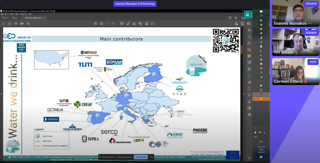
WQeMS project at GEO Week 2021, November 26, 2021
I. Manakos, speaker at the GEO Week 2021 in the session “A water quality emergency monitoring service evolution and the generation of a roadmap for future Copernicus water services: WQeMS meets Water-ForCE”
This session discussed:
- The evolution of Copernicus Services towards a targeted add-on to the EMS for Water Quality Emergency Monitoring for open surface water reservoirs used for the production of drinking water by the water utilities industry; addressed by the WQeMS RIA H2020 project.
- A Roadmap for future Copernicus water services as being developed by the Water-ForCE H2020 CSA project. It will provide a user driven concept by assessing the needs/opportunities of the current and future capabilities of satellite and in situ sensors, and addressing the disconnects between remote sensing, in situ observations and modelling communities.
SnapEarth project at GEO Week 2021
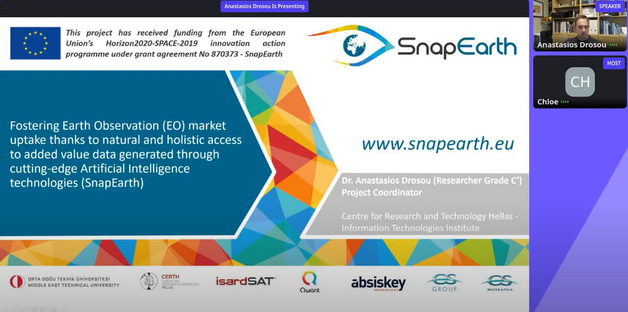
SnapEarth project at GEO Week 2021, November 23, 2021
A. Drosou speaker at the GEO Week 2021 in the session “Fostering Earth Observation (EO) market uptake thanks to natural and holistic access to added value data generated through cutting-edge Artificial Intelligence technologies (SnapEarth)”
This session’s scope is to present the SnapEarth EU H2020-funded project that aims to facilitate access to EO data and bring out new values through large-scale EO data services. This session will present the components of the SnapEarth project, conceptually, that:
- provide satellite images based on text queries (integrated with Qwant’s search engine)
- support climate and agricultural monitoring activities
- provide suggestions for deployment of EO applications
Presentation of Diploma Thesis of Afroditi Kita
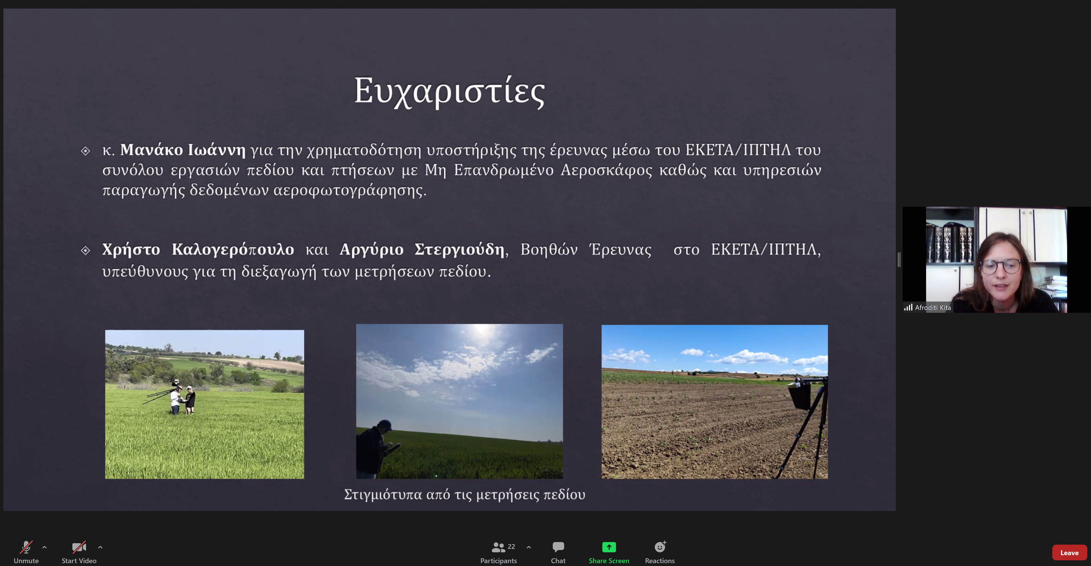
Presentation of Diploma Thesis of Afroditi Kita, November 12, 2021
The diploma thesis “Atmospheric correction of Sentinel-2 images using deep learning techniques”, supervised by Professor Anastasios Delopoulos and Principal Researcher Ioannis Manakos, was presented on November 12th by Ms. Afroditi Kita. It concerns research conducted at the Faculty of Electrical and Computer Engineering of Aristotle University of Thessaloniki in cooperation with the Information Τechnology Institute of the Centre for Research and Technology Hellas. Using field data, collected by the members of the Earth Observation Services team, Christos Kalogeropoulos and Argyrios Stergioudis, Convolutional Neural Networks were trained to learn to retrieve the atmospherically corrected surface reflectance from Sentinel-2 data. The thesis and its presentation were of very high quality deserving the unanimous 10/10 of the evaluation committee of the Department of Electrical and Computer Engineering, AUTH.
ESA - Sentinel Success Stories
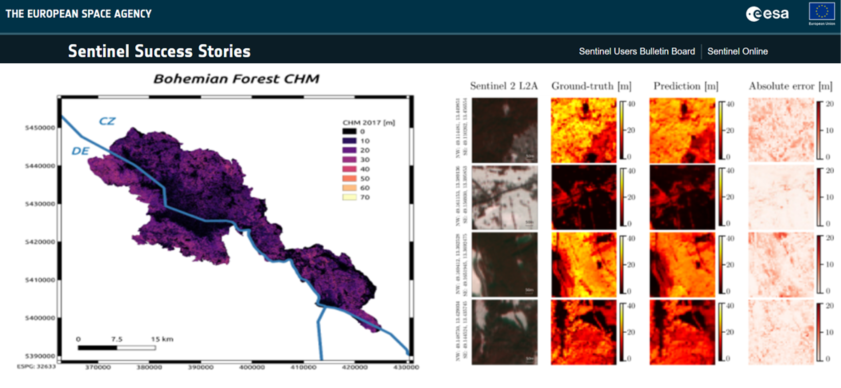
ESA - Sentinel Success Stories, November 09, 2021
New dissemination article published in ESA - Sentinel Success Stories on "Canopy height estimation from spaceborne imagery using convolutional encoder-decoder". The article is based on Alagialoglou et al. (2021) and compiled by Rizos-Theodoros Chadoulis and Ioannis Manakos (Centre for Research and Technology Hellas - CERTH, GR). Please find also the tweet from ESA here.
Online Workshop
Online Workshop, October 26, 2021
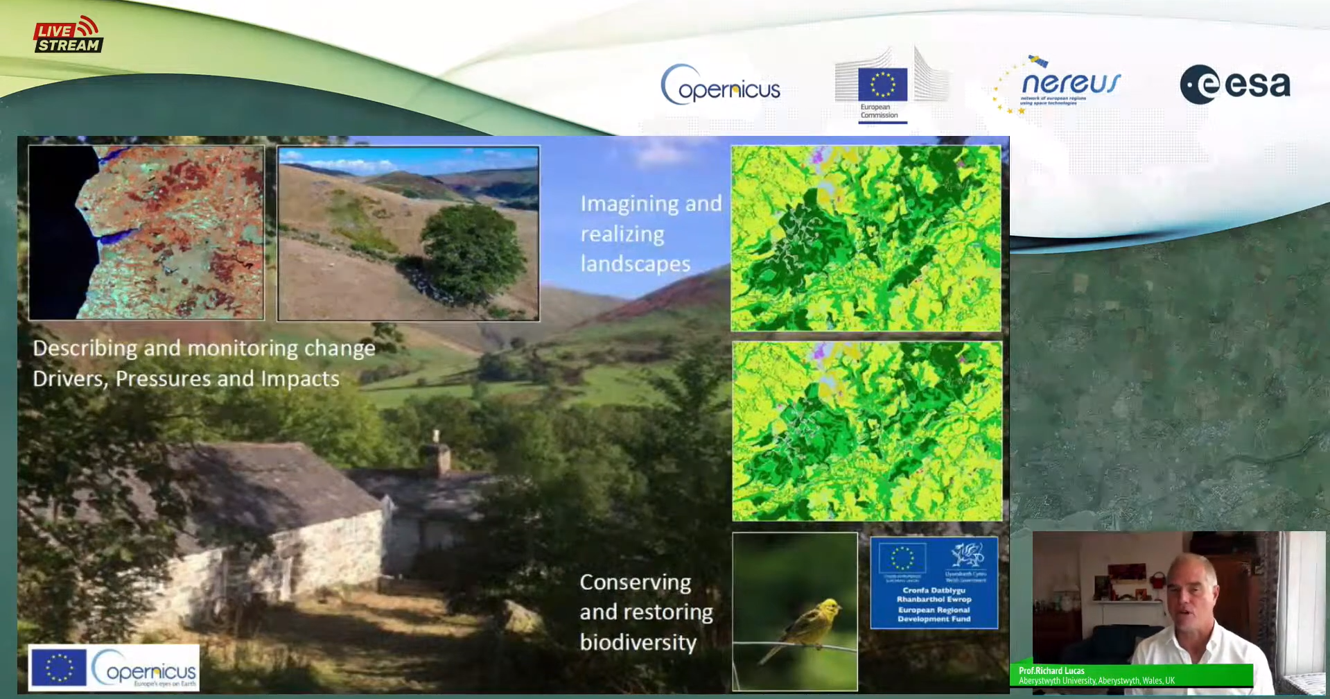
Topic: How Copernicus helps Europe's regions to support biodiversity and environmental protection.
CEMS Week 2021
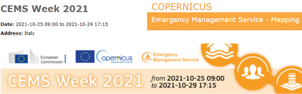
CEMS Week 2021, October 25, 2021
The Copernicus Emergency Management Service virtual annual workshop will be conducted from 2021-10-25 to 2021-10-29. CEMS Week will feature experts, users and policy makers in a discussion about the future of our service and user community. CERTH presented the WQeMS project the first day of the workshop.
PONTOS' first set of training sessions in Greece
PONTOS' first set of training sessions in Greece, October 14, 2021
The Information Technology Institute of CERTH in cooperation with Democritus University of Thrace organized and conducted the first set of training sessions in the context of the project "Copernicus assisted environmental monitoring across the Black Sea Basin – PONTOS". The main topics were:
- Management and analysis of Earth Observation data
- Coastal erosion assessment, monitoring of the eutrophication in lagoons and the improvement of the water use in agriculture
- The Copernicus Earth Observation program and its services
- Τhe integration and utilization of the Copernicus products by the project PONTOS
WQeMS Online Workshop
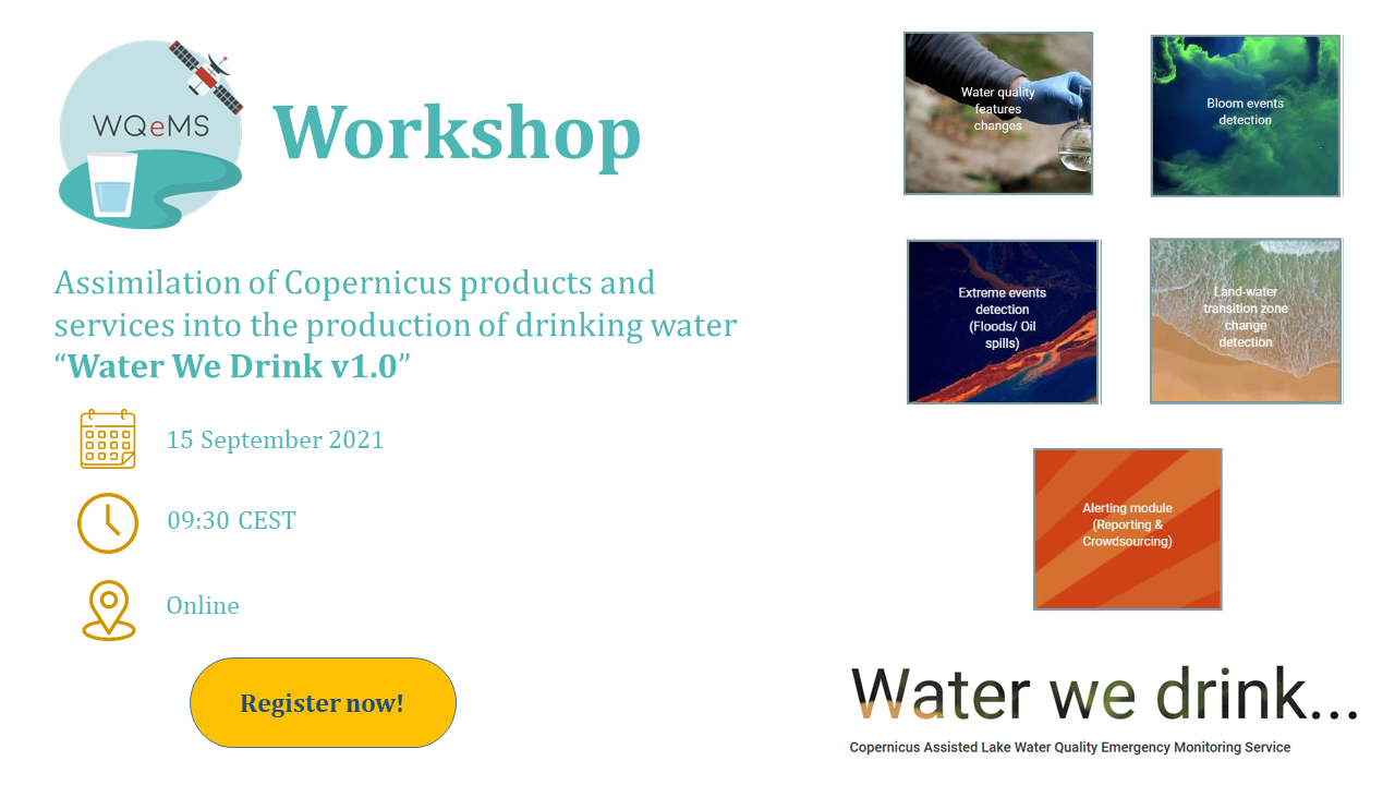
WQeMS Online Workshop, September 15, 2021
Topic: Invitation to a brain storming Workshop about the assimilation of Copernicus products and services into the production of drinking water “Water We Drink v1.0”. The Workshop will provide a forum for stakeholders to exchange experiences, best practices and ideas related to production, distribution and use of drinking water. It will be an online event and will take place at 9:30 (CEST).
WQeMS Press Release
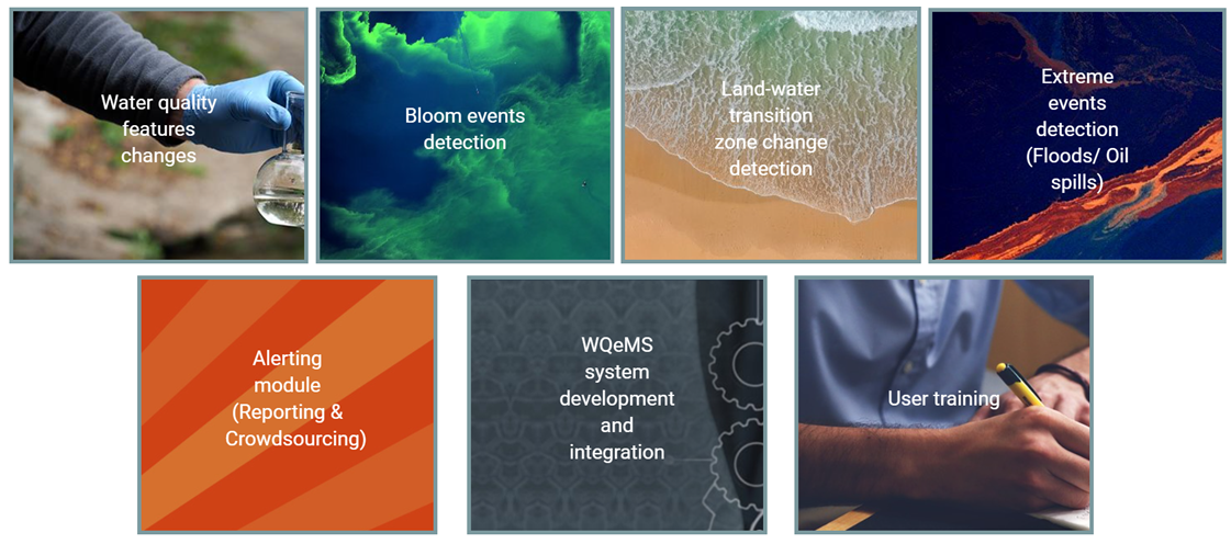
WQeMS Press Release, August 16, 2021
Topic: Invitation to a brain storming workshop about the assimilation of Copernicus products and services into the production of drinking water “Water We Drink v1.0”. The workshop will be conducted online on September 15, 2021.
WQeMS Newsletter I released
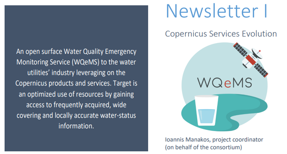
WQeMS Newsletter I released, August 16, 2021
The first newsletter of the WQeMS research project is out! It presents the main objectives of the project, the partners and the pilot areas profile.
Proximal sensing measurements in wheat plantations by the EOS team
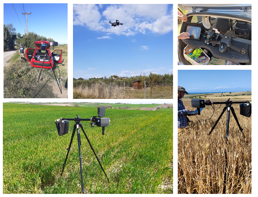
Members of the EOS team, Christos Kalogeropoulos and Argyrios Stergioudis, performed proximal sensing measurements in wheat plantations, in the wider area of Epanomi, close to Thessaloniki (GR), by utilizing drone and hyperspectral imaging system. The measurements were carried out from April to June 2021 for the needs of a new research line of the EOS team.
PONTOS' brainstorming event in Greece
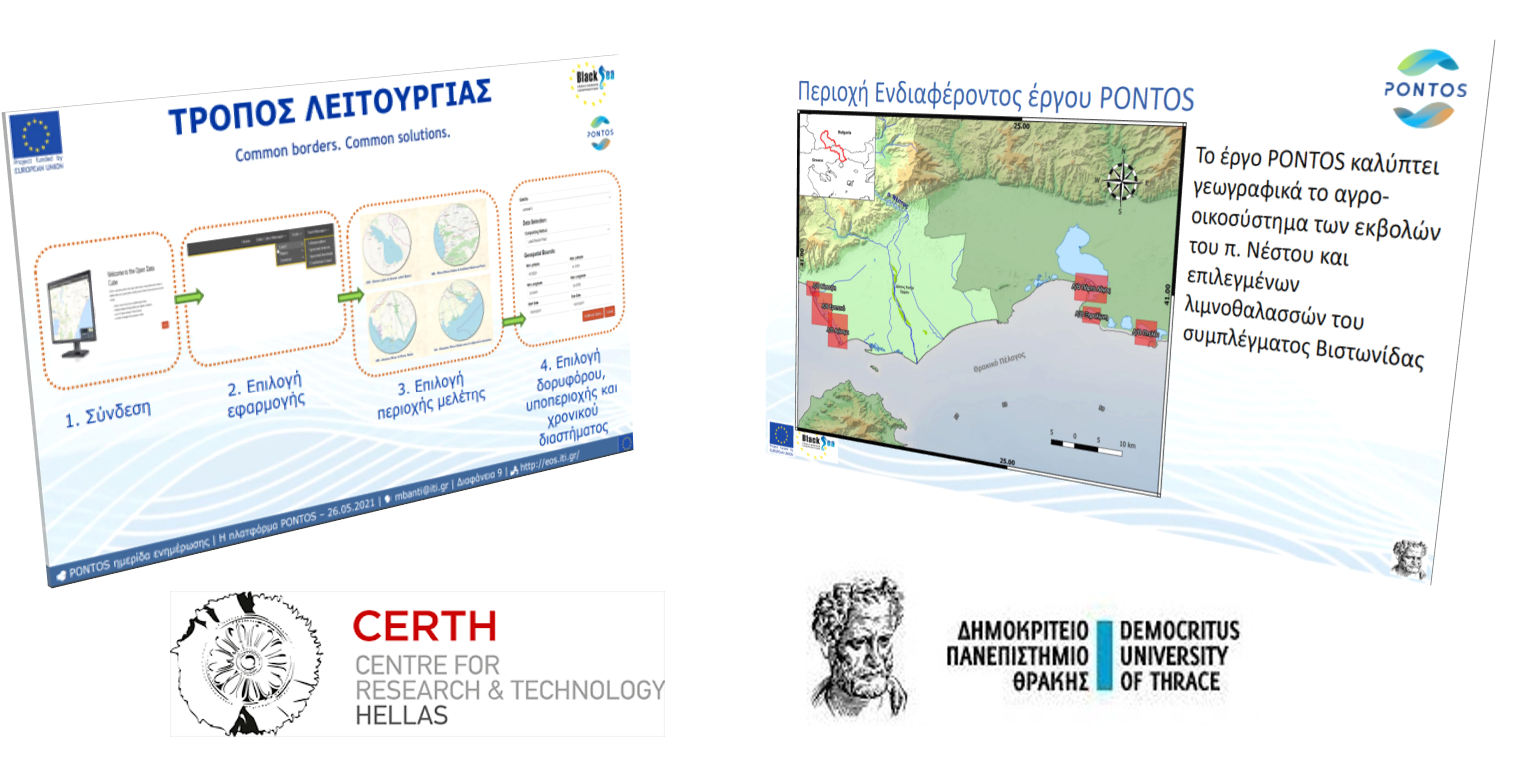
PONTOS' brainstorming event in Greece, May 26, 2021
The Information Technology Institute of CERTH in cooperation with Democritus University of Thrace organized and conducted an online brainstorming event in the context of the project "Copernicus assisted environmental monitoring across the Black Sea Basin – PONTOS". The main purposes were to:
- Introduce PONTOS project and its goals
- Present Copernicus Earth Observation program
- Collect the needs of stakeholders in order to incorporate them into the tasks that will be followed
Open Internship Offers
Open Internship offers at CERTH / ITI, May 18, 2021
The Information Technology Institute of CERTH offers internship opportunities in the subject of "Analysis of satellite images for information extraction aiming to natural resources management" in the context of research projects. The main objective will be the analysis of satellite images and radar data using Python programming language and specialized libraries.
EOS team @ the EARSeL Joint Workshop 2021
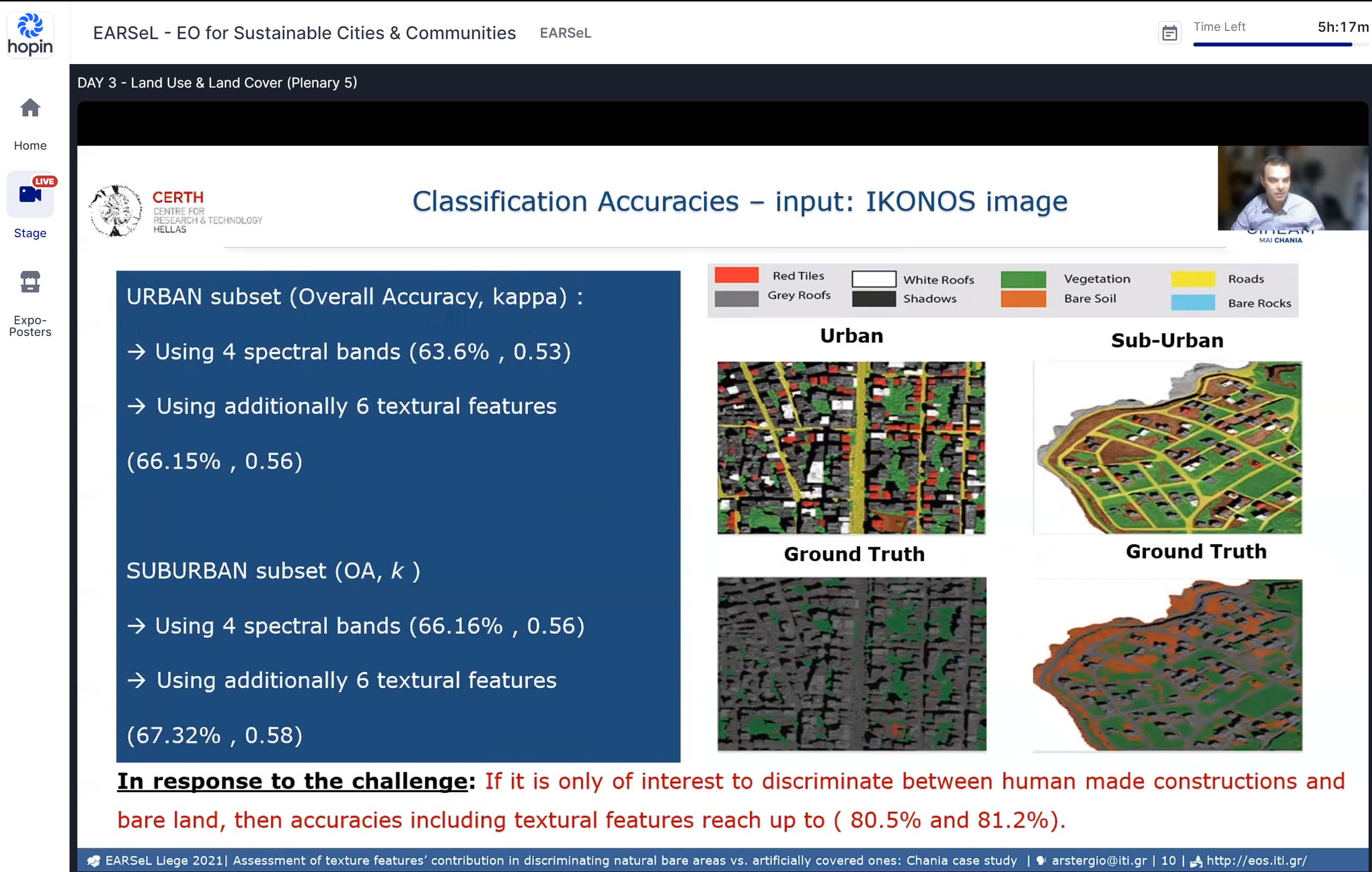
EOS team @ the EARSeL Joint Workshop 2021 "Earth Observation for sustainable cities and communities", April 1, 2021
Argyrios Stergioudis presented the EOS team's relevant work on the "Assessment of Texture Features’ Contribution in Discriminating Natural Bare Areas vs. Artificially Covered Ones: Chania Case Study" at the EARSeL Joint Workshop 2021 "Earth Observation for sustainable cities and communities", March 30 - April 1 2021.
You may find the extended abstract on pages 126 and 127 of the Abstract Book and cite our work as follows:
I. Manakos, A. Ledawi, A. Stergioudis, C. Kalaitzidis, Assessment of Texture Features’
Contribution in Discriminating Natural Bare Areas vs. Artificially Covered Ones: Chania Case Study, Proceedings
of the EARSeL Joint Workshop 2021 "EO for sustainable cities and communities", March 30 - April 1 2021, Liege, Belgium, pp. 126-127.
WQeMS’ website is online
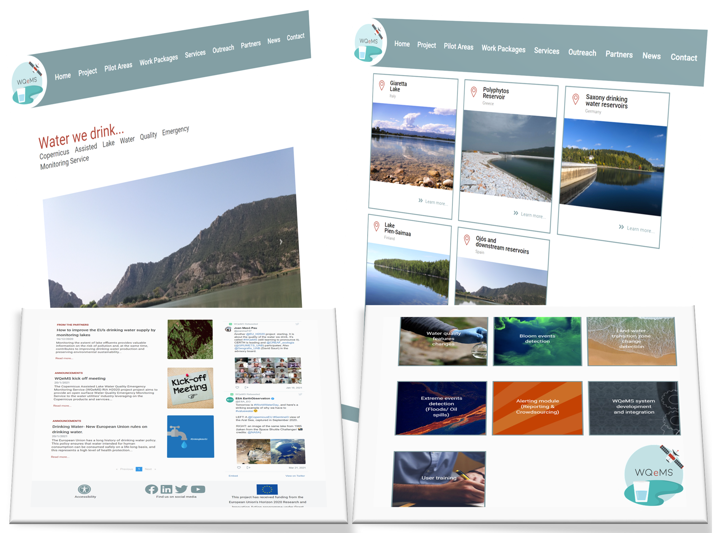
WQeMS’ website is online, April 1, 2021
The WQeMS’ website aims to reach a wider audience and especially end users and other stakeholders, through the provision of dynamic information, such as news about forthcoming and completed project activities, and events; multimedia material, such as project presentations, videos from events and pilot testing; social media streaming information related to WQeMS activities and online mentions.
The WQeMS’ website has been produced with the financial assistance of the European Union's Horizon 2020 Programme (Research and Innovation Action) Grant agreement: 101004157
EARSeL Joint Workshop 2021 - New date!
Earth Observation for sustainable cities and communities, March 30 – April 1, 2021 LIEGE - BELGIUM.
This event is a combination of:
- 4th joint EARSeL LULC & NASA LCLUC Workshop
- 6th EARSe Joint Workshop Urban Remote Sensing
- 1st EARSeL Remote Sensing For UN Sustainable Development Goals Workshop
* If the sanitary and/or travel conditions are not satisfactory at the end of next winter the joint workshop might become a 100% virtual event!
Online Interdisciplinary Workshop
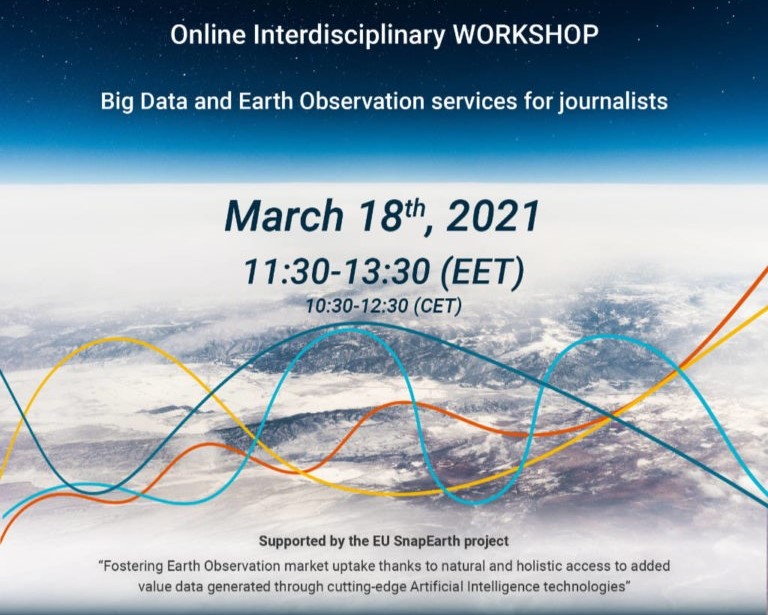
Interdisciplinary workshop on Big Data & Earth Observation services for journalists, March 18, 2021.
This online workshop is Co-organised by Center of Research & Technology Hellas and the School of Journalism and Mass Communication of the Aristotle University of Thessaloniki. The main purpose is to intoduce the project SnapEarth, to present its goals and recieve feedback from the participants regarding the optimization of the proposed solutions.
PONTOS Newsletter released
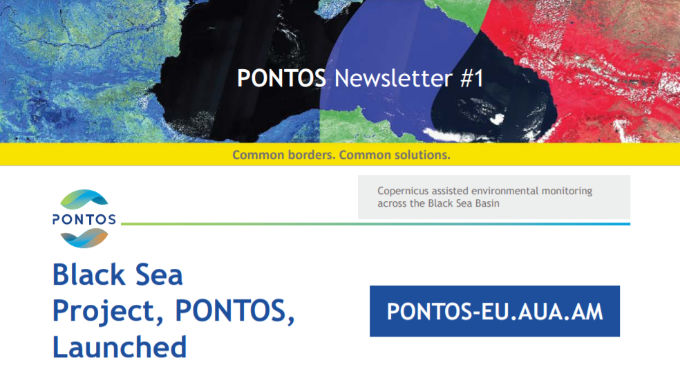
PONTOS Newsletter Released, February 8, 2021.
The first newsletter of the PONTOS’ research project is out! It presents the pilot areas profile as well as the main points concerning the Shoreline Change Methodology Training and the training for the AquaCrop Model.
WQeMS Kick-off meeting
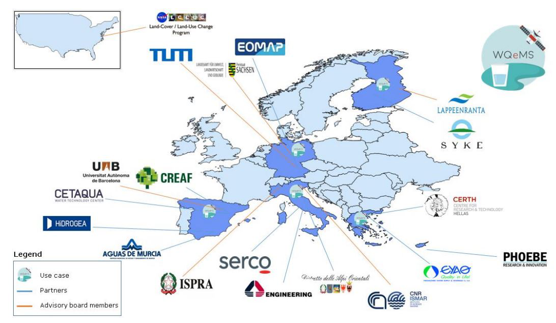
The WQeMS project 'Copernicus Assisted Lake Water Quality Emergency Monitoring Service' was launched at the kick-off meeting on 18, 19 and 20 of January 2021 and brings together 11 partners from countries across Europe: Greece (Lead Beneficiary), Spain, Germany, Italy, Finland and Cyprus.
The overall objectives of WQeMS:
- Provide an open surface Water Quality Emergency Monitoring Service to the water utilities’ industry leveraging on the Copernicus products and services;
- Optimize the use of resources by gaining access to frequently acquired, wide covering and locally accurate water-status information;
- Citizens will gain a deeper insight and confidence for selected key quality elements of the ‘water we drink’, while enjoying a friendlier environmental footprint from a more intelligent production process.
WQeMS is funded under the European Union's Horizon 2020 Programme (Research and Innovation Action) Grant agreement: 101004157
E-shape @ Kerkini Lake Protected Area Authority
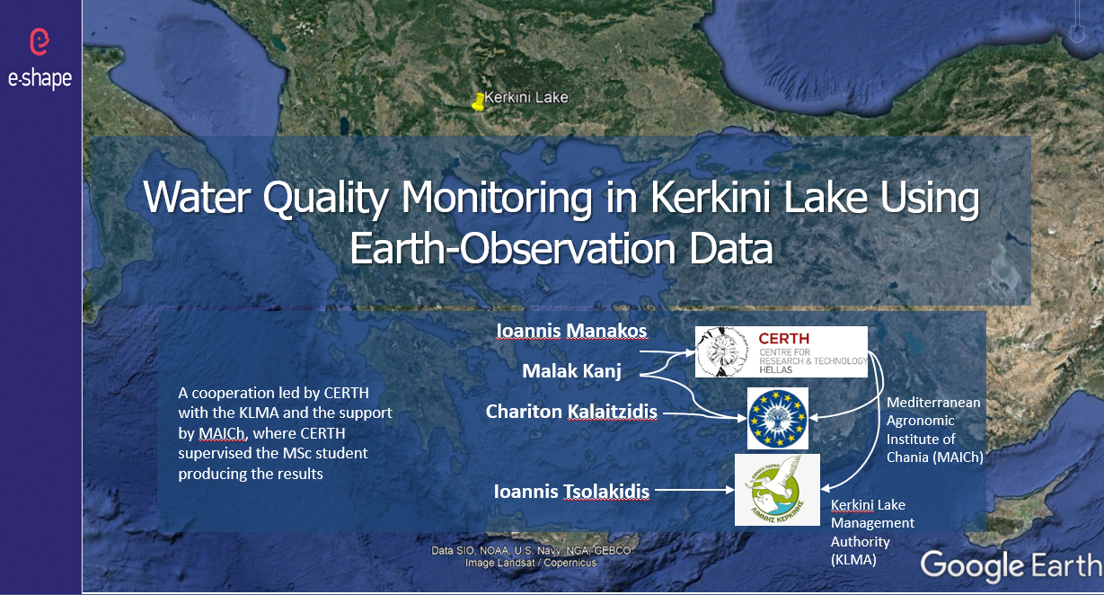
Dr. I. Manakos and his colleagues from the Centre for Research and Technology Hellas with the support of MAICh and the Management Body of Kerkini Lake organized a web meeting, within the framework of the e-Shape H2020 IA project, to discuss the progress and the key outcomes of the Earth Observation spaceborne water quality monitoring in Lake Kerkini.
The E-SHAPE project is funded and supported by the European Union’s Horizon 2020 Research and Innovation program under Grant Agreement No. 820852.
Copernicus assisted services for forest management (NextLand Showcase)
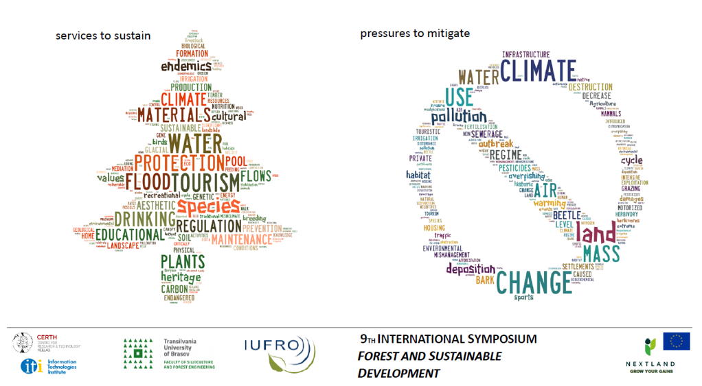
On 16 October 2020 Dr. Ioannis Manakos, Principal Researcher at the Centre of Research and Technology Hellas, was invited to present online at the 9th International Symposium on Forest and Sustainable Development, the ‘Copernicus assisted services for forest management’ within the H2020 NextLand project.
EOTiST Kick-off meeting
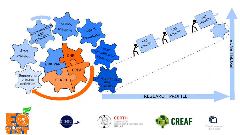
The EOTiST project ‘Earth Observation Training in Science and Technology at the Space Research Centre of the Polish Academy of Sciences’ was launched at the kick-off meeting on October 6, 2020 and brings together 4 partners from countries across Europe: Poland (Lead Beneficiary), Greece, Spain and Italy.
The general aim of the project is to enhance the S&T capacity of the CBK PAN and to achieve excellence in research of EO products’ assimilation in the ecosystem assessment and monitoring. The goal will be reached by establishing close collaboration with three EU research Centres of Excellence: CERTH, CREAF, CNR.
EOTiST is funded under the European Union’s Horizon 2020 Programme (Research and Innovation Action) | Grant agreement: 952111
Black Sea Project, PONTOS, launched
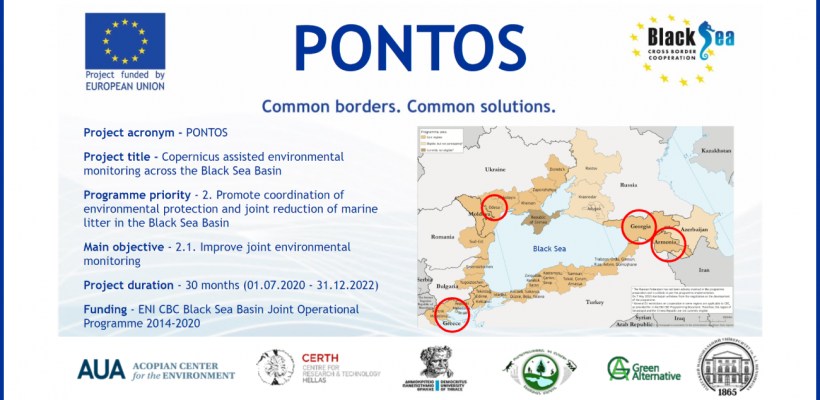
On July 22, 2020, the American University of Armenia (AUA) Acopian Center for the Environment in collaboration with partners from Armenia, Georgia, Greece, and Ukraine publicly launched the 30-month Copernicus Assisted Environmental Monitoring Across the Black Sea Basin project, also known as PONTOS. The 1 million euro project, funded mainly by the European Union’s ENI Cross-Border Cooperation Black Sea Basin Programme 2014-2020, commenced on July 1 of this year.
Among others the project will make Black Sea environmental information from the EU Copernicus Earth Observation system accessible to scientists, policymakers, citizens, and other stakeholders, by:
- utilizing information and data science to retrieve Copernicus information and images,
- coupling them with national or regional data and
- providing online monitoring services for the Black Sea and the surrounding environment in a transboundary, standardized and homogenized manner.
Proximal sensing measurements in cotton plantations by the EOS team
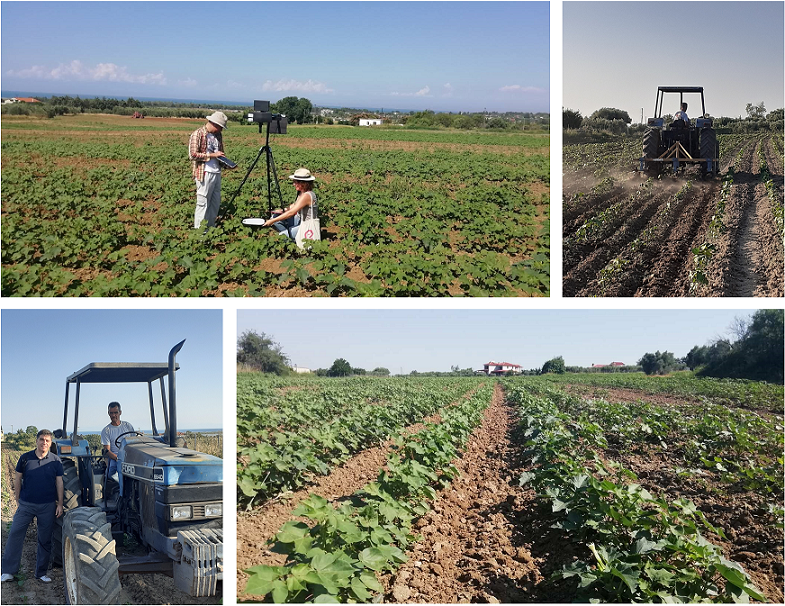
Members of the EOS team, Ioannis Manakos, Christos Kalogeropoulos and Danai Aristeridou, performed proximal sensing measurements in cotton plantations, in the wider area of Epanomi, close to Thessaloniki (GR), by utilizing the hyperspectral imaging system Muses. Target is to identify the vitality status and/ or stress signs of the plants across the formed spectral cube. In addition, the team has the chance to test own or generate new automated (unsupervised as possible) processing workflows. Moreover, findings will be juxtaposed with relevant ones derived from timely parallel acquired high resolution satellite imagery for the same pixels in an effort to extrapolate the applicability of the workflows.
The local farmer Mr Athanasios Gkaros (bottom left and upper right pictures on the tractor) kindly granted access to his plots for the experimentation, and shared with us applied cultivation practices, plot history conditions, and expected yields. Further in situ measurements are scheduled throughout the cultivation period.
Second edition of MedRIN's newsletter
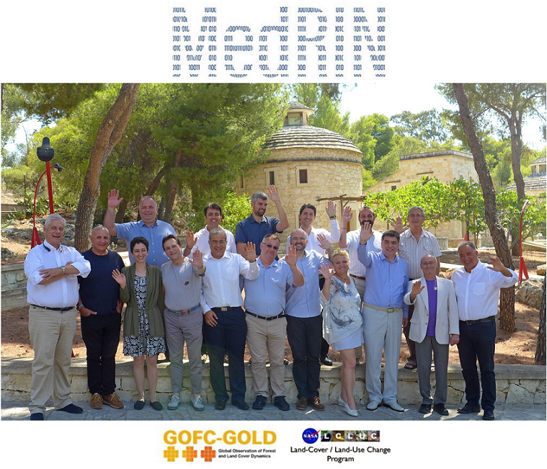
The benefits for joining forces in the Mediterranean region in earth observation: The Mediterranean Regional Information Network (MedRIN)
MedRIN was established after discussions with European, African and American colleagues. It is a new network for the Mediterranean Region which is coupled with the framework of the Global Observations of Forests Cover and Land Dynamics (GOFC-GOLD).
In this newsletter edition, you may find a short presentation and an interview of Dr. Ioannis Manakos.
Second edition of SnapEarth's newsletter
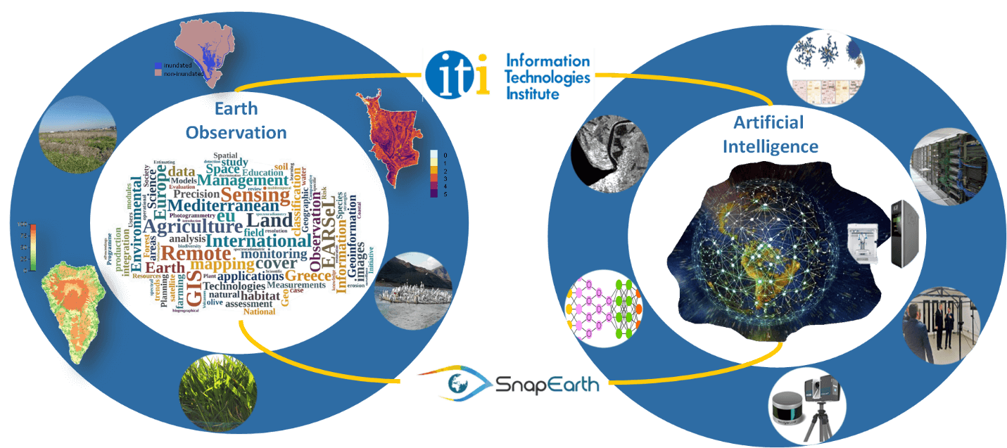
In this newsletter, the progress, the key outcomes and the events within the framework of SnapEarth are discussed.
Furthermore, in this newsletter the first two partners of the project are introduced: Qwant - the coordinator of SnapEarth consortium and Centre for Research and Technology Hellas from Greece
This is one of the largest research centres in Greece, founded in 2000. The mission of CERTH is to promote the triplet Research – Development – Innovation by conducting high quality scientific research and developing innovative products and services while building strong partnerships with industry and strong collaborations with research centres and universities in Greece and abroad. CERTH has participated successfully in more than 1,000 competitive research projects and is listed among the Top-20 Research Centres of the EU with the highest participation in FP7 competitive research grants for the period 2007-2012 and received numerous awards and distinctions...
Join the SnapEarth user community
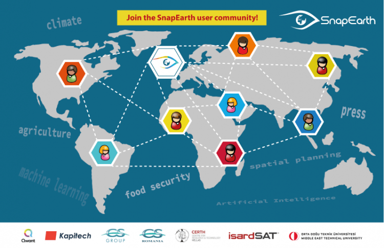
Are you familiarize to agriculture, food security, climate or journalism and would like to learn how you can easily search and analyze EO data? Are you interested in Artificial Intelligence, machine learning or want to know the open-source portable and secured multi-cloud management solution?
If you would like to participate with us in developing appropriate application solutions that could support your work, please let us know.
NextLand’s kick-off meeting
The NextLand project “Next Generation Land Management Services for Agriculture and Forestry” was launched through online means (instead of physical kick-off meeting) on 2, 3 and 4 of June, 2020.
NextLand will develop 15 innovative and operational services, as shown in the picture above, to strengthen the entire value chain of the agricultural and forestry sector. These services could be use through 7 different scenarios:
- Support to irrigation
- Crop planning optimization
- Early stress / anomaly identification
- Deforestation & illegal logging
- Forest growth
- Fire impact & risk assessment
- Forest health
*Picture source: https://remotesensing.vito.be/
Read the latest news about the AQUACYCLE project
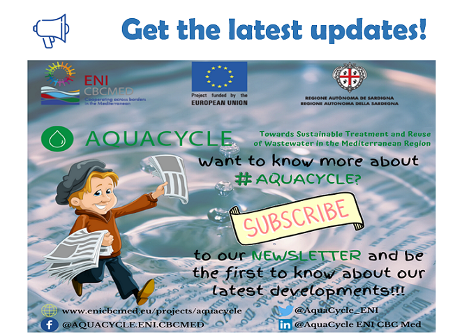
Find out more about AQUACYCLE's activities:
Subscribe in AQUACYCLE's Newsletter list
Subscribe in AQUACYCLE's YouTube channel
Follow AQUACYCLE on Facebook
Follow AQUACYCLE on Twitter
The AQUACYCLE project is funded and supported by the European Union through the ENI CBC Mediterranean Sea Basin Programme under the Grant Contract A_B41_0027_AQUACYCLE. For more information, please visit enicbcmed.eu and enicbcmed.eu/projects/aquacycle.
CERTH is in service of the society.
CERTH is in service of the society. Since the outbreak of the pandemic virus SARS-CoV-2 (COVID-19) CERTH follows closely the developments. Capitalizing on knowledge and capacity in the domain of the bio-analytical and diagnostic services, accumulated through its research and innovation activities, CERTH offers support to the Greek government and health care system. You may find more information in the following article (written in Greek).
Earth Observation data and Artificial Intelligence in support of Journalism
Earth Observation data is valuable for journalist’s reports to the public. An example are the maps released in little time during or after the tsunami in Indian Ocean in 2004 or the Fukushima disaster in 2011, accompanying the verbal or text reports of theirs. Taking advantage of the improved temporal frequency and spatial cover of the Sentinel satellite sensors SnapEarth aims to assimilate latest spaceborne retrieved information to support journalists in their work in near real time...
SnapEarth's innovative platform (leaflet available)
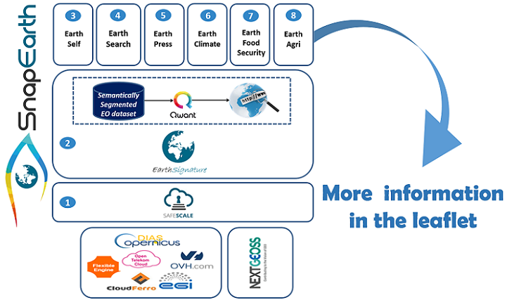
SnapEarth project aims to initiate the creation of a virtuous circle of innovation by providing to EO data users an innovative platform with leading edge EO segmented datasets, Neural Networks models and Cloud computing ecosystem.
This project has received funding from the European Unions' Horizon 2020 innovation action program, under Grant Agreement No 870373.
5 reasons why E-shape is important for you and your organization
For more information about the project activities, visit the website https://e-shape.eu or the helpdesk of E-shape https://helpdesk.e-shape.eu.
2nd meeting in Malta for the Aquacycle project
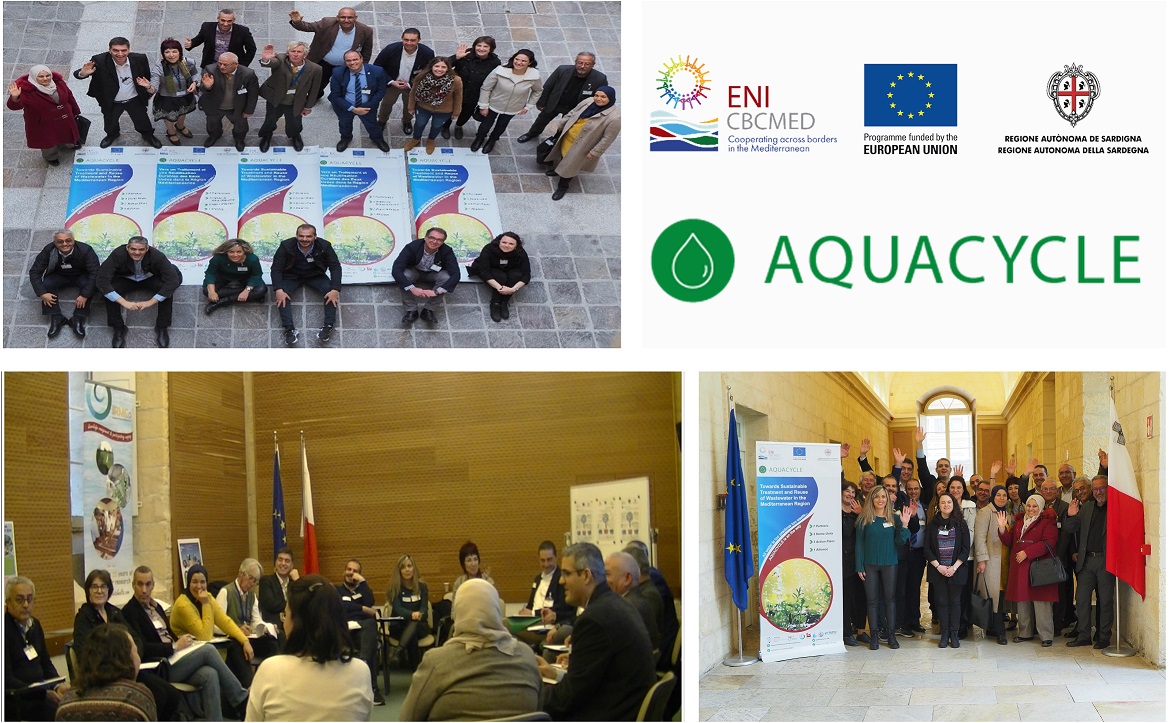
An initial training of partners was organized on the occasion of the 2nd project meeting in Malta during 3 to 5 February 2020, which at the same time served to further develop the prototype webGIS.
In the final part of the training session, Dr. Ioannis Manakos presented the envisaged webGIS platform and its functionalities. Based on an open source software globally acknowledged solution, the AQUACYCLE webGIS will be enriched with geospatial data analysis functionality. This way cubes of existing data, both Earth Observation and existing thematic ones, will generate analysis ready data.
The AQUACYCLE project is funded and supported by the European Union through the ENI CBC Mediterranean Sea Basin Programme under the Grant Contract A_B41_0027_AQUACYCLE. For more information, please visit enicbcmed.eu and enicbcmed.eu/projects/aquacycle.
SnapEarth Kick-off meeting
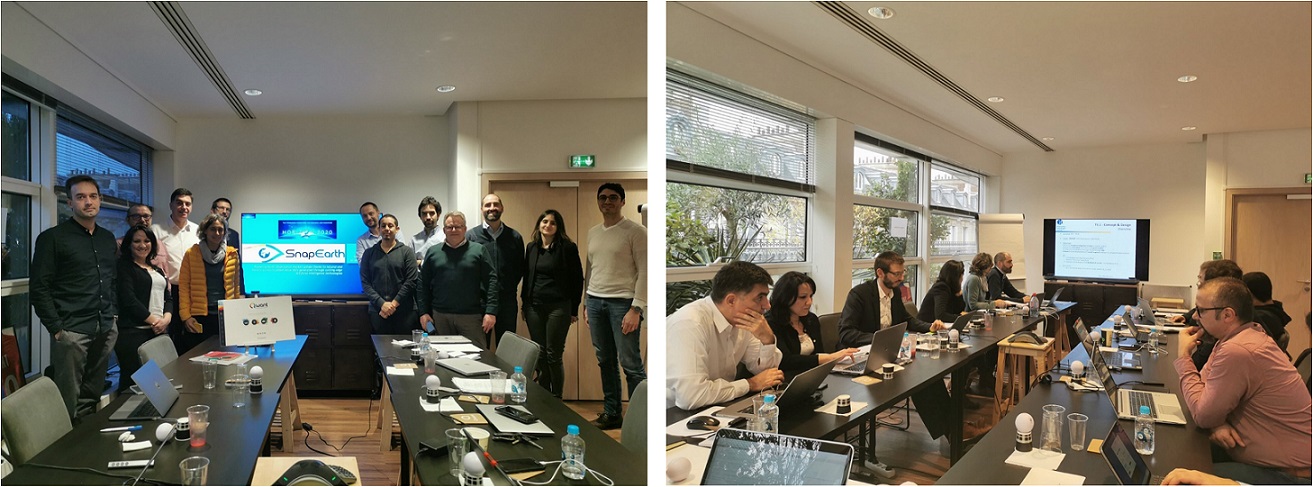
The SnapEarth project “Fostering Earth Observation market uptake thanks to natural and holistic access to added value data generated through cutting-edge Artificial Intelligence technologies” was launched in Paris on 19 and 20 of December, 2019.
SnapEarth will unlock new value, derive actionable service ideas on top of EO big data collections, and address future priorities by leveraging cutting-edge Artificial Intelligence and Cloud technologies and tools.
SnapEarth is funded under the European Union’s Horizon 2020 Programme (Innovation Action) | Grant agreement: 870373
Multiple Purpose Forestry Seminars: 'Improving future ecosystem benefits through Earth Observations - from EO to ecosystem services modelling'
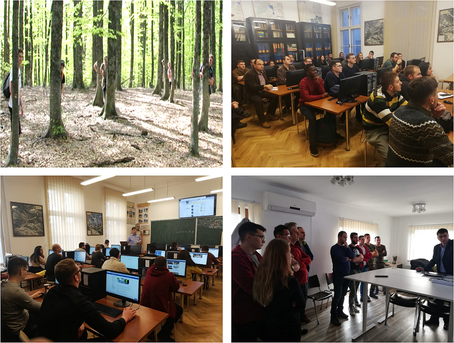
Two invited seminars of 'Improving future ecosystem benefits through Earth Observations - from EO to ecosystem services modelling' are held by Dr. Ioannis Manakos at the International 'Multiple Purpose Forestry' 2 years MSc of the Transilvania University of Brasov, Romania. Further dedicated technical meetings included familirization of the academic personnel with the results of ECOPOTENTIAL H2020 project, the ongoing E-SHAPE one, and the Open Data Cubes. Forest Design Romania, a successful private sector company, is introduced to eos.iti.gr team work, and took part in the discussions.
Special thanks to the Dean, Prof. dr. ing. Lucian CURTU, and the Associate Professor Mihai NITA for the invitation and fruitful discussions.
Remote Sensing course tutored by Dr. I. Manakos at CIHEAM.
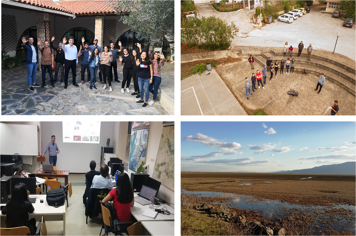
The course of 'Remote Sensing' at the 'Geoinformation in Environmental Management' MSc of the International Centre for Advanced Meditarrenean Agronomic Studies at the Mediterranean Agronomic Institute of Chania, GR, is successfully concluded. Dedicated sessions included the presentation of the 'ODYSSEAS' project eos.iti.gr team spectrophotometer, drone data acquisition - thanks to Nicolas Gailhard, who is the director of Arkeoservice, a market oriented presentation and discussion for Earth Observation career opportunities with ALTUS LSA representative - Dr. Zak Sarris, and the progress of MSc candidate Ms. Malak Kanj within the framework of E-SHAPE project.
Credit: Nicolas Gailhard for the drone photo.
Land Cover Change and Land Degradation Assessment (EuroGEO Showcase) presented at the Geo Week in Canberra, in Australia
The Land Cover Change and Land Degradation Assessment (EuroGEO Showcase) was presented at Canberra during the Geo Week by Gilles Ollier, who is a representative of the European Commission. CERTH and Dr. I. Manakos received credits for their contribution. You may watch the respective video bellow.
EuroGEO launches a pioneering new project, e-shape
EuroGEO is the European component of the Global Earth Observation System of Systems (GEOSS). It is a shared initiative of the European Commission and the European Caucus Member States and Participating Organisations.
To strengthen Europe’s contribution to the Global Earth Observation System of Systems (GEOSS), EuroGEO has launched e-shape. With a user-centric approach to Earth observation (EO) data sharing, the system aims to improve forecasting capabilities for sound decision making.
E-shape is funded under the European Union’s Horizon 2020 Programme. E-shape allows Europe to position itself as global force in Earth observation through leveraging Copernicus, making use of existing European capacities and improving user uptake of the data from GEO assets.
ESA's Sentinel Online Journal news about "Copernicus Sentinels improve hydroperiod estimations of Mediterranean wetlands"
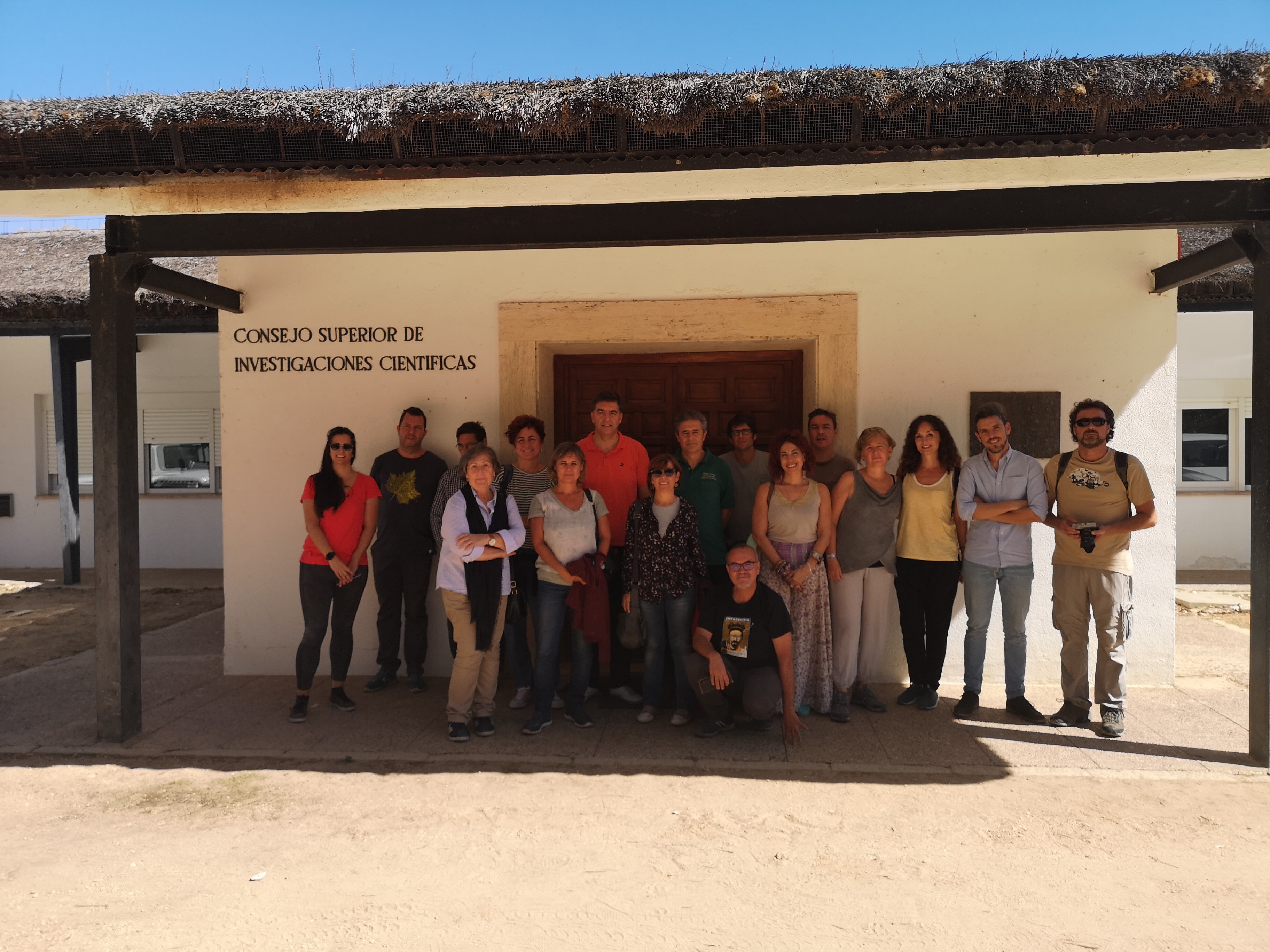
Within the ECOPOTENTIAL project, researchers of Estación Biológica de Doñana (EBD-CSIC, Spain) and the Centre for Research and Technology Hellas (CERTH) worked in close collaboration, using satellite data, to study wetland seasonal dynamics and hydroperiods duration and trends in the Doñana National Park (Southern Spain)..
The ECOPOTENTIAL project is funded and supported by the European Union’s Horizon 2020 Research and Innovation program under Grant Agreement No. 641762.
ECOPOTENTIAL tools hands-on workshop
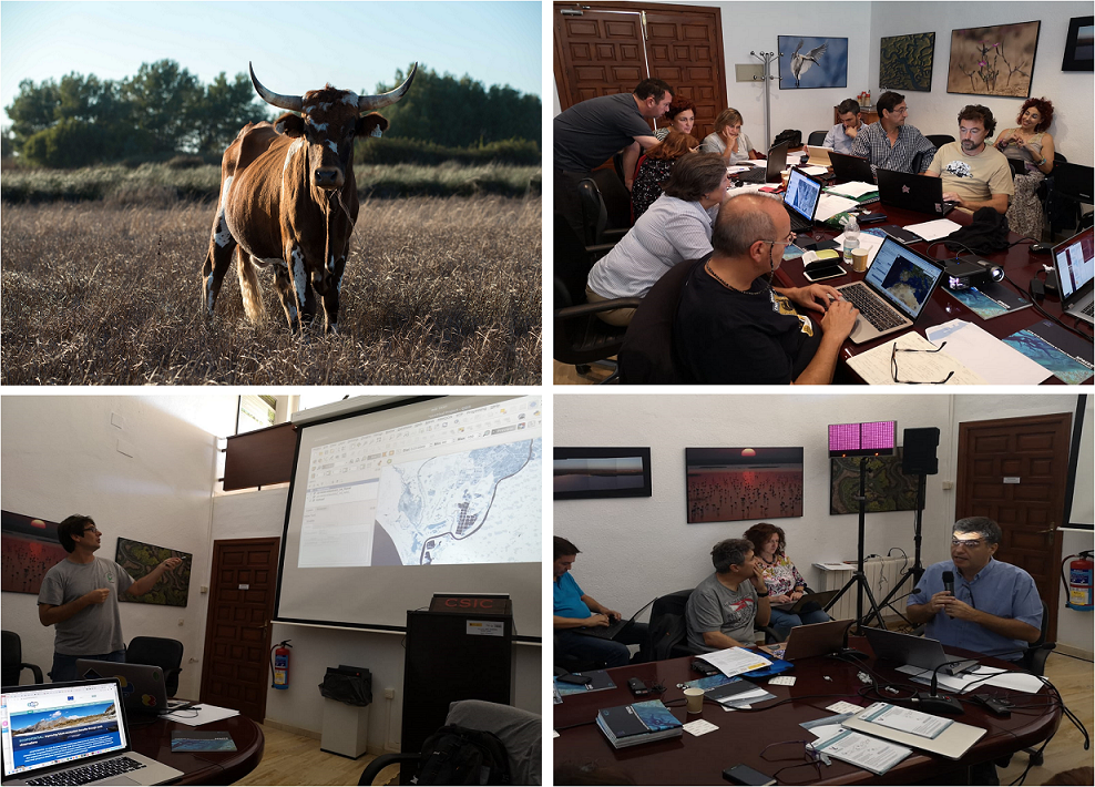
ECOPOTENTIAL tools hands-on workshop took place in Doñana Biological Reserve (RBD-CSIC), in Spain. The workshop was organized in order to present the results and tools that have been produced in the H2020 project ECOPOTENTIAL (ref. No 641762), to the managers and technicians of Doñana Protected Area in particular, and other protected area managers in general.
Dr. Manakos was speaker in the following sessions:
- "Using Sentinel 2 to estimate hydroperiod in Doñana"
- "How to incorporate Sentinel 1 to hydroperiod estimates in Doñana"
The ECOPOTENTIAL project is funded and supported by the European Union’s Horizon 2020 Research and Innovation program under Grant Agreement No. 641762.
Aquacycle Kick-off meeting
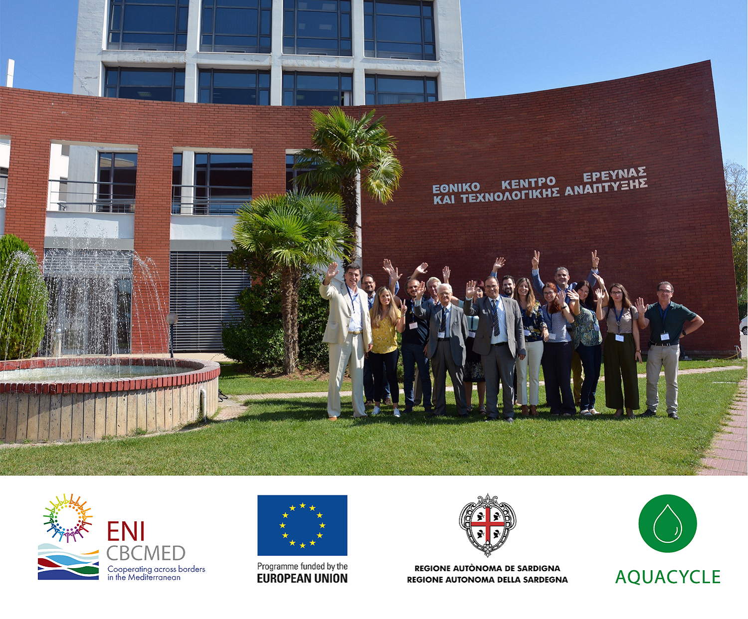
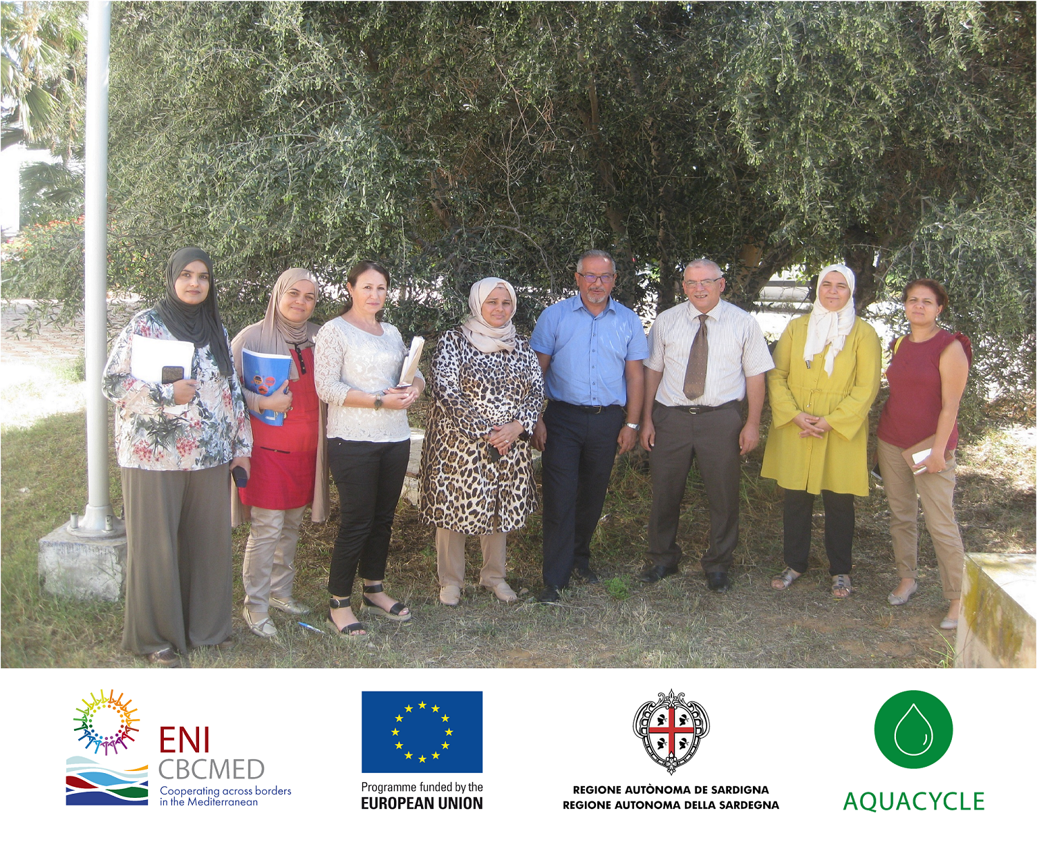
The AQUACYCLE project “Towards Sustainable Treatment and Reuse of Wastewater in the Mediterranean Region” was launched in Thessaloniki on September 30, 2019, and brings together 7 partners and 4 associated partners from 8 countries around the Mediterranean: Greece (Lead Beneficiary), Lebanon, Malta, Spain, Tunisia, Algeria, France and Morocco.
AQUACYCLE is set to bring an eco-innovative wastewater treatment technology that will consist of anaerobic digestion, constructed wetlands and solar treatment for the cost-effective treatment of urban wastewater with minimal costs of operation and maximum environmental benefits. The novel technology will be demonstrated in 3 pilot sites in Lebanon, Spain and Tunisia.
The AQUACYCLE project is funded and supported by the European Union through the ENI CBC Mediterranean Sea Basin Programme under the Grant Contract A_B41_0027_AQUACYCLE. For more information, please visit enicbcmed.eu and enicbcmed.eu/projects/aquacycle.
ECOPOTENTIAL project at Researchers' Night 2019
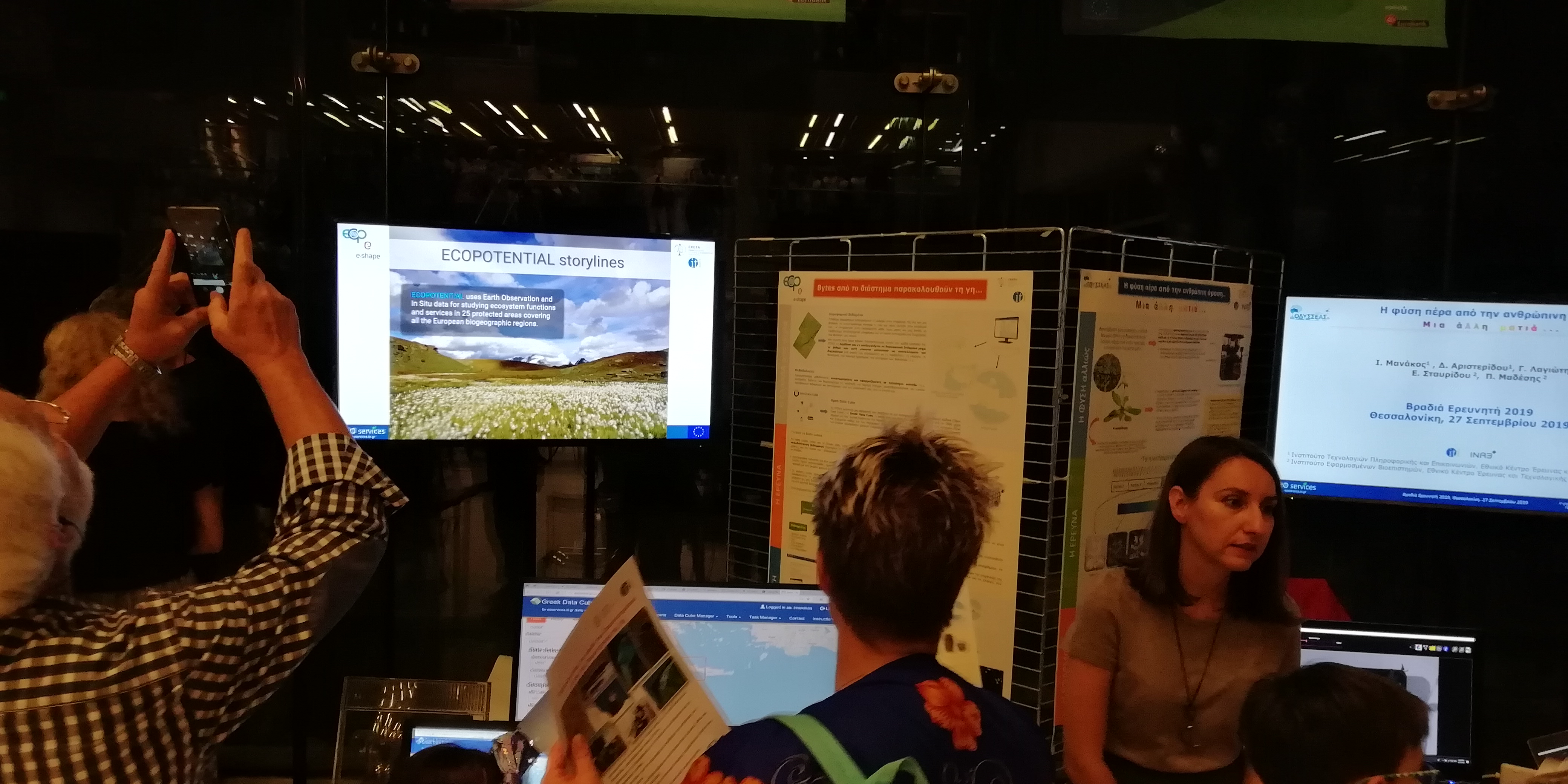
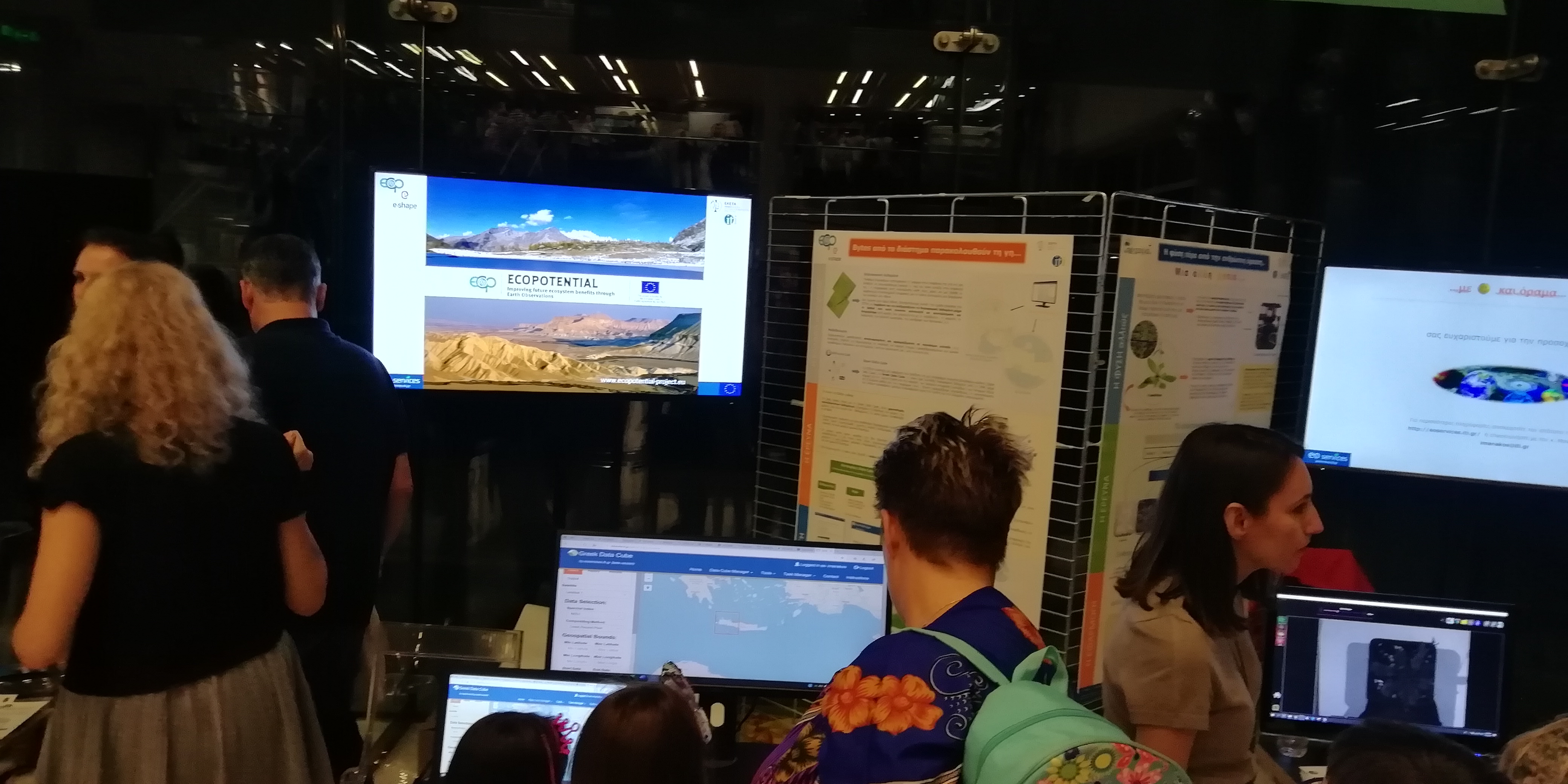
On 27 September 2019, the Centre for Research and Technology Hellas (CERTH) organized the Researchers’ Night in Thessaloniki, with the goal to bring researchers closer to the society and encourage young people pursue relevant careers. The event had a big success and managed to reach more than 4500 visitors within 5 hours.
Among other participating teams, the ECOPOTENTIAL/ CERTH team presented the H2020 flagship ECOPOTENTIAL project and its main results, providing the opportunity to visitors to view the beauty of the protected areas in Europe and beyond, get informed about issues and challenges they face and familiarized with ECOPOTENTIAL services towards an advanced monitoring of these areas. A series of presentations, posters and flyers illustrated the ECOPOTENTIAL achievements while the ECOPOTENTIAL/ CERTH team members ceaselessly discussed with visitors of all ages about the usefulness of earth observation to improve future ecosystem benefits.
The ECOPOTENTIAL project is funded and supported by the European Union’s Horizon 2020 Research and Innovation program under Grant Agreement No. 641762.
E-SHAPE project at Researchers' Night 2019
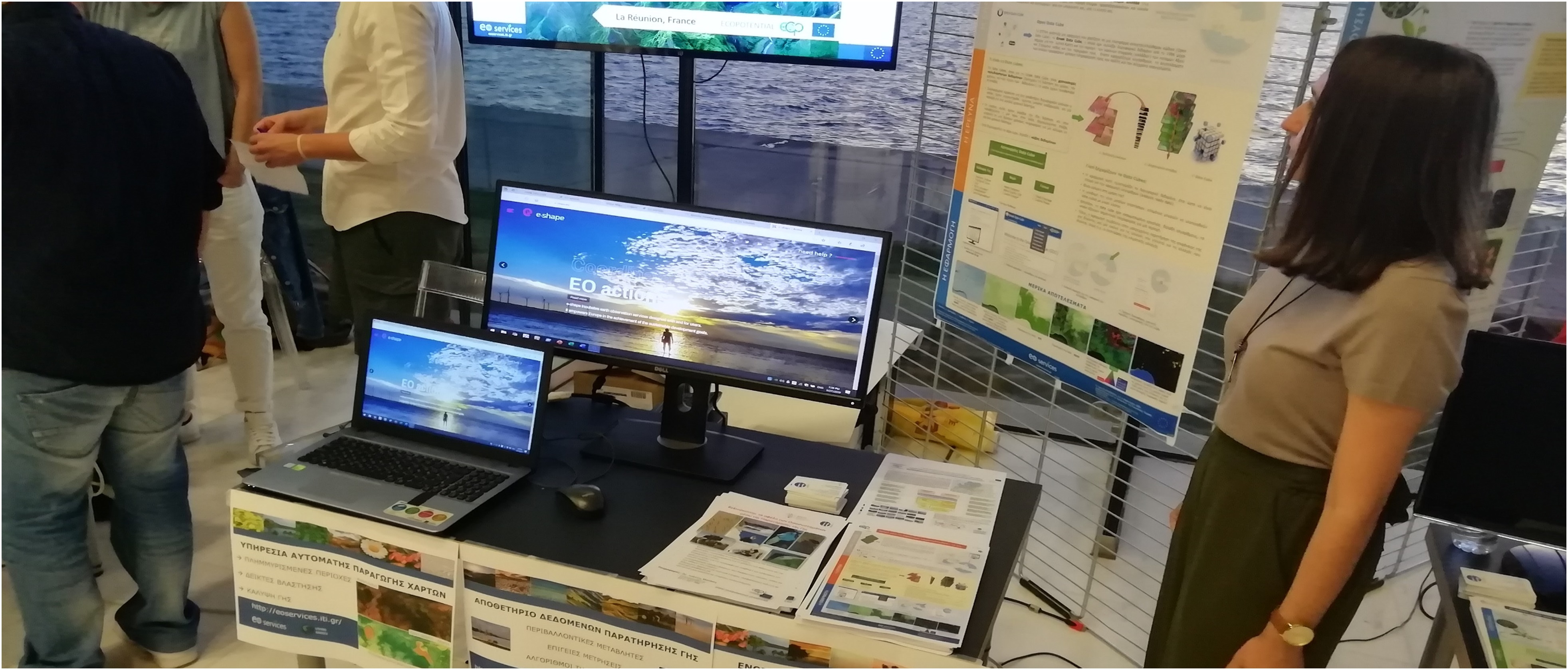
Within the framework of the Researcher’s Night held in Thessaloniki on 27 September 2019, the H2020 E-SHAPE project has been presented to the visitor flows of all ages by the E-SHAPE/ CERTH team. The whole event had a big success and managed to reach more than 4500 visitors within 5 hours.
E-SHAPE related information was placed at a central point. Presentations and posters demonstrated especially the myEcosystem Showcase of the project to familiarize the audience with the latest advancements in Europe in regards with earth observation and its usefulness to the ecosystem monitoring and the achievement of Sustainable Development Goals. Ways of access to consistently scaled environmental information on ecosystems from various sources and cutting-edge technologies (e.g. the open data technologies) that deliver analysis ready data for the user were showcased.
The E-SHAPE project is funded and supported by the European Union’s Horizon 2020 Research and Innovation program under Grant Agreement No. 820852.
ODYSSEAS project at Researchers' Night 2019
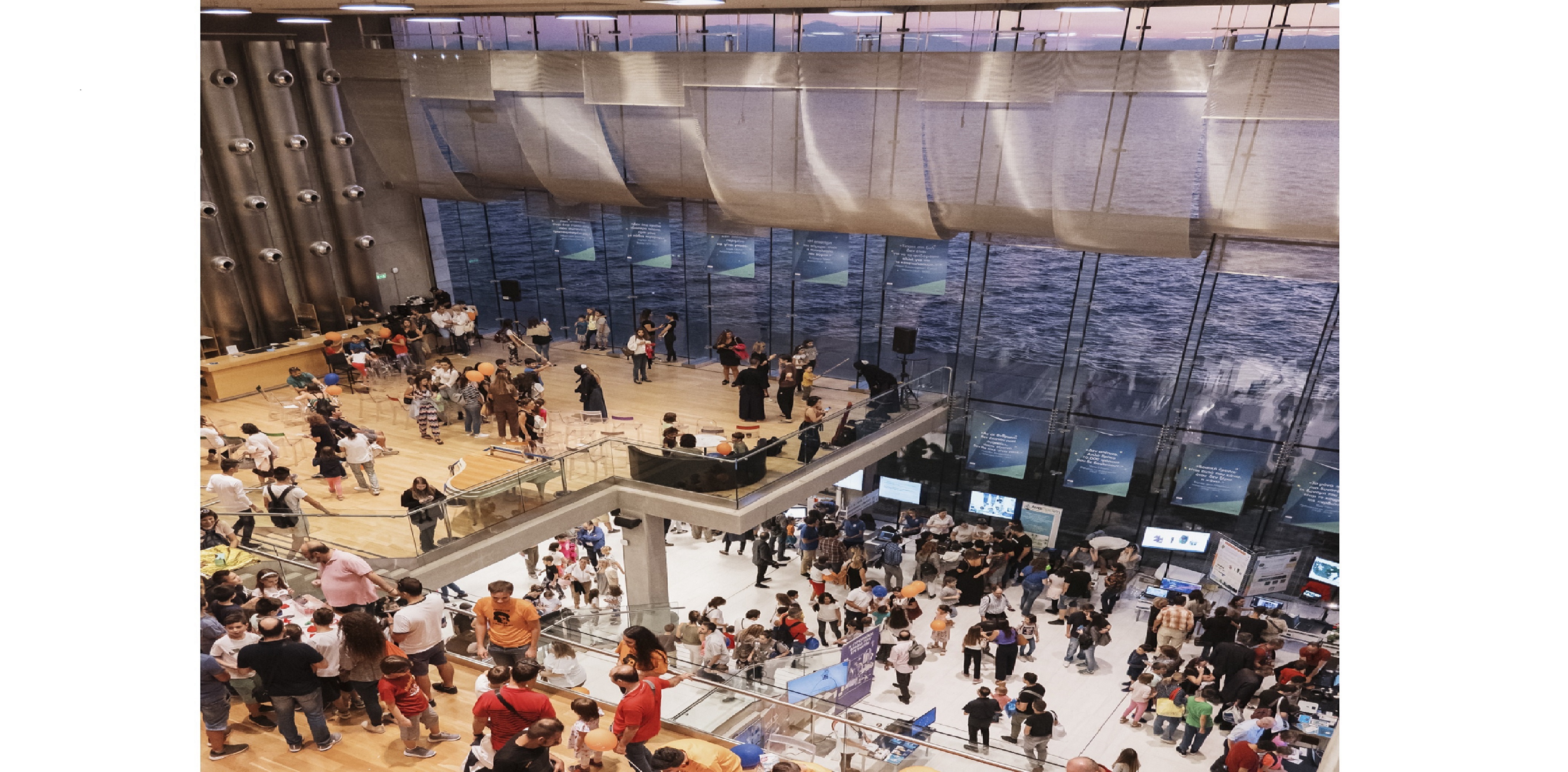
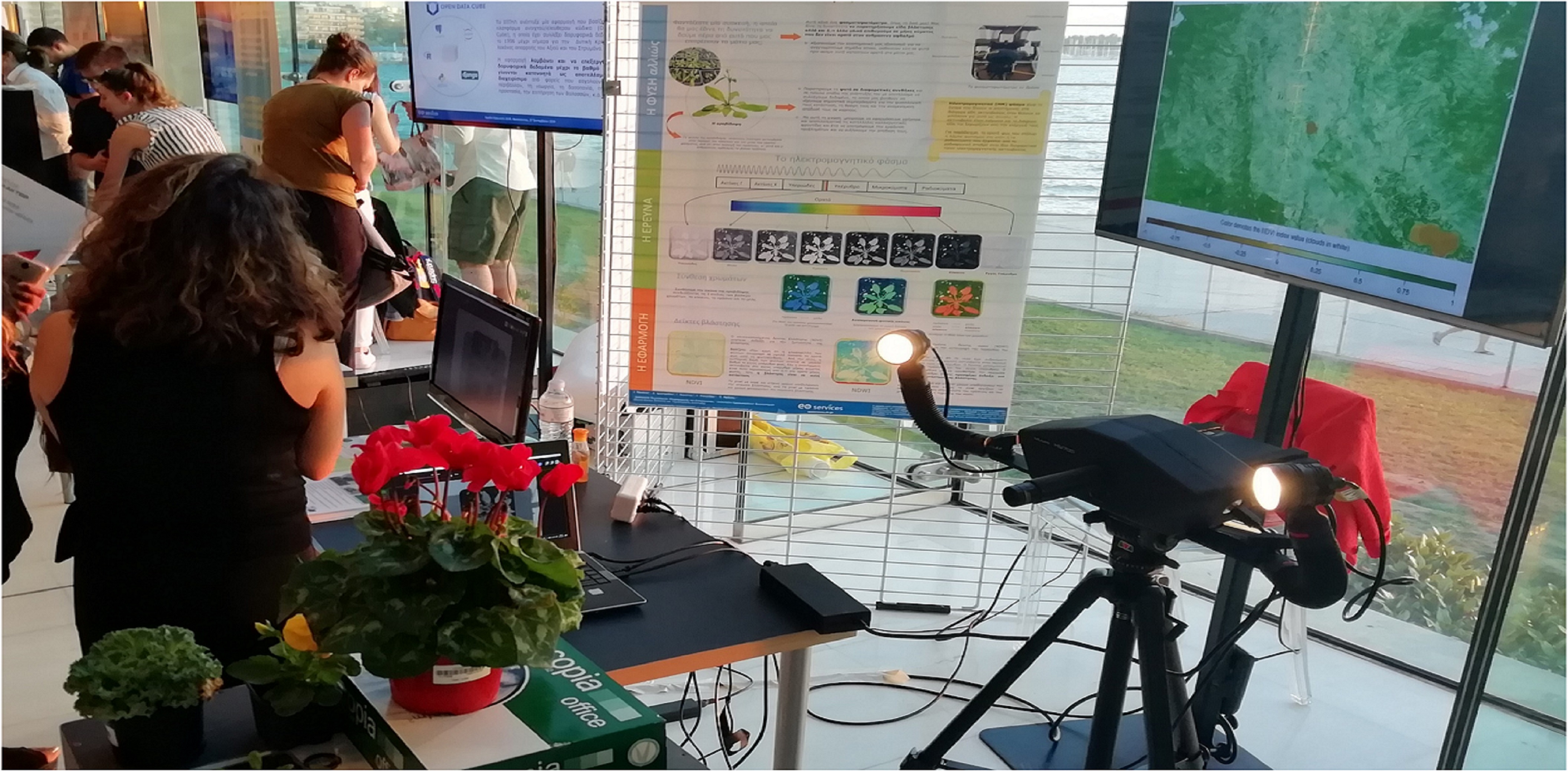
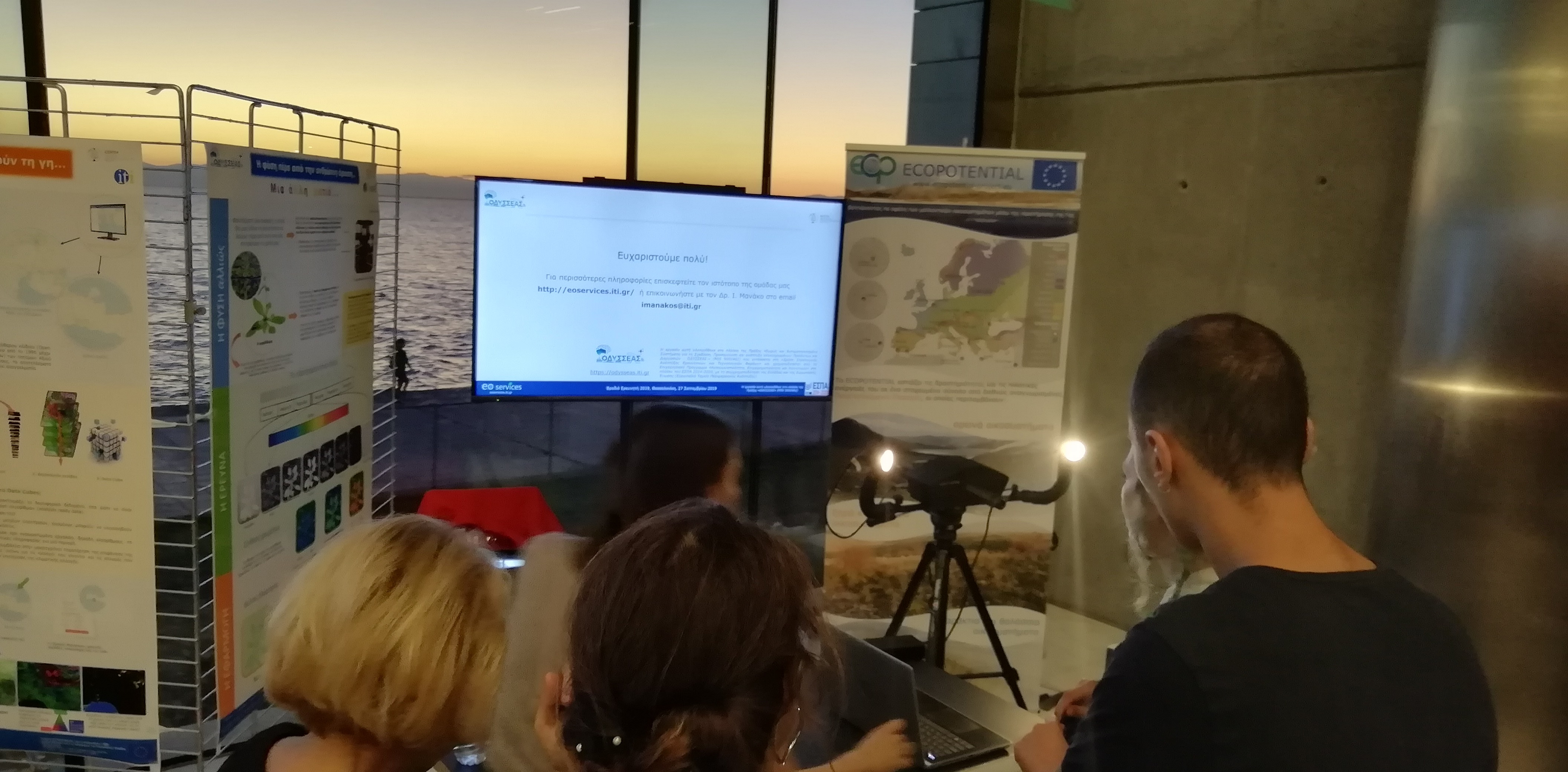
On 27 September 2019, the Centre for Research and Technology Hellas (CERTH) organized the Researchers’ Night in Thessaloniki, with the goal to bring researchers closer to the society and encourage young people pursue relevant careers.The whole event had a big success and managed to reach more than 4500 visitors within 5 hours.
ODYSSEAS activities related with the use and applications of the spectrophotometer were presented by the research team of Dr. I. Manakos’ of the Information Technologies Institute (ITI) of the Centre of Research & Technology Hellas (CERTH), which is specialized in Remote Sensing. The newly acquired spectrophotometer, purchased within the framework of the project, was displayed to the visitors, while detailed presentations on the operating principles and the capacity of the equipment and its high potential in various application areas were explained.
In addition, acquisition of spectral images performed live on plant samples and projected on the screen. Accordingly, during the experiments, that were recently designed with Dr. P. Madesis’ research team of the Institute of Applied Biosciences (INAB) of CERTH, spectral images are also acquired from the plant Arabidopsis. The Madesis research group has expertise in DNA- and RNA-based analytical tools, -omics technologies, and bioinformatics, which are primarily used for understanding biosynthetic pathways and gene regulatory networks underlying plant stress responses.
Both research teams, simultaneously perform different types of experiments to the plant and by the end of the experimentation, they will analyze the data and correlate the foundings.
International LCLUC Regional Science Joint Meeting for Central Asia and Caucasus: Water - Energy - Food and Sustainability
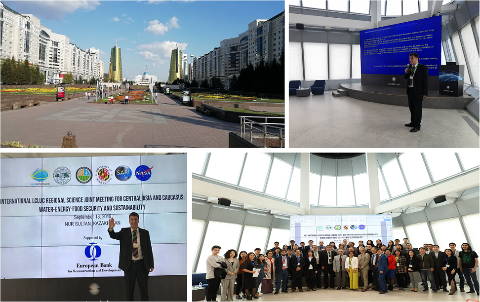
International LCLUC Regional Science Joint Meeting for Central Asia and Caucasus took place in Nur Sultan, in Kazakhstan. Dr. Manakos was speaker at the workshops and thematic sessions on September 16 and 17 as follows:
- September 17: "Cooperation experiences and outlook with the Validation focus Working Group of SCERIN"
- September 16: "Inundation mapping by fusing Sentinel-1 and Sentinel-2 images with machine learning techniques: the ECOPOTENTIAL legacy"
E-shape @ Kerkini Lake Protected Area Authority
Dr. I. Manakos and his colleagues visited the premises of Kerkini Lake Protected Area in Northern Greece following an invitation of the responsible Management Authority. Ways for cooperation within the framework of the E-SHAPE project were extensively discussed. Issue of main interest is the exploitation of Earth Observation (EO) data and existing EO based products to support monitoring of changes and management of the area.
The E-SHAPE project is funded and supported by the European Union’s Horizon 2020 Research and Innovation program under Grant Agreement No. 820852.
Special Issue of "Sentinel Analysis Ready Data (Sentinel ARD)" @ Remote Sensing MDPI Journal
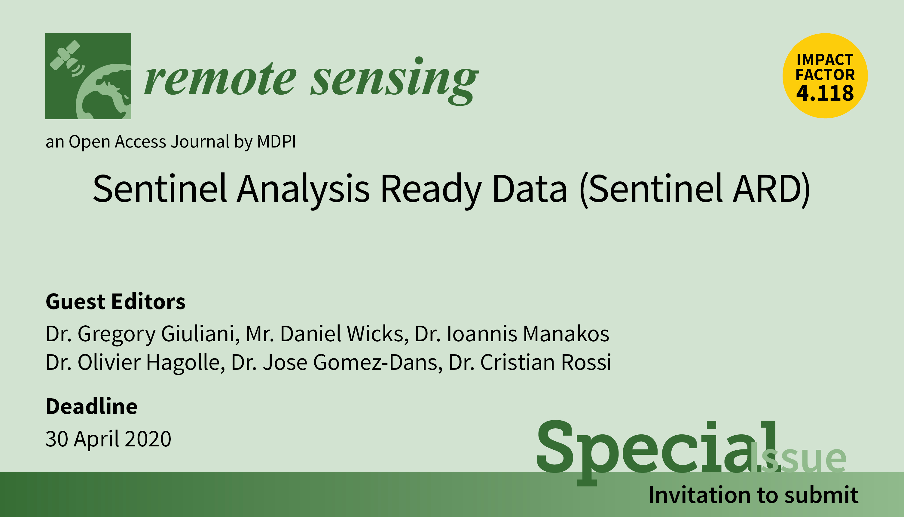
This Special Issue is consequently aiming to cover the most recent advances in ARD developments and implementations for Sentinel data.
Topics include:
- Methods for generating Analysis Ready Data for both optical (Sentinel-2 and 3) and SAR imagery (Sentinel-1);
- Defining ARD level for thermal imagery (Sentinel-3);
- Defining guidelines for ARD product interoperability;
- Defining ARD level for Sentinel-5P (Air pollution);
- Significance of ARD for Data Producers; Data Distributors; Data Users;
- Data quality, reliability, flagging, etc.;
- Cost/Benefits analysis for ARD data;
- Thematic application of Sentinel ARD;
- Software tools that support generating analysis-ready data for both optical and SAR imagery;
- Support to policy framework such as the Sustainable Development Goals, the Paris Agreement, or Aichi targets;
- Links with initiatives like Copernicus or the Global Earth Observation System of Systems (GEOSS);
- Data cube interoperability;
- Error propagation and uncertainty handling;
- ARD standards;
- User driven requirements for ARD;
- The significance of sensor Cal/Val in ARD including issues related to cross-sensor interoperability.
Did you hear the news about our book?
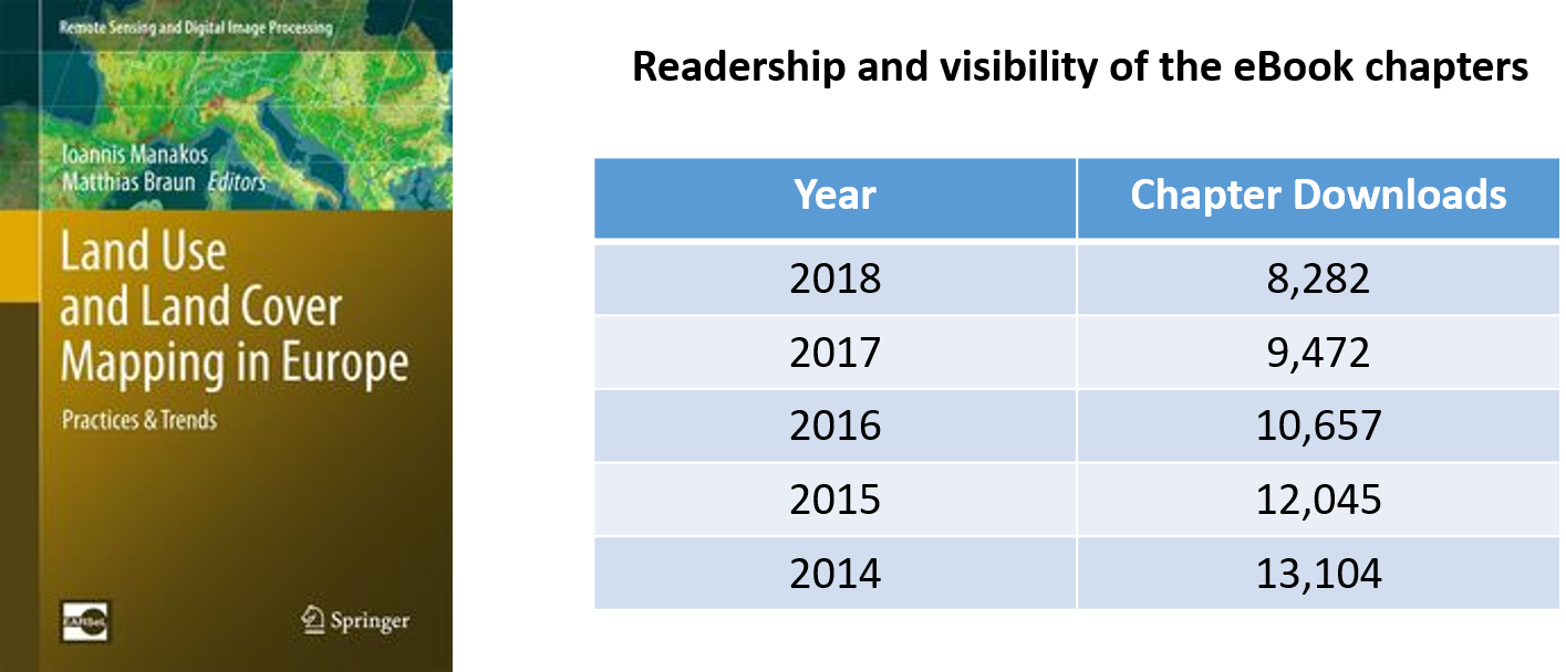
“Land Use and Land Cover Mapping in Europe – Practice & Trends” has more than 53.560 chapter downloads and was among the top 25% most downloaded eBooks in its respective Springer eBook Collection in 2018!
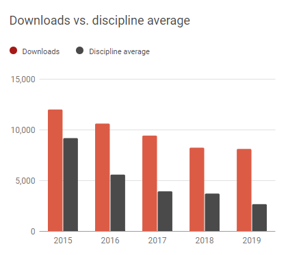
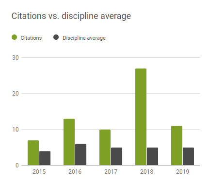
About the book:
…the book provides a comprehensive view of various LULC activities focusing on European initiatives, such as the LUCAS surveys, the CORINE land covers, the ESA/EU GMES program and its resulting Fast-Track- and Downstream Services, the EU JRC Global Land Cover, the ESA GlobCover project as well as the ESA initiative on Essential Climate Variables.
…the book covers the operational approaches, but also provides reviews of current state-of-the-art scientific methodologies and recommendations
... the book showcases best-practice examples that lead to a perspective exceeding pure mapping towards investigating drivers and causes, as well as future projections
Editors: Ioannis Manakos, Matthias Braun | eBook ISBN: 978-94-007-7969-3 | DOI: 10.1007/978-94-007-7969-3 | Publisher: Springer Netherlands | Copyright: 2014
EuroGEOSS Workshop 2019
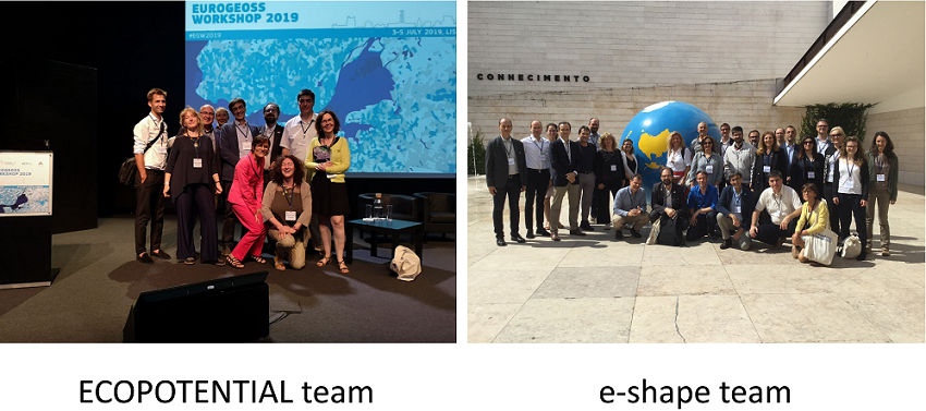
Fruitful discussion took place last week at the EuroGEOSS Workshop in Lisbon where the ECOPOTENTIAL and the E-shape teams interacted with the rest of the EuroGEOSS community.
SCERIN-7 Capacity Building Workshop on Earth System Observations
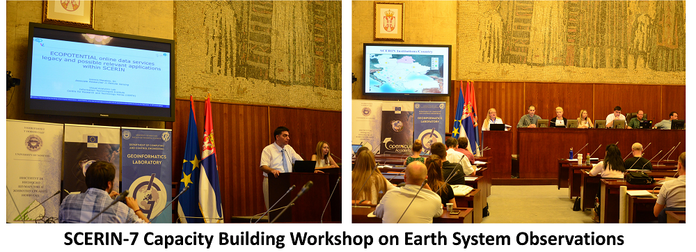
"Land Cover Dynamics in the Agricultural and Protected Natural Areas in the SCERIN Domain", Novi Sad, Serbia.
Oral presentation by Dr. I. Manakos about "The ECOPOTENTIAL online data services legacy and SCERIN
applications".
H2020 ECOPOTENTIAL's final meeting
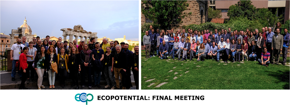
The legacy of Rome embraces the legacy of H2020 ECOPOTENTIAL at the final meeting of the project in Rome, 20-24.05.19, where representatives from 48 partner Entities discussed about joint past and future activities.
2019 Living Planet Symposium at Milan, Italy.
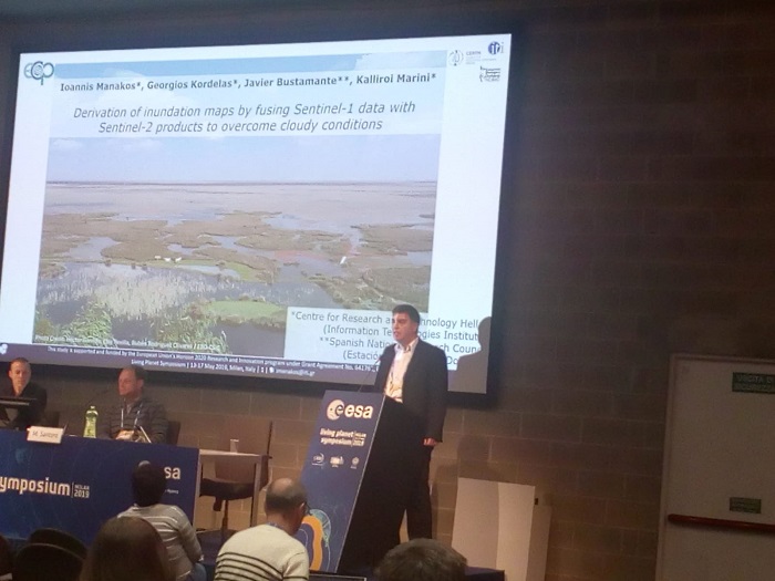
Dr. Ioannis Manakos' oral presentation at 2019 Living Planet Symposium: Derivation of inundation maps by fusing Sentinel-1 data with Sentinel-2 products to overcome cloudy conditions.
Abstract:
Monitoring of inundation regimes for wide areas and frequent time intervals is of great value for the fulfilment of the 2020 Aichi Biodiversity Targets and United Nations Sustainable Development Goals (SDGs) and targets, such as Aichi Targets 7, 11, 12, 14, 15 & SDG targets 6.6, 13.1, 15.1, 15.5.
Multispectral satellite data are suitable for the estimation of the inundation extent under cloud-free weather conditions achieving a high degree of accuracy. Radar data on the contrary, especially Sentinel-1 ones, face limitations and challenges in reaching credible results. As such may be referred the land cover synthesis of the scene, as, for example, shallow waters or waters with emergent vegetation or flat sandy areas may produce a confusing signal with either non-inundated areas in the first two cases or inundated ones in the latter.
Exploitation of high accuracy Sentinel-2 inundation derived maps to train Sentinel-1 varying pixel values in time leads to credible results up to a time interval and coverage percentage from the date that training occurred. The aim of this study is to unravel the conditions, especially the time interval from available accurate inundation maps that the sole use of Sentinel-1 data, in view of lack of available multispectral data for the desired date, may lead to credible results.
Focus is on Doñana marshlands in Spain, a breeding and wintering habitat for many water birds, where inundation maps are required to balance bird nesting and cattle breeding ecosystem services, as expressed via the biomass production due to water presence. Generated inundation maps can be provided via the ECOPOTENTIAL Virtual Laboratory, fully integrated in GEOSS and in support of GEO ECO initiative’s objectives.
E-shape - Kick off meeting
54 partners (100 participants) from Europe and beyond were gathered in Cannes for the launching of the e-shape project!
United Nations/Romania International Conference on Space Solutions for Sustainable Agriculture and Precision Farming at Cluj-Napoca, Romania
Poster: EEOBSS - EO education for Bulgarian secondary schools
ECOPOTENTIAL at the 2019 NASA LCLUC Spring Science Team Meeting
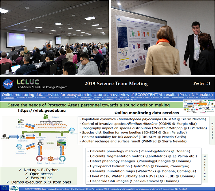
ECOPOTENTIAL results have been presented at the recent NASA Land-Cover and Land-Use Change (LCLUC) Spring Science Team Meeting, held in April (9th-11th) at the Hilton Washington DC, USA. This annual Science meeting consisted of presentations from and discussions among the LCLUC Science Team members funded for research by the NASA LCLUC program.
Focus was a) on the use of fine resolution data for LCLUC, b) the preliminary results of the Multi-Source Land Imaging team making benefit of the complementary use of Copernicus and Landsat satellite data towards a Landsat-8 and Sentinel-2 harmonized surface reflectance product, c) LCLUC synthesis projects over the globe, and d) applications in Southeast Asia and Northern Eurasia.
CERTH (Greece) was among the approximately 150 participants to present and highlight ECOPOTENTIAL achievements in LCLUC products generation, and, more specifically, about online monitoring data services (mounted on the Virtual Laboratory Platform) that promote repeatability of layers production; triggered by users. The flash talk was respectively about ‘Online monitoring data services for ecosystem indicators: an overview of ECOPOTENTIAL results’. Vivid discussions followed at the poster presentation.
Mediterranean Regional Information Network (MedRIN) Meeting and Workshop
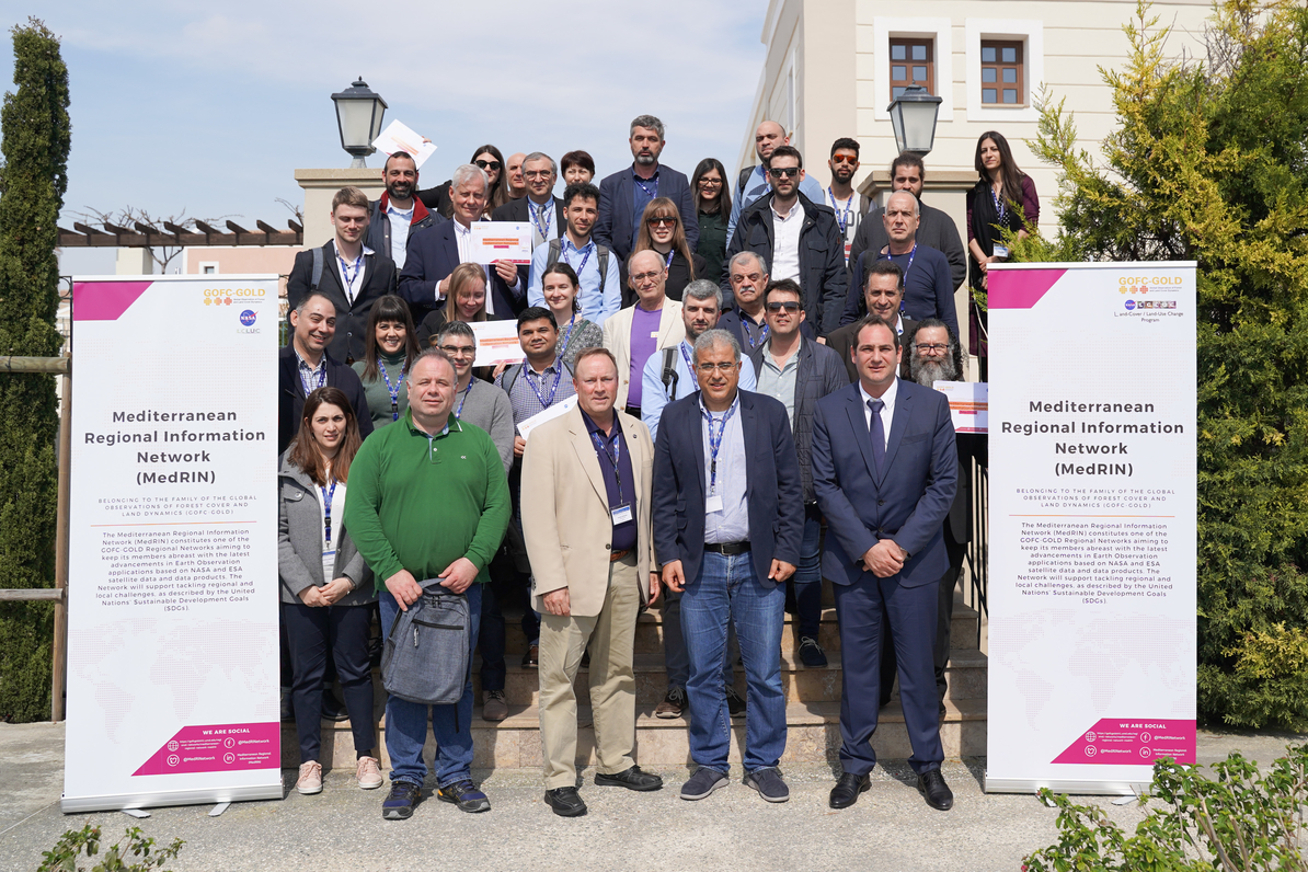
The second Mediterranean Regional Information Network (MedRIN) meeting and workshop took place at the Aliathon Holiday Village, in Paphos, Cyprus as a component of the 7th International Conference on Remote Sensing and Geoinformation of the Environment (RSCy2019).
In the link you may find the presentation of Dr. Ioannis Manakos on “The SCERIN network: Best practices and achievements”.
Special Issue of “Remote Sensing in Ecosystem Modelling” @ Remote Sensing MDPI Journal
Topics include:
- direct comparisons of EO with in-situ data
- assessment of the added value of EO to ecosystem models
- interoperability topics, for example spatial and temporal scale issues, derived from the incorporation of EO in ecosystem models
- uncertainty propagation of EO-derived inputs in ecosystem models
- benefits by the EO assimilation and side-effects in the designed processing chains
- adjustments in ecosystem models to better integrate EO inputs
- the new capacity being developed and explored by the installation and operation of the Data and Information Access Services (DIASs)
Real time analysis direct from the Sentinel data hub to your screen
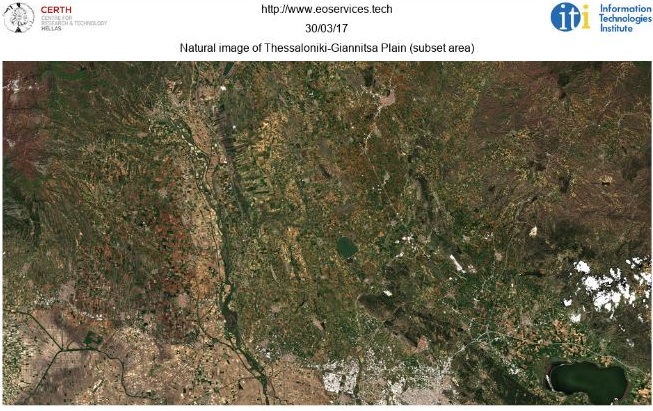
Special Issue of “Monitoring Land Cover Change: Towards Sustainability” @ Land MDPI Journal
Topics include:
- New instruments and data processing methods
- Geological, hydrological, land and ice applications
- Climate and climate change
- Agriculture and Forestry
- Urban and Thermal remote sensing
- Use of LIDAR and RADAR data for various applications
- Applications employing UAVs and UASs
- Synergy of remote sensing technologies for land-use change monitoring
- The role of earth observations within the Water–Energy–Food nexus
- Social and behavioral aspects of land use supported by remote sensing observations
- Advances and outlook in the processing and analysis of remotely sensed data
ECOPOTENTIAL at the European Parliament
The science-policy briefing event “Science for Post 2020 Environmental Targets – Insights from Earth Observation of Protected Areas” for the EU Parliament will take place on the 27th of September 2018 (09:00-11:00). At the event, the most relevant ECOPOTENTIAL key findings for post 2020 environmental strategies will be presented.
The event will be chaired by MEPs Ricardo Serrão Santos and Sirpa Pietikäinen and is organized in cooperation with EBCD which serves as the secretariat of the European Parliament Intergroup on Climate Change, Biodiversity and Sustainable Development.
Land-Use/Cover Change Drivers, Impacts and Sustainability within the Water-Energy-Food Nexus
3rd joint EARSeL LULC/NASA LCLUC Workshop
Following the success of the two previous EARSeL Special Interest Group on Land Use and Land Cover (SIG LU/LC) and NASA Land-Cover/Land-Use Change (LCLUC) Program joint Workshops (Berlin 2014 and Prague 2016) with more than 270 participants from 4 continents, the 3rd EARSeL LULC and NASA LCLUC joint Workshop “Land-Use/Cover Change Drivers, Impacts and Sustainability within the Water-Energy-Food Nexus” set the questions towards and beyond the 2020 emerging challenges.